
MyTopo
Yanush Oklahoma US Topo Map
Couldn't load pickup availability
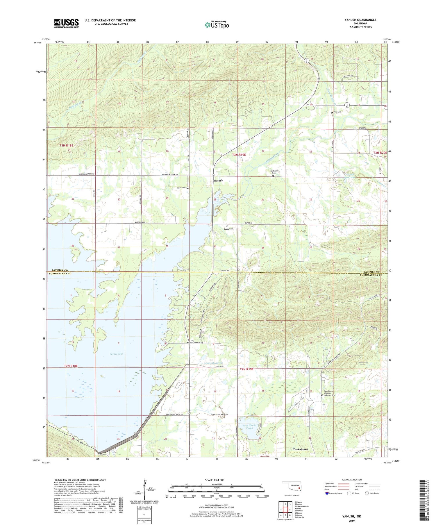
2019 topographic map quadrangle Yanush in the state of Oklahoma. Scale: 1:24000. Based on the newly updated USGS 7.5' US Topo map series, this map is in the following counties: Latimer, Pushmataha. The map contains contour data, water features, and other items you are used to seeing on USGS maps, but also has updated roads and other features. This is the next generation of topographic maps. Printed on high-quality waterproof paper with UV fade-resistant inks.
Quads adjacent to this one:
West: Sardis
Northwest: Higgins
North: Damon
Northeast: Baker Mountain
East: Kiamichi
Southeast: Albion SW
South: Clayton
Southwest: Stanley
Contains the following named places: Anderson Creek, Boggs Hollow Creek, Buffalo Church, Buffalo Creek, Cedar Creek, Clayton Lake, Clayton Lake Dam, Cupco Cemetery, Cupco Church, Hokit Cemetery, King Cemetery, Lake Nanih Waiya, Nanih Waiya Lake Dam, Oknoname 077008 Dam, Oknoname 077008 Reservoir, Oknoname 127005 Dam, Oknoname 127005 Reservoir, Old Choctaw Indian Council House, Township of Buffalo, Trowbridge Cemetery, Tuskahoma Census Designated Place, Tuskahoma Choctaw Veterans Cemetery, Yanush, ZIP Code: 74574


