MyTopo
Yuba Oklahoma US Topo Map
Couldn't load pickup availability
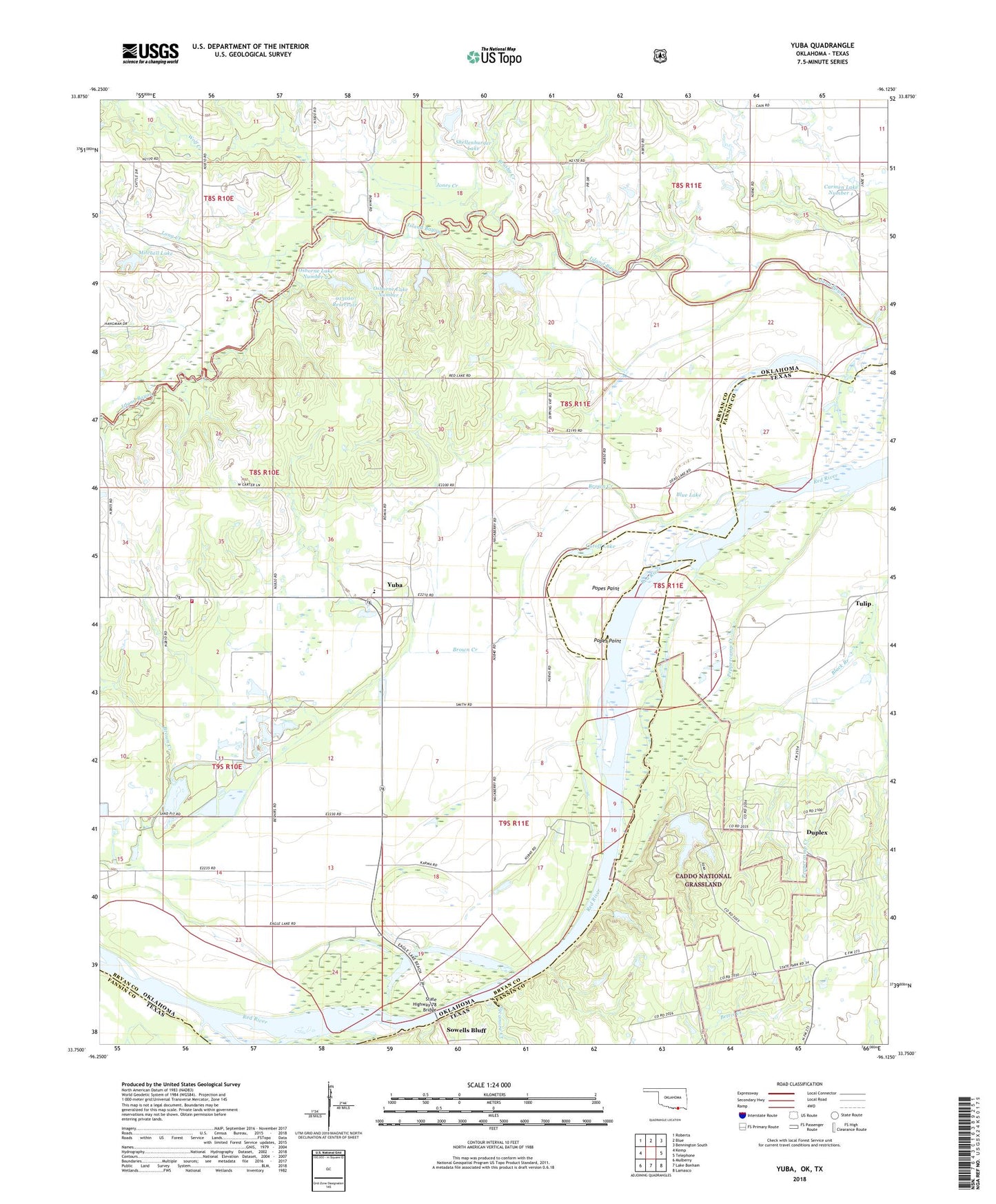
2018 topographic map quadrangle Yuba in the states of Oklahoma, Texas. Scale: 1:24000. Based on the newly updated USGS 7.5' US Topo map series, this map is in the following counties: Bryan, Fannin. The map contains contour data, water features, and other items you are used to seeing on USGS maps, but also has updated roads and other features. This is the next generation of topographic maps. Printed on high-quality waterproof paper with UV fade-resistant inks.
Quads adjacent to this one:
West: Kemp
Northwest: Roberta
North: Blue
Northeast: Bennington South
East: Telephone
Southeast: Lamasco
South: Lake Bonham
Southwest: Mulberry
Contains the following named places: Blue Lake, Brown Creek, Brushy Creek, Carman Lake Number 1 Dam, Carmen Lake Number 1, Cottonwood Creek, Cutoff Lake, Duplex, Duplex Cemetery, Eagle Lake, Jones Creek, Karma, Lake Fannin, Lake Fannin Dam, Long Creek, Lunt Lake, Lunt Lake Dam, Mitchell Lake, Mitchell Lake Dam, Musgrove Lake Number 1, Musgrove Lake Number 1 Dam, Musgrove Lake Number 2, Musgrove Lake Number 2 Dam, Oknoname 013001 Dam, Oknoname 013001 Reservoir, Oknoname 013010 Dam, Oknoname 013010 Reservoir, Oknoname 013011 Dam, Oknoname 013011 Reservoir, Osborne Lake, Osborne Lake Dam, Osborne Lake Number 1, Osborne Lake Number 1 Dam, Osborne Lake Number 2, Osborne Lake Number 2 Dam, Peppercamp Creek, Popes Paint, Popes Point, Romia, Sandy Creek, Shellenberger Lake Dam, Shellenburger Lake, Southeast Bryan Division, Sowells Bluff, State Highway 78 Bridge, Sycamore Creek, Township of Albany, Tulip, W F Rains Dam, W F Rains Reservoir, Wolf Creek, Yuba, Yuba Elementary School, Yuba Volunteer Fire Department