MyTopo
Zafra Oklahoma US Topo Map
Couldn't load pickup availability
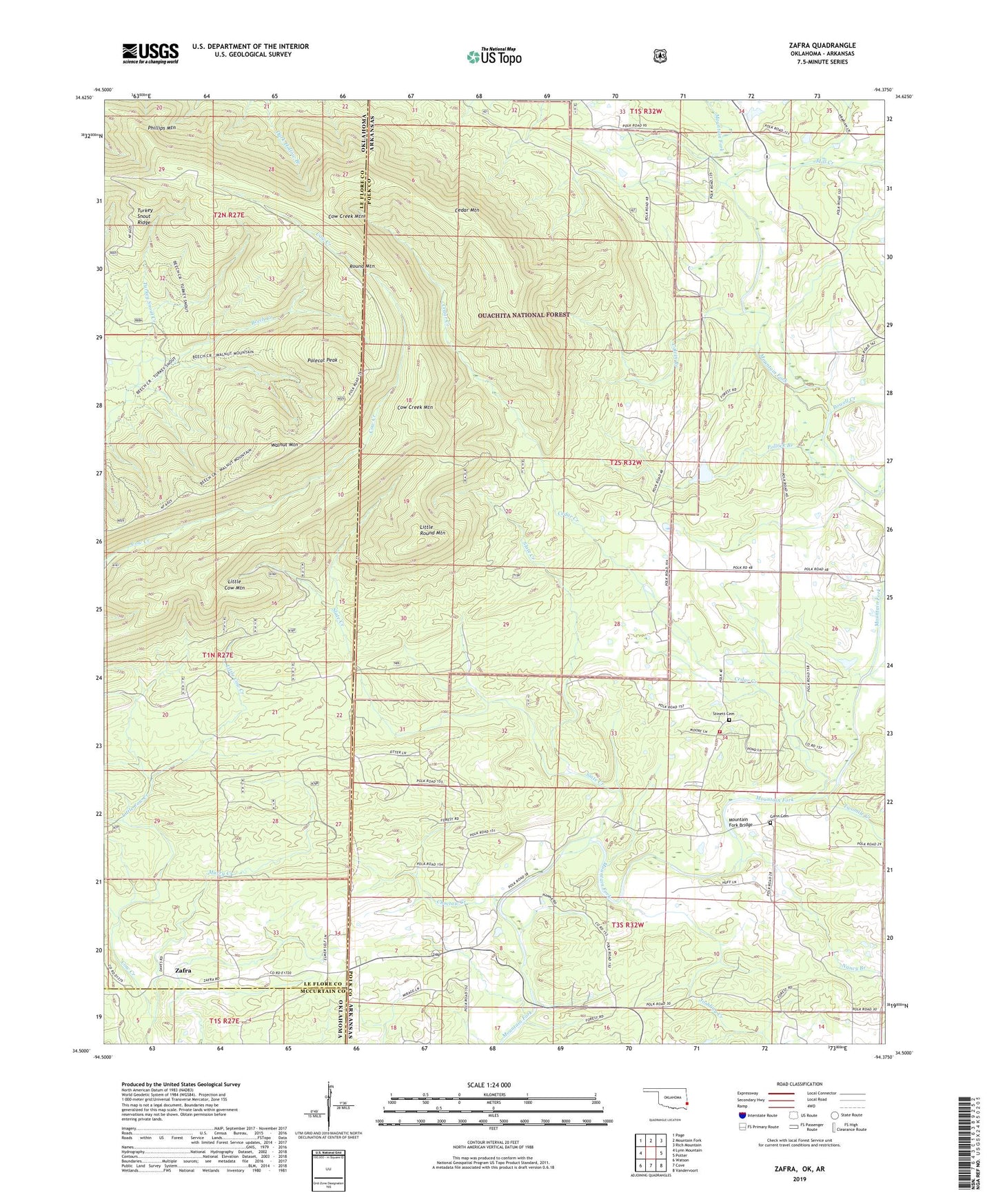
2019 topographic map quadrangle Zafra in the states of Arkansas, Oklahoma. Scale: 1:24000. Based on the newly updated USGS 7.5' US Topo map series, this map is in the following counties: Le Flore, Polk, McCurtain. The map contains contour data, water features, and other items you are used to seeing on USGS maps, but also has updated roads and other features. This is the next generation of topographic maps. Printed on high-quality waterproof paper with UV fade-resistant inks.
Quads adjacent to this one:
West: Lynn Mountain
Northwest: Page
North: Mountain Fork
Northeast: Rich Mountain
East: Potter
Southeast: Vandervoort
South: Cove
Southwest: Watson
Contains the following named places: Alder Springs Church, Calvin Branch, Camp Pioneer, Cedar Creek, Cedar Mountain, Choctaw Creek, Cow Creek Mountain, Gann Cemetery, Ivey Lake, Ivey Lake Dam, Joshling Creek, Little Cow Creek, Little Cow Mountain, Little Round Mountain, Mill Creek, Mountain Fork Bridge, Murry Creek, Nancy Branch, Phillips Mountain, Polecat Peak, Pollock Branch, Potter Fire Department Substation, Powell Creek, Queen Creek, Rock Creek, Round Mountain, Slate Creek, Stinett Cemetery, Township of Cedar, Turkey Snout Creek, Turkey Snout Ridge, Twomile Creek, Walnut Mountain, West Valley, West Valley Church, Zafra, Zafra School