MyTopo
Zeb Oklahoma US Topo Map
Couldn't load pickup availability
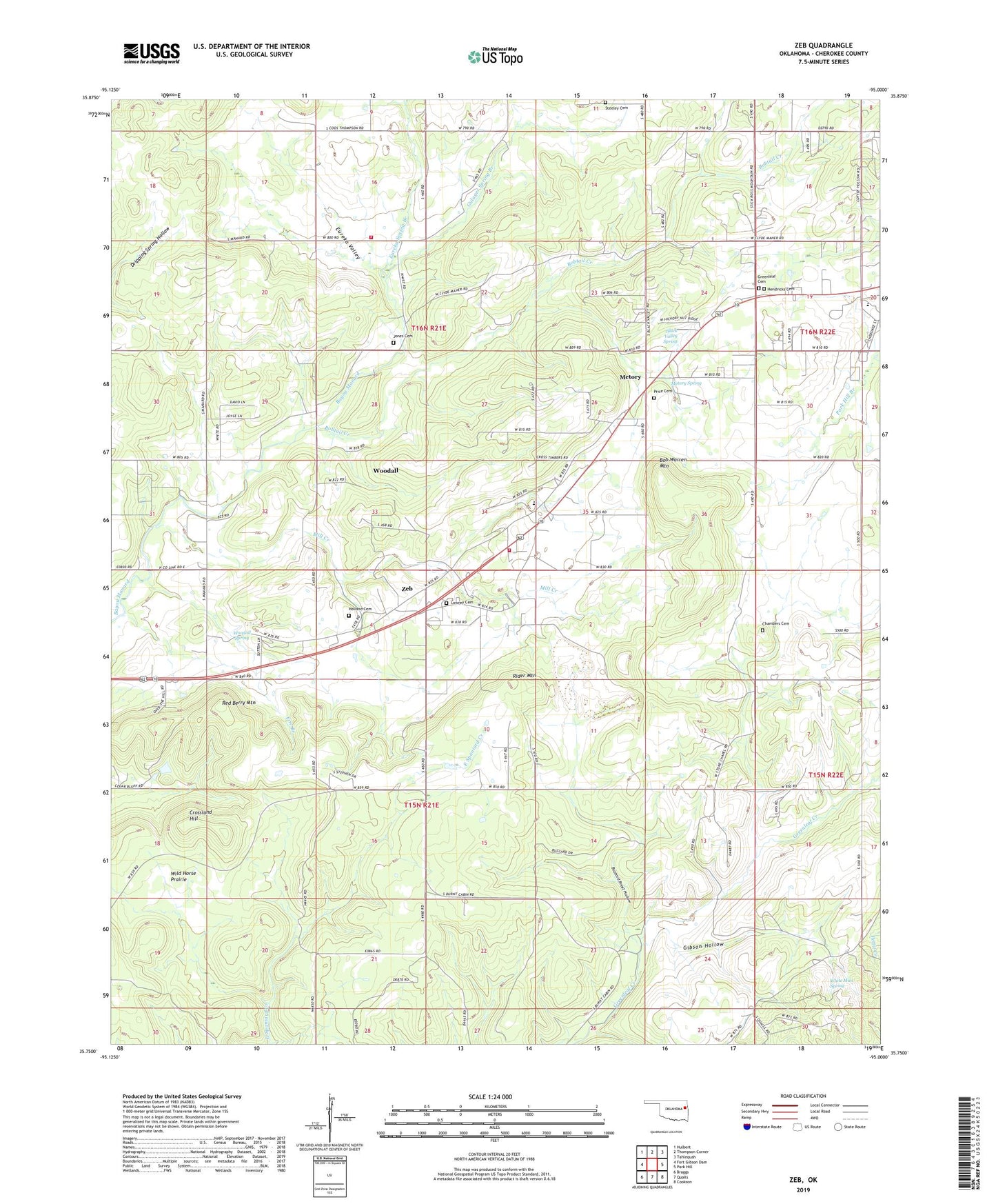
2019 topographic map quadrangle Zeb in the state of Oklahoma. Scale: 1:24000. Based on the newly updated USGS 7.5' US Topo map series, this map is in the following counties: Cherokee. The map contains contour data, water features, and other items you are used to seeing on USGS maps, but also has updated roads and other features. This is the next generation of topographic maps. Printed on high-quality waterproof paper with UV fade-resistant inks.
Quads adjacent to this one:
West: Fort Gibson Dam
Northwest: Hulbert
North: Thompson Corner
Northeast: Tahlequah
East: Park Hill
Southeast: Cookson
South: Qualls
Southwest: Braggs
Contains the following named places: Berch Hole, Black Valley Spring, Bob Warren Mountain, Bobtail Creek, Buzzard Roost Hollow, Chambers Cemetery, Crescent Valley Church, Crossland Hill, Eureka Spring Branch, Eureka Valley, Fire Branch, Gibson Hollow, Greenleaf Cemetery, Greenleaf Church, Gulager Spring Branch, Hendricks Cemetery, Holland Cemetery, Jones Cemetery, Lowrey Cemetery, Manard, Metory, Metory Spring, Mill Creek, Pentecostal Holiness Church, Price Cemetery, Red Berry Mountain, Rider Mountain, Sequoyah High School, South Cherokee Division, Steeley Cemetery, Stone Chapel School, White Man Spring, Wild Horse Prairie, Woodall, Woodall Census Designated Place, Woodall Fire Department Station 1, Woodall Fire Department Station 2, Woodall Public Schools, Woodall Spring, Zeb, Zeb Census Designated Place