MyTopo
Adobe Flat Oregon US Topo Map
Couldn't load pickup availability
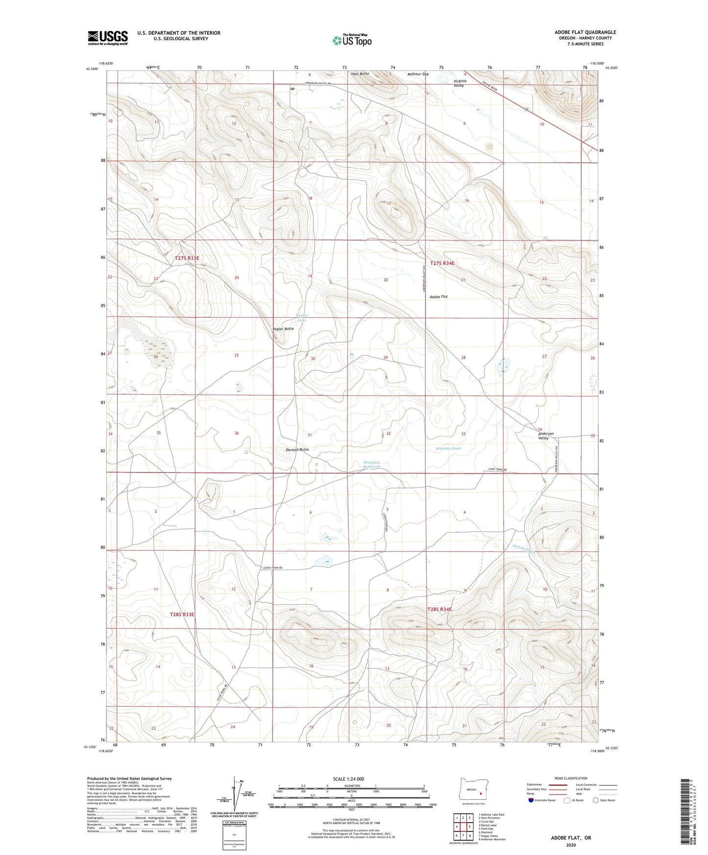
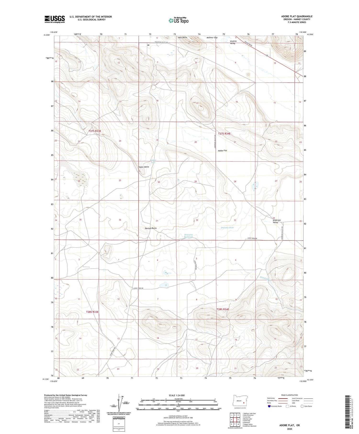
2020 topographic map quadrangle Adobe Flat in the state of Oregon. Scale: 1:24000. Based on the newly updated USGS 7.5' US Topo map series, this map is in the following counties: Harney. The map contains contour data, water features, and other items you are used to seeing on USGS maps, but also has updated roads and other features. This is the next generation of topographic maps. Printed on high-quality waterproof paper with UV fade-resistant inks.
Quads adjacent to this one:
West: Barton Lake
Northwest: Malheur Lake East
North: New Princeton
Northeast: Circle Bar
East: Sand Gap
Southeast: Anderson Mountain
South: Happy Valley
Southwest: Diamond
Contains the following named places: Adobe Flat, Anderson, Anderson Valley, Carl Smith Ranch, Davies Ranch, Davison Butte, Dracatos Draw, Dracatos Reservoir, Hatt Butte, Kegler Butte, Kegler Lake, Princeton, Princeton Post Office, Standcliff Creek, Virginia Valley, Windy Post Office