MyTopo
Agency Lake Oregon US Topo Map
Couldn't load pickup availability
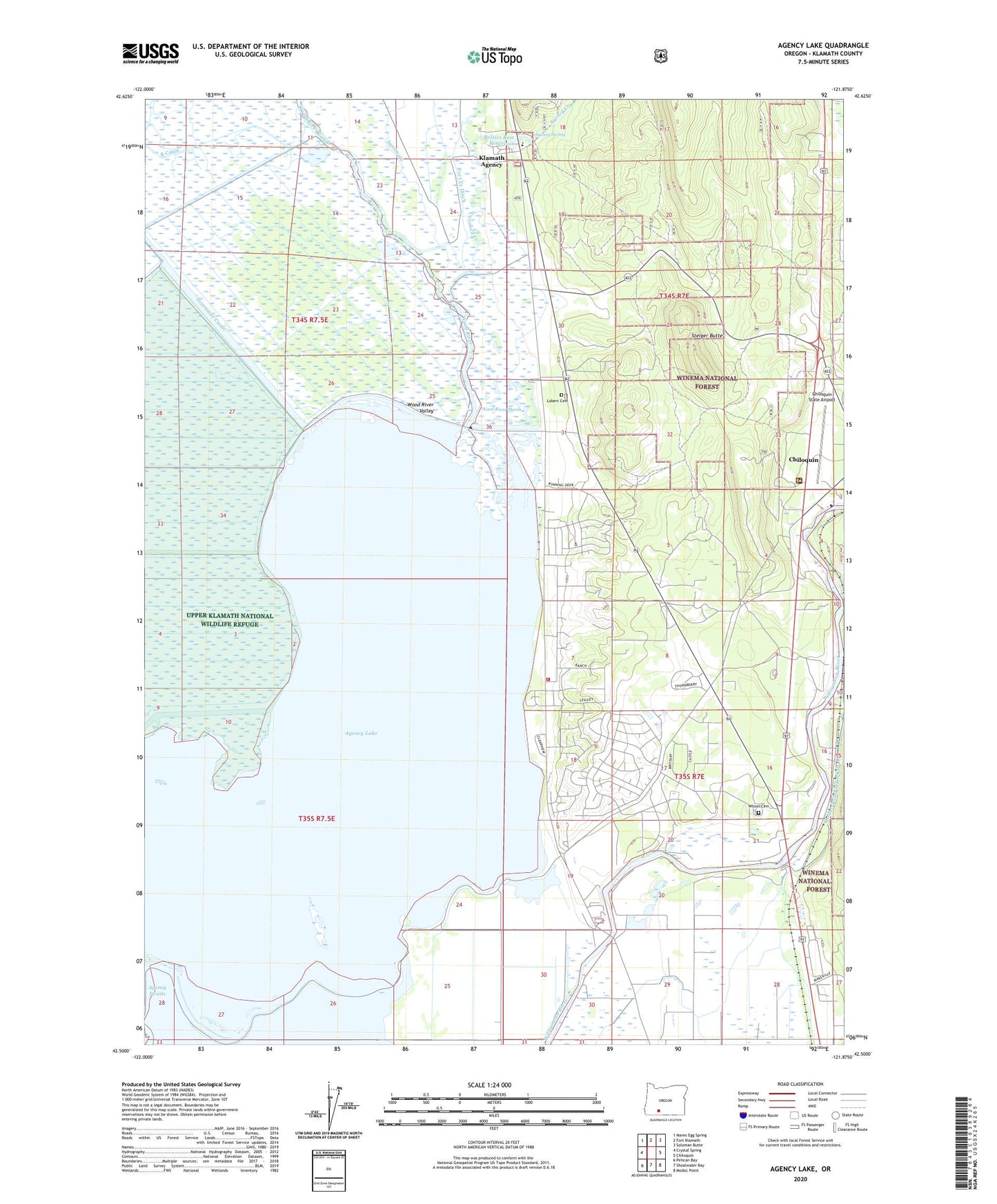
2020 topographic map quadrangle Agency Lake in the state of Oregon. Scale: 1:24000. Based on the newly updated USGS 7.5' US Topo map series, this map is in the following counties: Klamath. The map contains contour data, water features, and other items you are used to seeing on USGS maps, but also has updated roads and other features. This is the next generation of topographic maps. Printed on high-quality waterproof paper with UV fade-resistant inks.
Quads adjacent to this one:
West: Crystal Spring
Northwest: Mares Egg Spring
North: Fort Klamath
Northeast: Soloman Butte
East: Chiloquin
Southeast: Modoc Point
South: Shoalwater Bay
Southwest: Pelican Bay
Contains the following named places: Agency Creek, Agency Lake, Agency Lake Resort, Agency Lake Resort Boat Ramp, Agency Landing, Agency Spring, B Canal, Beetles Rest Reservoir, Bootleg Pond, C Canal, Chiloquin Agency Lake Fire District Station 2, Chiloquin Boat Access, Chiloquin Ranger Station, Chiloquin State Airport, Crooked Creek, Henzel County Park, Henzel Park Boat Ramp, Klamath Agency, Klamath Agency Post Office, Lobert, Lobert Cemetery, Lobert Draw, Miller Pond, Modoc Point Main Canal, Oregon Shores Census Designated Place, Petric County Park, Petric Park Boat Ramp, Rayenoof Field, Sevenmile Canal, Squaw Creek, Steiger Butte, Waterwheel Campground Boat Launch, Williamson River Mission, Williamson River Pumping Plant, Wilson Cemetery, Wood River, Wood River Marsh, Wood River Valley