MyTopo
Airlie South Oregon US Topo Map
Couldn't load pickup availability
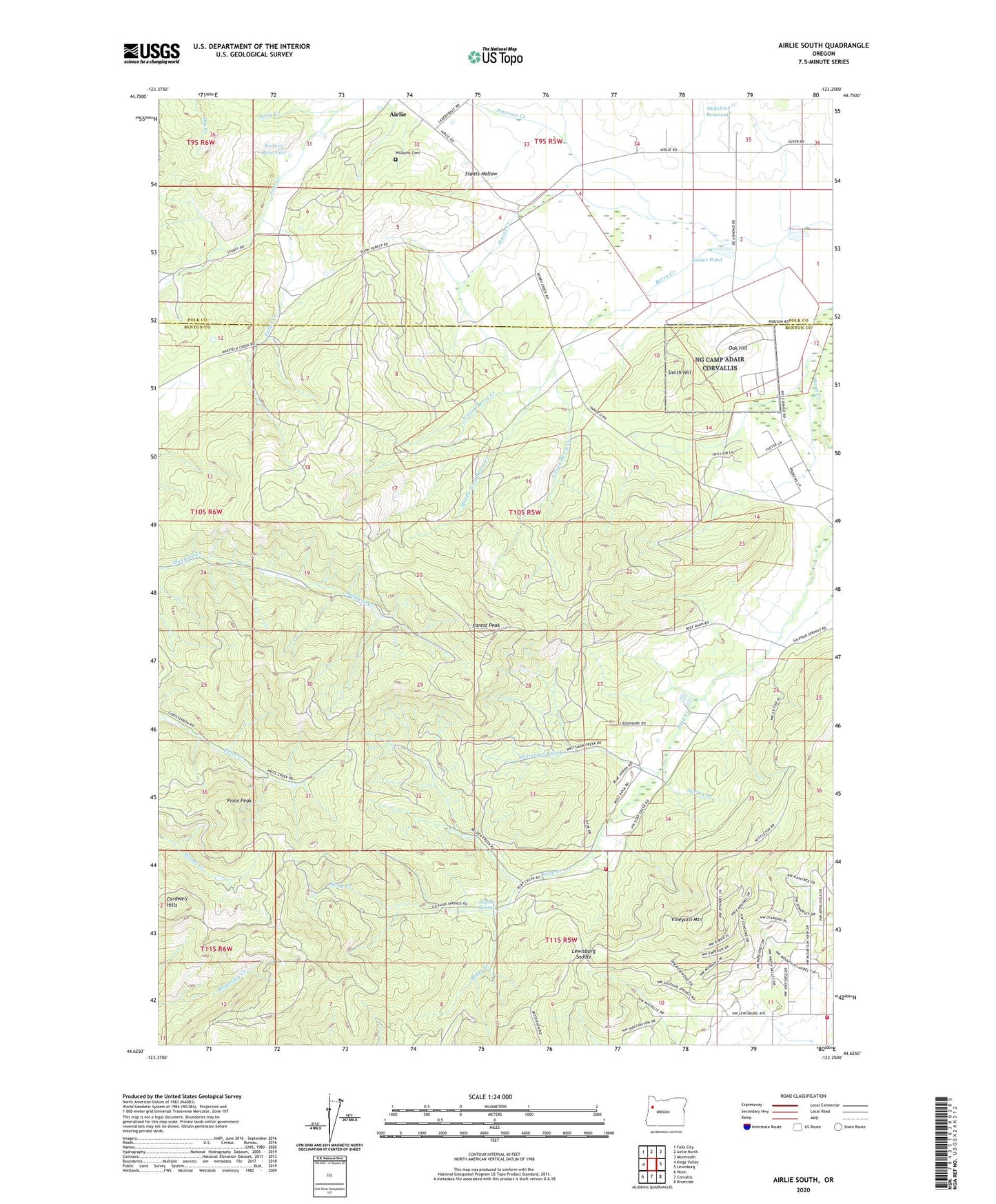
2020 topographic map quadrangle Airlie South in the state of Oregon. Scale: 1:24000. Based on the newly updated USGS 7.5' US Topo map series, this map is in the following counties: Benton, Polk. The map contains contour data, water features, and other items you are used to seeing on USGS maps, but also has updated roads and other features. This is the next generation of topographic maps. Printed on high-quality waterproof paper with UV fade-resistant inks.
Quads adjacent to this one:
West: Kings Valley
Northwest: Falls City
North: Airlie North
Northeast: Monmouth
East: Lewisburg
Southeast: Riverside
South: Corvallis
Southwest: Wren
Contains the following named places: Adair Rural Fire Protection District Station 1402, Adair Tract State Forest, Baker Creek, Bald Hill City Park, Cardwell Hills, Corvallis Fire Department Station 6, Crescent Valley, Forest Peak, Fuller Creek, Johnson Reservoir, Kenney Reservoir, Kester Pond, KHPE-FM, KLOO-FM, KOAC-TV, KRKT-FM, Lewisburg Saddle, McDonald State Forest, Middle Fork Berry Creek, North Fork Berry Creek, Oak Hill, Oakshire Reservoir, Peterson Creek, Price Peak, Smith Hill, Soap Creek School, South Fork Berry Creek, Spring Branch, Staats Creek, Staats Hollow, Sulphur Springs, Vineyard Mountain, Williams Cemetery, Writsman Brook, ZIP Code: 97330