
MyTopo
Akawa Butte Oregon US Topo Map
Couldn't load pickup availability
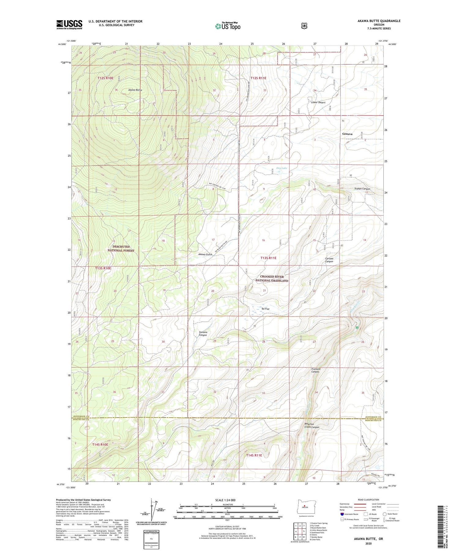
2020 topographic map quadrangle Akawa Butte in the state of Oregon. Scale: 1:24000. Based on the newly updated USGS 7.5' US Topo map series, this map is in the following counties: Jefferson, Deschutes. The map contains contour data, water features, and other items you are used to seeing on USGS maps, but also has updated roads and other features. This is the next generation of topographic maps. Printed on high-quality waterproof paper with UV fade-resistant inks.
Quads adjacent to this one:
West: Little Akawa Butte
Northwest: Prairie Farm Spring
North: Fly Creek
Northeast: Round Butte Dam
East: Steelhead Falls
Southeast: Cline Falls
South: Henkle Butte
Southwest: Sisters
Contains the following named places: Akawa Butte, Akawa Gulch, Dry Lake, Emery Post Office, Fremont Canyon, Geneva, Geneva Post Office, Lower Desert, Rim Rock Ranch, Singing Horse Ranch, Stevens Canyon, Tai Flat


