MyTopo
Akers Butte Oregon US Topo Map
Couldn't load pickup availability
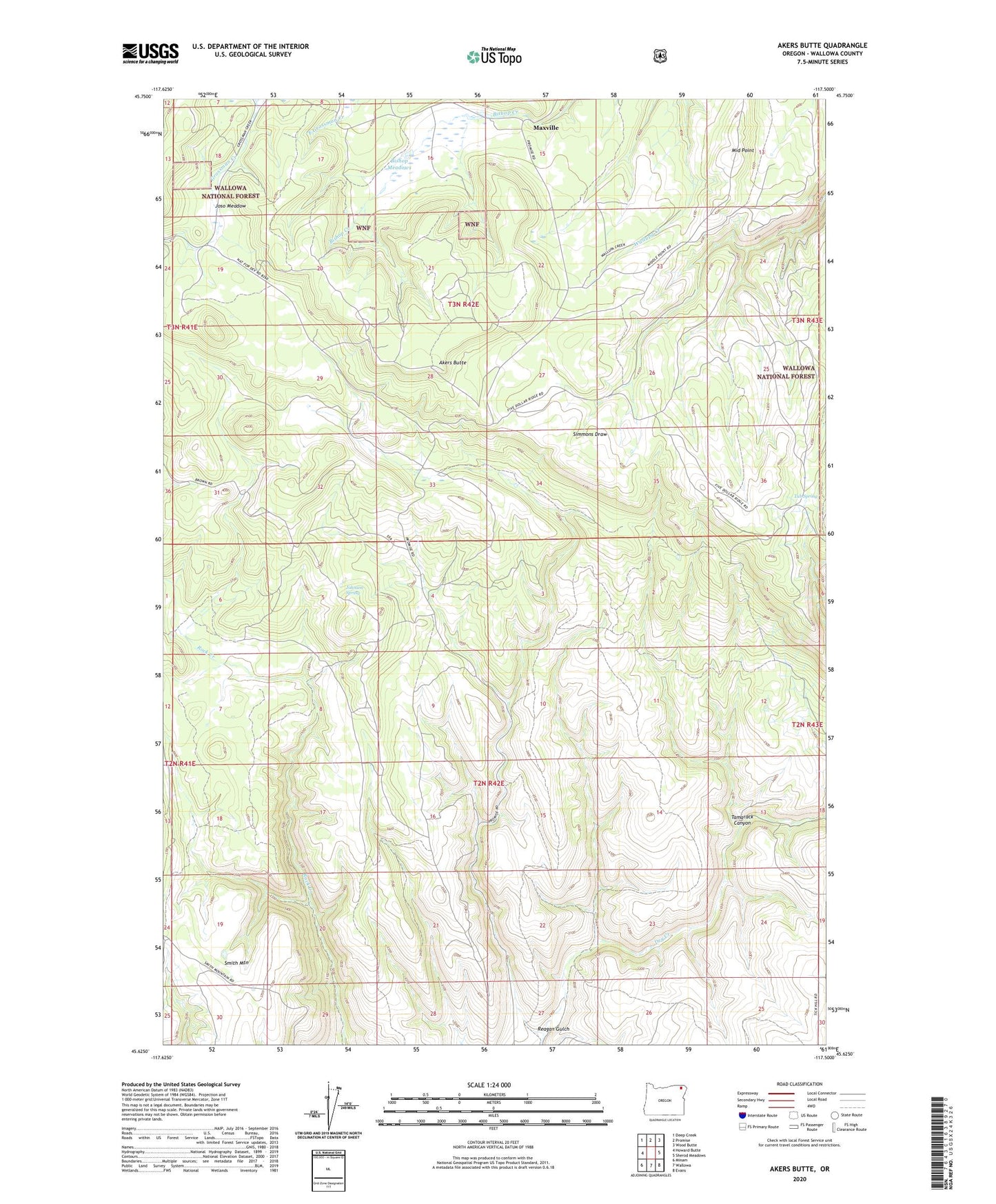
2020 topographic map quadrangle Akers Butte in the state of Oregon. Scale: 1:24000. Based on the newly updated USGS 7.5' US Topo map series, this map is in the following counties: Wallowa. The map contains contour data, water features, and other items you are used to seeing on USGS maps, but also has updated roads and other features. This is the next generation of topographic maps. Printed on high-quality waterproof paper with UV fade-resistant inks.
Quads adjacent to this one:
West: Howard Butte
Northwest: Deep Creek
North: Promise
Northeast: Wood Butte
East: Sherod Meadows
Southeast: Evans
South: Wallowa
Southwest: Minam
Contains the following named places: Akers Butte, Bishop Meadows, Johnson Spring, Joso Meadow, Maxville, Maxville Post Office, Middle Point, Reagan Gulch, Tamarack Canyon, Tub Spring, ZIP Code: 97885