MyTopo
Aldrich Mountain South Oregon US Topo Map
Couldn't load pickup availability
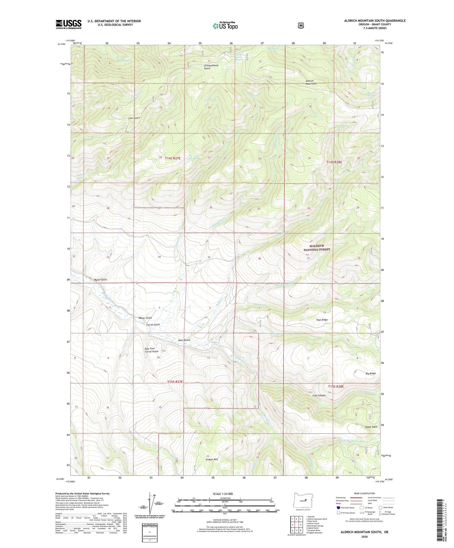
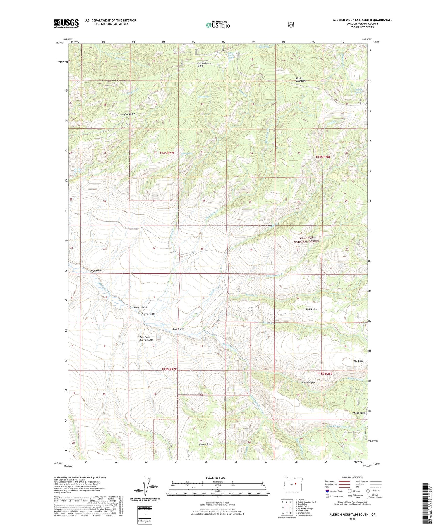
2020 topographic map quadrangle Aldrich Mountain South in the state of Oregon. Scale: 1:24000. Based on the newly updated USGS 7.5' US Topo map series, this map is in the following counties: Grant. The map contains contour data, water features, and other items you are used to seeing on USGS maps, but also has updated roads and other features. This is the next generation of topographic maps. Printed on high-quality waterproof paper with UV fade-resistant inks.
Quads adjacent to this one:
West: Aldrich Gulch
Northwest: Dayville
North: Aldrich Mountain North
Northeast: Shop Gulch
East: Big Weasel Springs
Southeast: Flagtail Mountain
South: Graylock Butte
Southwest: Suplee Butte
Contains the following named places: Bark Cabin Creek, Big Pine Springs, Big Ridge, Big Spring, Cabbage Patch Camp, Cabbage Patch Spring, Cabin Creek, Cabin Creek Trail, Cold Spring, Corral Gulch, Cow Canyon, Crazy Creek, Deer Gulch, Dry Cabin Creek, Dry Cabin Creek Trail, Dry Duncan Creek, Dry Duncan Creek Trail, Duncan Creek, East Fork Corral Gulch, Mud Spring, Murderers Creek Ranch, Roaring Spring, Shake Table, South Fork Murderers Creek, Thorn Creek, Timber Mountain, Todd Creek, Todd Creek Camp, Trail Ridge, Water Gulch, Weaver Cabin, Wylie Gulch