
MyTopo
Alger Lake Oregon US Topo Map
Couldn't load pickup availability
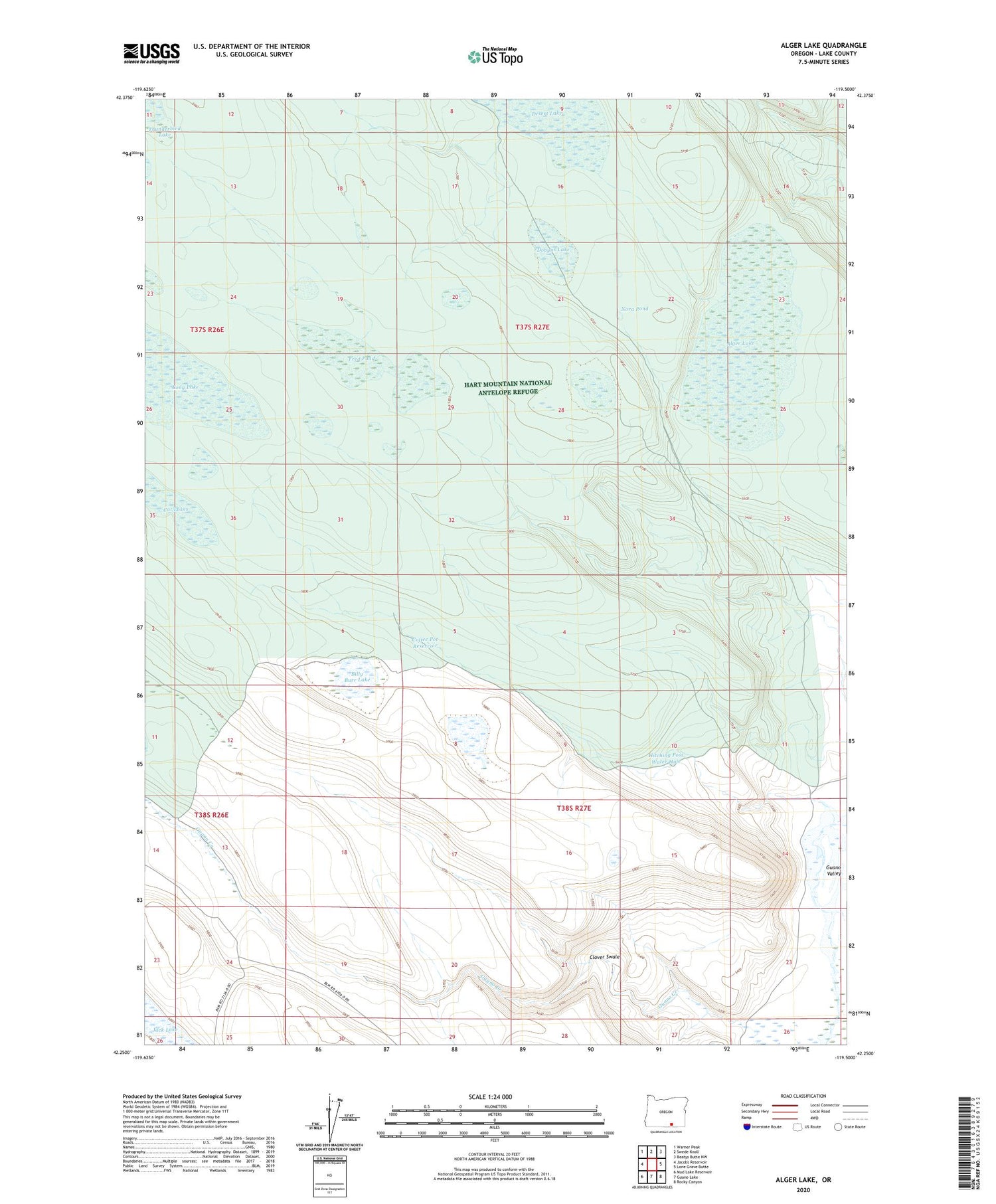
2020 topographic map quadrangle Alger Lake in the state of Oregon. Scale: 1:24000. Based on the newly updated USGS 7.5' US Topo map series, this map is in the following counties: Lake. The map contains contour data, water features, and other items you are used to seeing on USGS maps, but also has updated roads and other features. This is the next generation of topographic maps. Printed on high-quality waterproof paper with UV fade-resistant inks.
Quads adjacent to this one:
West: Jacobs Reservoir
Northwest: Warner Peak
North: Swede Knoll
Northeast: Beatys Butte NW
East: Lone Grave Butte
Southeast: Rocky Canyon
South: Guano Lake
Southwest: Mud Lake Reservoir
Contains the following named places: Alger Lake, Billy Burr Lake, Cat Lakes, Clover Swale, Coffee Pot Reservoir, Dobyns Lake, Fred Pond, Hitching Post Water Hole, Jack Lake, Nora Pond, North Lakes


