
MyTopo
Alsup Mountain Oregon US Topo Map
Couldn't load pickup availability
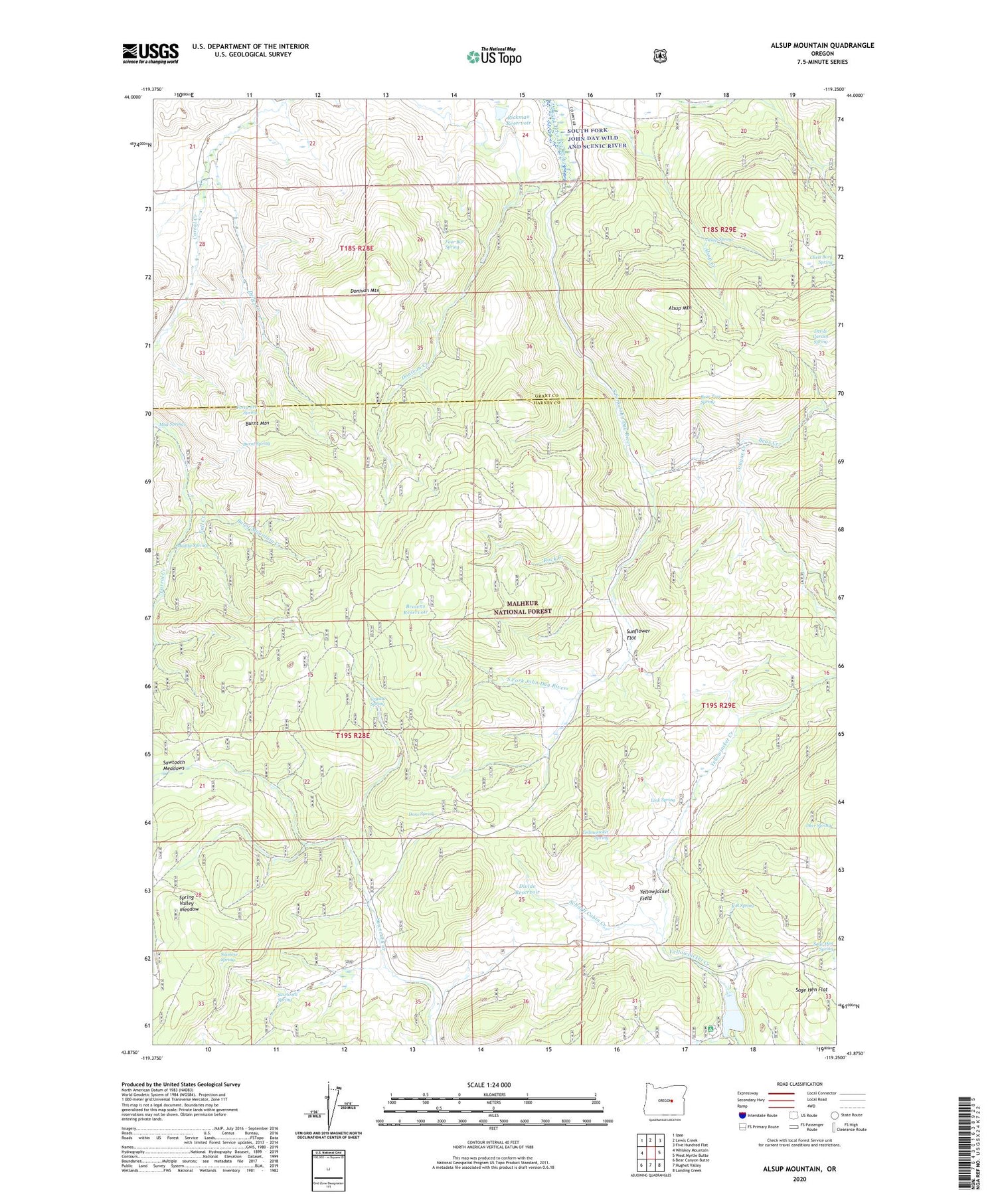
2020 topographic map quadrangle Alsup Mountain in the state of Oregon. Scale: 1:24000. Based on the newly updated USGS 7.5' US Topo map series, this map is in the following counties: Harney, Grant. The map contains contour data, water features, and other items you are used to seeing on USGS maps, but also has updated roads and other features. This is the next generation of topographic maps. Printed on high-quality waterproof paper with UV fade-resistant inks.
Quads adjacent to this one:
West: Whiskey Mountain
Northwest: Izee
North: Lewis Creek
Northeast: Five Hundred Flat
East: West Myrtle Butte
Southeast: Landing Creek
South: Hughet Valley
Southwest: Bear Canyon Butte
Contains the following named places: Alsup Creek, Alsup Mountain, Alsup Spring, Bear Creek, Bear Tree Guard Station, Bear Tree Spring, Brown Ranch, Browns Reservoir, Burnt Mountain, Burnt Mountain Creek, Burnt Spring, Buttes Ranch, Carey Ranch, Chris Borg Spring, Clemens Dam, Cougar Creek, Cougar Mountain, Crystal Reservoir, Crystal Spring, Deer Spring, Delles Creek, Delles Creek Camp, Devils Garden Spring, Divide Reservoir, Donivan Creek, Donivan Mountain, Dons Spring, Fall Creek, Forty-five Spring, Four Bar Spring, Hunter Cabin, K B Spring, Link Spring, Mud Springs, Mud Springs Creek, Muddy Spring, Rickman Ranch, Rickman Reservoir, Rock Creek, Sage Hen Flat, Sawtooth Meadows, Sawtooth Spring, Scharff Cabin Creek, Siamese Spring, Spring Valley meadow, Sunflower Flat, Turner Cabin, Yellowjacket Field, Yellowjacket Lake, Yellowjacket Recreation Site, Yellowjacket Spring


