MyTopo
Aneroid Mountain Oregon US Topo Map
Couldn't load pickup availability
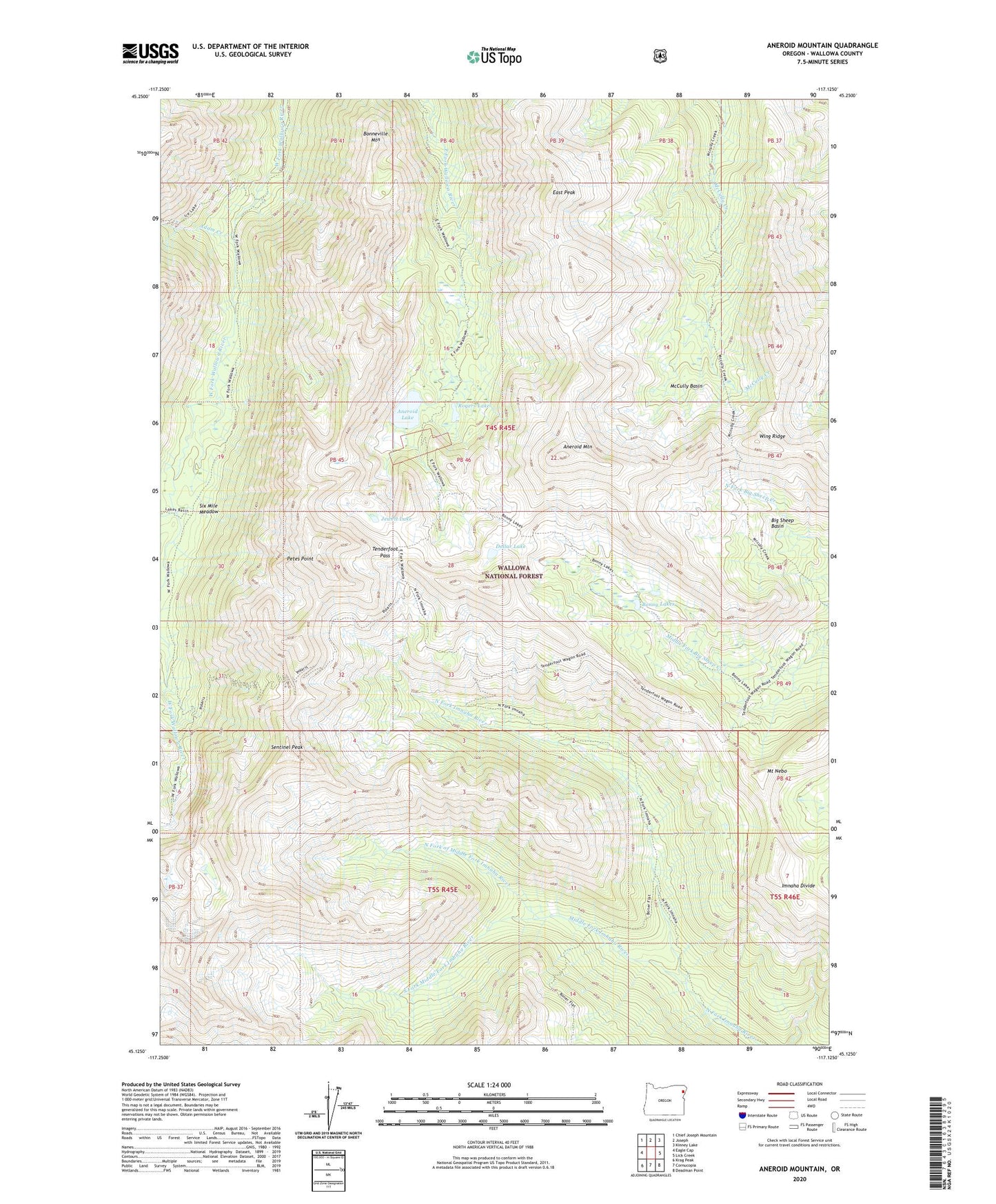
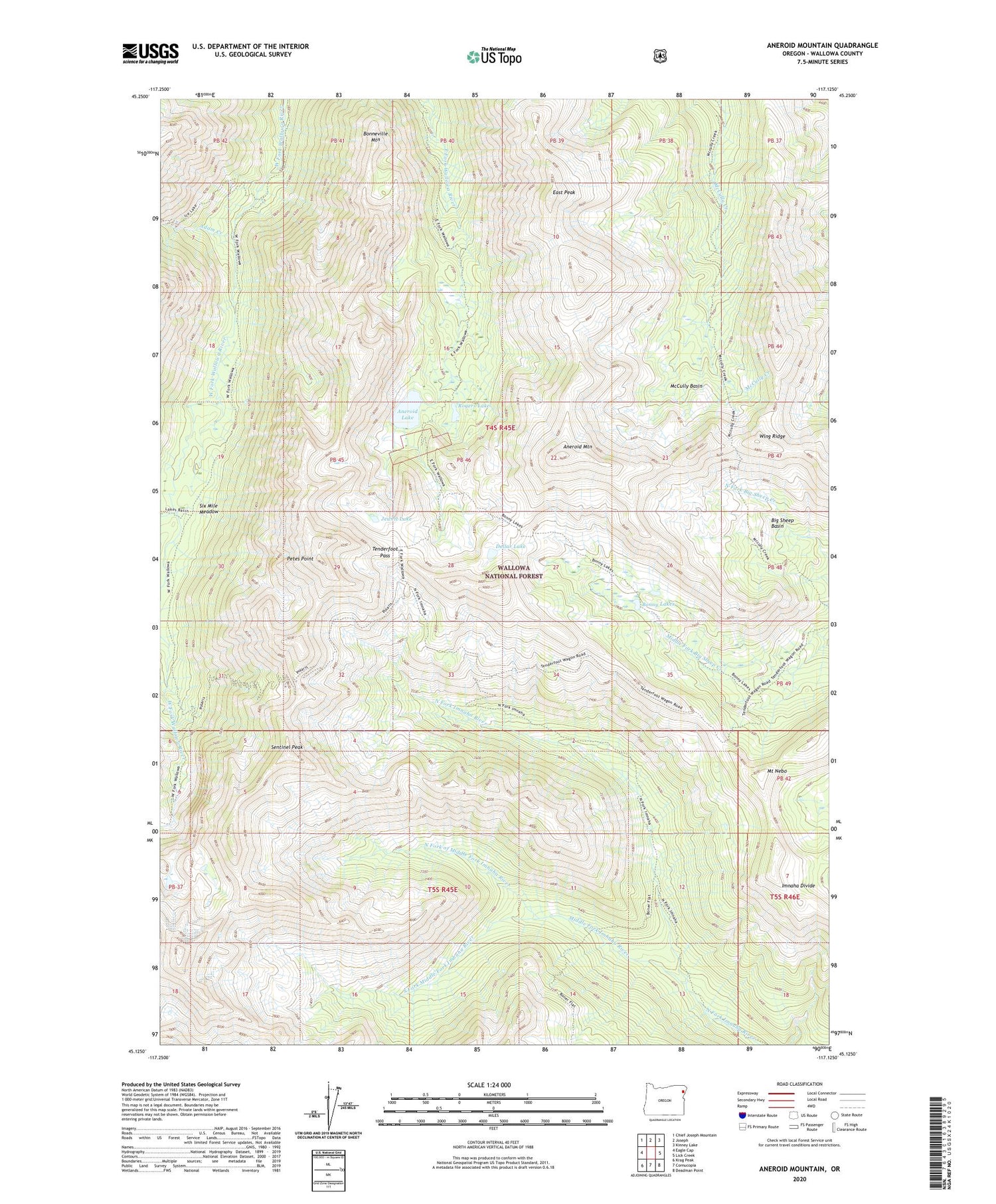
2020 topographic map quadrangle Aneroid Mountain in the state of Oregon. Scale: 1:24000. Based on the newly updated USGS 7.5' US Topo map series, this map is in the following counties: Wallowa. The map contains contour data, water features, and other items you are used to seeing on USGS maps, but also has updated roads and other features. This is the next generation of topographic maps. Printed on high-quality waterproof paper with UV fade-resistant inks.
Quads adjacent to this one:
West: Eagle Cap
Northwest: Chief Joseph Mountain
North: Joseph
Northeast: Kinney Lake
East: Lick Creek
Southeast: Deadman Point
South: Cornucopia
Southwest: Krag Peak
Contains the following named places: Adam Creek, Aneroid Lake, Aneroid Mountain, Big Sheep Basin, Bonneville Mountain, Bonny Lakes, Cusick Mountain, Dollar Lake, East Peak, Imnaha Divide, Jewett Lake, Joseph Division, Lake Creek, McCully Basin, Middle Fork Imhaha River, Mount Nebo, North Fork of Middle Fork Imnaha River, Petes Point, Rogers Lake, Sentinel Peak, Six Mile Meadow, South Fork Middle Fork Imhaha River, Tenderfoot Pass, Wing Ridge