MyTopo
Applegate Oregon US Topo Map
Couldn't load pickup availability
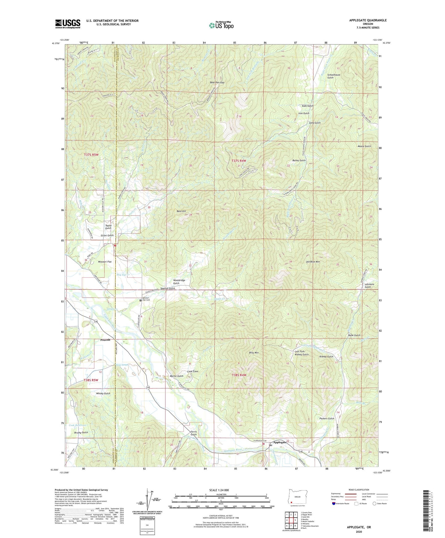
2020 topographic map quadrangle Applegate in the state of Oregon. Scale: 1:24000. Based on the newly updated USGS 7.5' US Topo map series, this map is in the following counties: Jackson, Josephine. The map contains contour data, water features, and other items you are used to seeing on USGS maps, but also has updated roads and other features. This is the next generation of topographic maps. Printed on high-quality waterproof paper with UV fade-resistant inks.
Quads adjacent to this one:
West: Murphy
Northwest: Grants Pass
North: Rogue River
Northeast: Gold Hill
East: Mount Isabelle
Southeast: Ruch
South: Tallowbox Mountain
Southwest: Williams
Contains the following named places: Applegate, Applegate Branch Library, Applegate Elementary School, Applegate Post Office, Applegate Valley Rural Fire Protection District 9 Station 1, Applegate Valley Rural Fire Protection District 9 Station 6, Bailey Gulch, Bald Hill, Balls Branch, Bear Pen Gap, Billy Mountain, Bridgepoint Ditch, Brushy Gulch, Camp Spencer, Cook Cove, Cook Reservoir, Cove Creek, Davidson Post Office, Dry Creek, Eads Gulch, Ferris Gulch, FS Reservoir, Gillet Gulch, Hog Eye Creek, Humbug Creek, Iron Gulch, Johnsons Gulch, Kane Creek, Kane Gulch, Kidney Gulch, Kubli, Kubli Post Office, Left Fork Balls Branch, Left Fork Humbug Creek, Left Fork Kidney Gulch, Long Gulch, Miller Mine, Miners Creek, Missouri Flat, Missouri Flat Cemetery, Mountain Lion Mine, Myrtle Gulch, New Berryman Ditch, Old Blue Mountain, Packers Gulch, Pennington Creek, Powell Creek, Provolt, Provolt Post Office, Rocky Creek, Rowden Mine, Schoolhouse Gulch, Slagle Creek, Spanish Gulch, Stone Sumps, Taylor Gulch, Thompson Creek, Watts and Topping Ditch, Whisky Gulch, Williams Creek, Williams Creek Post Office, Williams Guard Station, Wooldridge Creek, Wooldridge Gulch