MyTopo
Battle Mountain Oregon US Topo Map
Couldn't load pickup availability
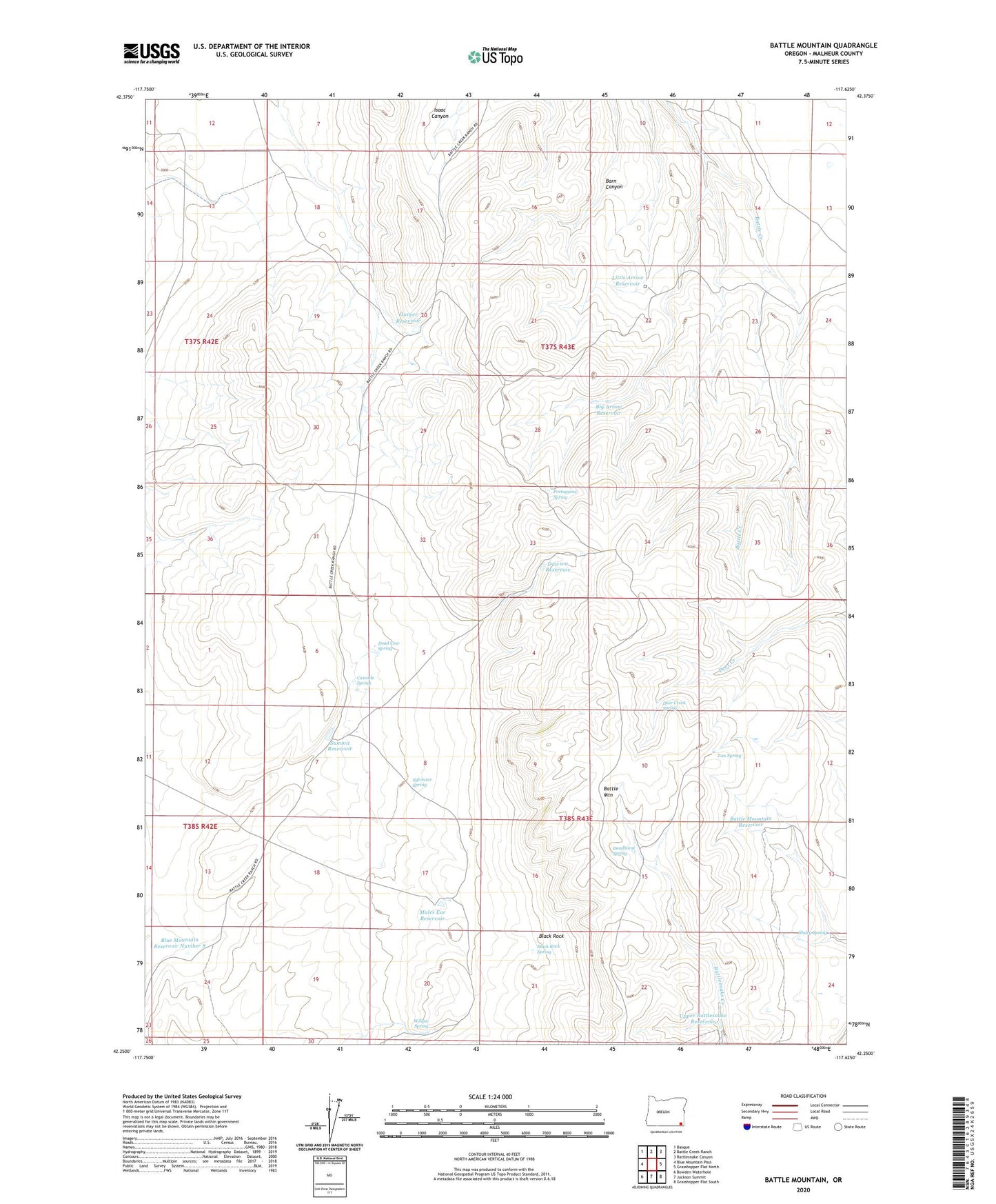
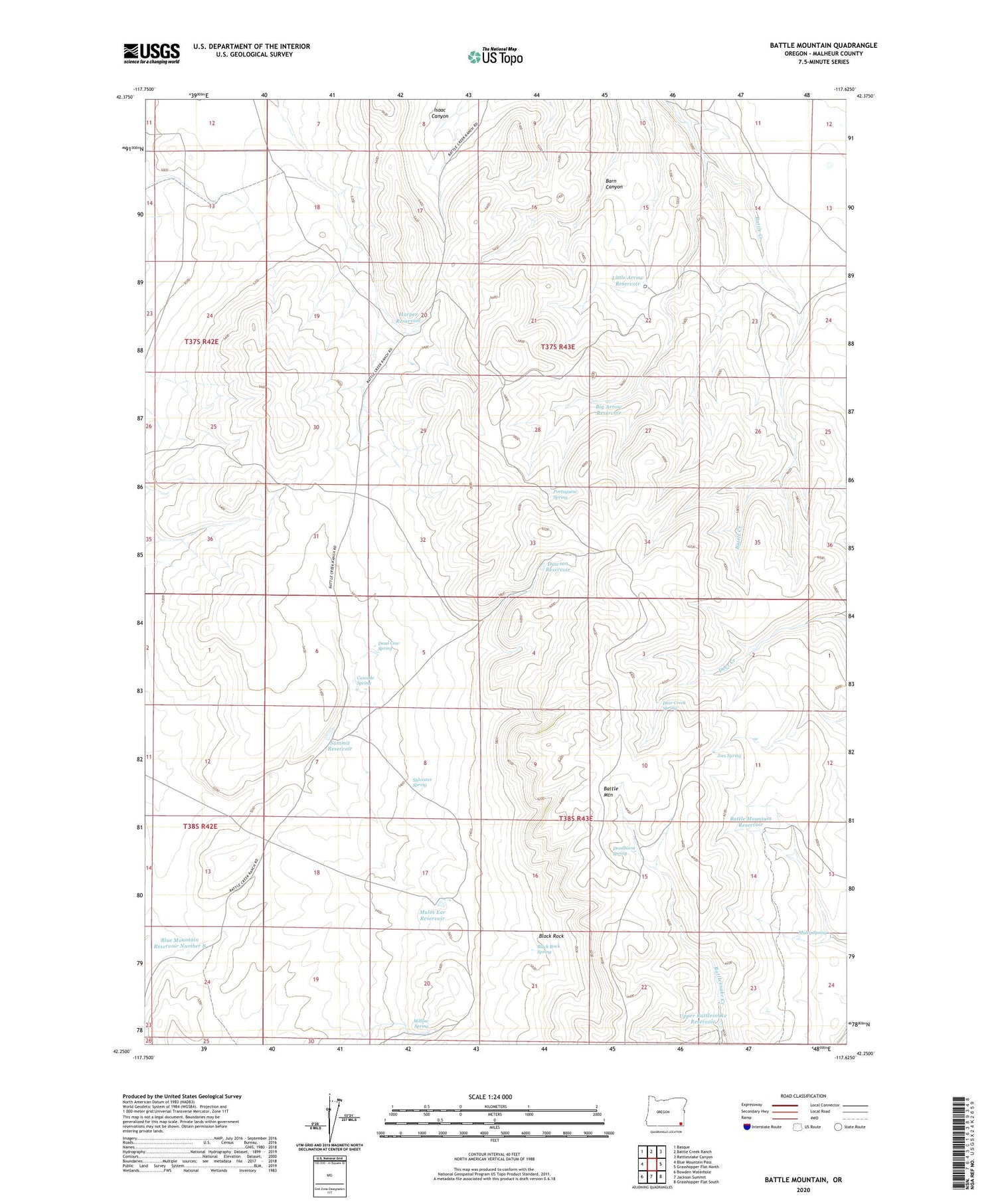
2020 topographic map quadrangle Battle Mountain in the state of Oregon. Scale: 1:24000. Based on the newly updated USGS 7.5' US Topo map series, this map is in the following counties: Malheur. The map contains contour data, water features, and other items you are used to seeing on USGS maps, but also has updated roads and other features. This is the next generation of topographic maps. Printed on high-quality waterproof paper with UV fade-resistant inks.
Quads adjacent to this one:
West: Blue Mountain Pass
Northwest: Basque
North: Battle Creek Ranch
Northeast: Rattlesnake Canyon
East: Grasshopper Flat North
Southeast: Grasshopper Flat South
South: Jackson Summit
Southwest: Bowden Waterhole
Contains the following named places: Battle Mountain, Battle Mountain Reservoir, Big Arrow Reservoir, Black Rock, Black Rock Spring, Blue Mountain Reservoir Number 8, Cascade Spring, Dawson Reservoir, Dead Cow Spring, Deadhorse Spring, Deer Creek Spring, Harper Reservoir, Joes Spring, Little Arrow Reservoir, Mules Ear Reservoir, Muley Spring, Portuguese Spring, Summit Reservoir, Sylvester Spring, Upper Rattlesnake Reservoir, Willow Spring