
MyTopo
Zumwalt Oregon US Topo Map
Couldn't load pickup availability
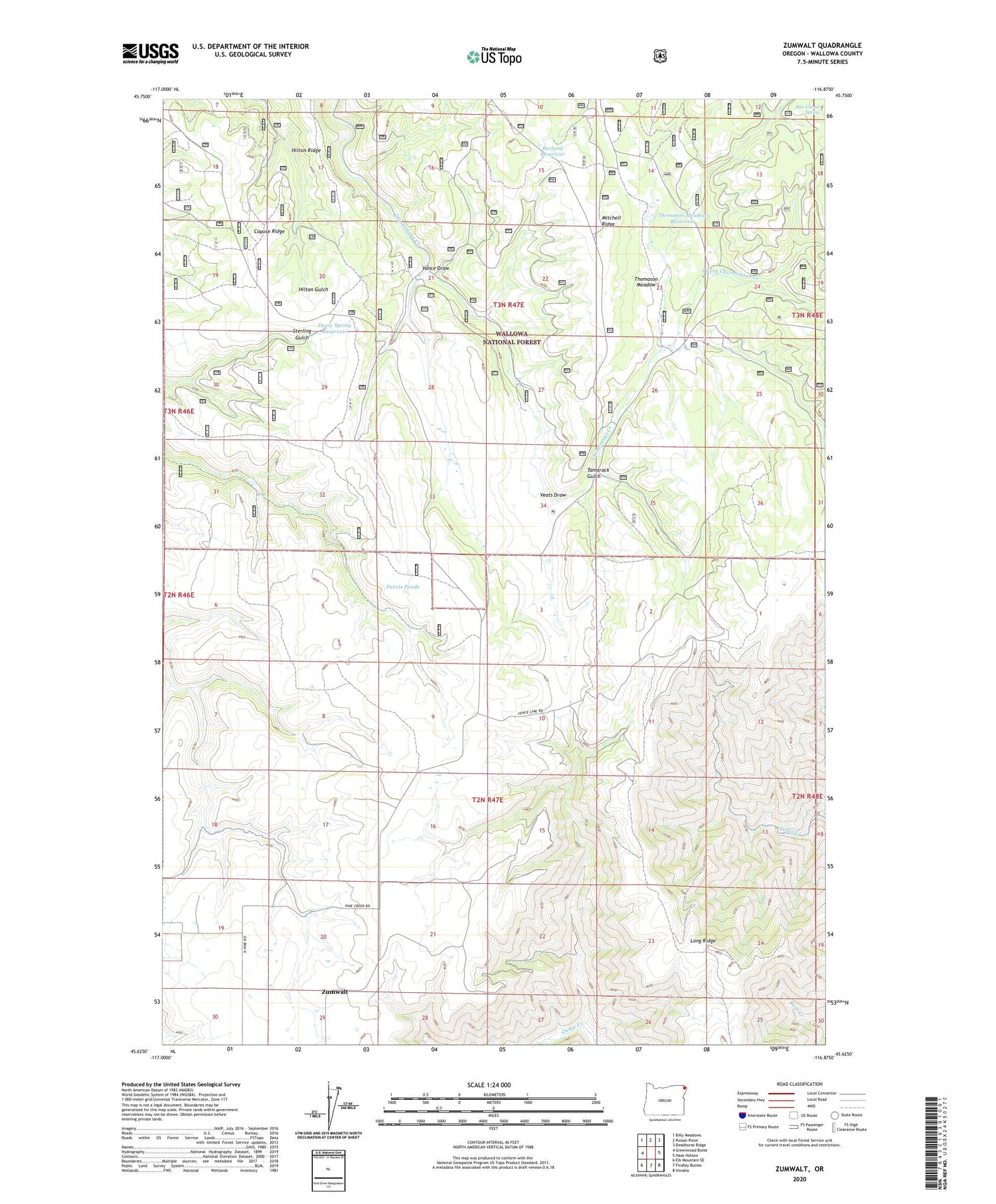
2020 topographic map quadrangle Zumwalt in the state of Oregon. Scale: 1:24000. Based on the newly updated USGS 7.5' US Topo map series, this map is in the following counties: Wallowa. The map contains contour data, water features, and other items you are used to seeing on USGS maps, but also has updated roads and other features. This is the next generation of topographic maps. Printed on high-quality waterproof paper with UV fade-resistant inks.
Quads adjacent to this one:
West: Greenwood Butte
Northwest: Billy Meadows
North: Poison Point
Northeast: Deadhorse Ridge
East: Haas Hollow
Southeast: Imnaha
South: Findley Buttes
Southwest: Elk Mountain SE
Contains the following named places: Berland Reservoir, Cayuse Ridge, Chesnimnus Cow Camp, Davis Spring Reservoir, Gill Ranch, Long Ridge, Purvis Ponds, Rice Corral Spring, South Fork Chesnimnus Creek, Steen Ranch, Tamarack Gulch, Thomason Meadow, Thomason Meadow Guard Station, Thomason Meadow Reservoir, Vance Draw, Veats Draw, Zumwalt, Zumwalt Post Office, Zumwalt School


