MyTopo
Aldenville Pennsylvania US Topo Map
Couldn't load pickup availability
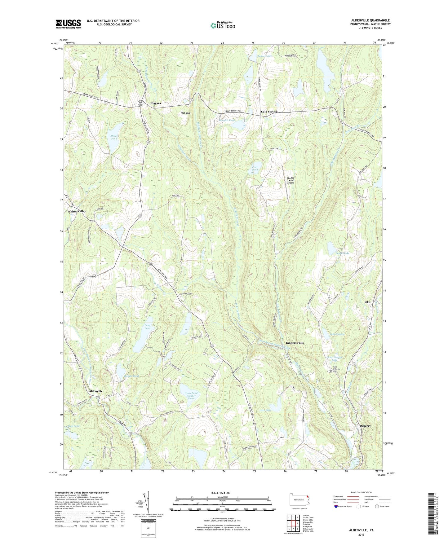
2019 topographic map quadrangle Aldenville in the state of Pennsylvania. Scale: 1:24000. Based on the newly updated USGS 7.5' US Topo map series, this map is in the following counties: Wayne. The map contains contour data, water features, and other items you are used to seeing on USGS maps, but also has updated roads and other features. This is the next generation of topographic maps. Printed on high-quality waterproof paper with UV fade-resistant inks.
Quads adjacent to this one:
West: Forest City
Northwest: Orson
North: Lake Como
Northeast: Long Eddy
East: Galilee
Southeast: White Mills
South: Honesdale
Southwest: Waymart
Contains the following named places: Aldenville, Alder Marsh Brook, Beaver Lake, Beaver Lake Dam, Big Brook, Camp Cayuga Lake, Camp Towanda, Carr Pond, Charles G Kalko Airport, Cold Spring, Cramer Creek, Cramer Pond Dam, Douglas Pond, Douglas Pond Dam, Dyberry, East Branch Dyberry Creek, East Dyberry Cemetery, Flat Rock, Glass Pond Dam Number Three, Glass Pond Number Three, Glass Pond Number Two, Hoppl Dam, Justin Lake, Lake Cayuga, Lake Elsie, Lake Elsie Dam, Long Pond, Long Pond Dam, Lower Dam, Lower Wood Pond Dam, Lower Woods Pond, Middle Branch Dyberry Creek, Miller Pond, Mud Pond, Niagara, Pa-57 Dam, Ponderosa Pines Dam, Red Schoolhouse Corner, Rose Pond Branch, Rosner Pond, Rosner Pond Dam, Saint Cecilia Church, School Number 3, Siko, Stookey Dam, Sunset Lake, Tanners Fall Mill Dam, Tanners Falls, Township of Dyberry, Township of Lebanon, Wayne County, West Branch Dyberry Creek, Whites Valley