MyTopo
Alfarata Pennsylvania US Topo Map
Couldn't load pickup availability
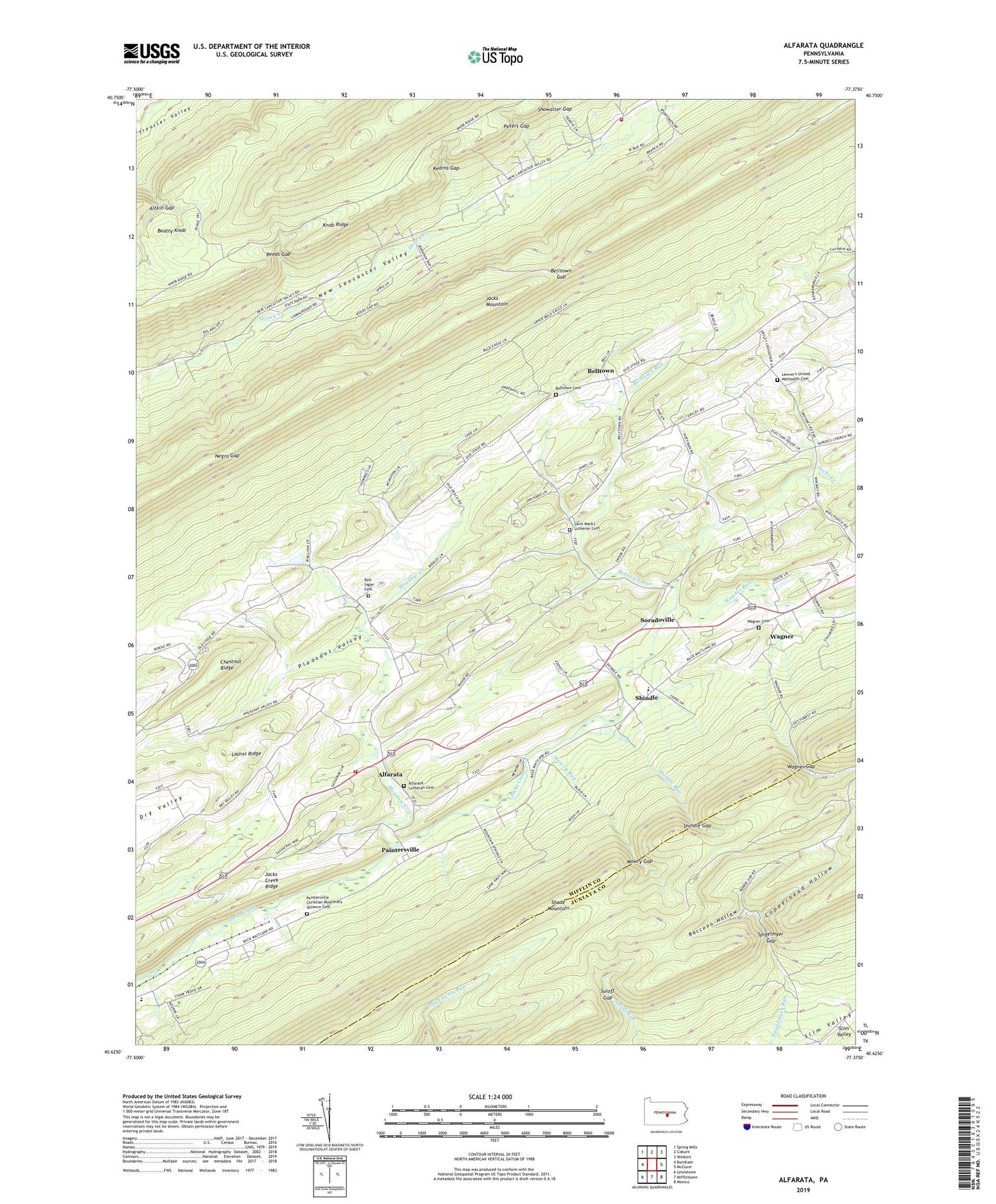
2019 topographic map quadrangle Alfarata in the state of Pennsylvania. Scale: 1:24000. Based on the newly updated USGS 7.5' US Topo map series, this map is in the following counties: Mifflin, Juniata. The map contains contour data, water features, and other items you are used to seeing on USGS maps, but also has updated roads and other features. This is the next generation of topographic maps. Printed on high-quality waterproof paper with UV fade-resistant inks.
Quads adjacent to this one:
West: Burnham
Northwest: Spring Mills
North: Coburn
Northeast: Weikert
East: McClure
Southeast: Mexico
South: Mifflintown
Southwest: Lewistown
Contains the following named places: Aitkin Gap, Alfarata, Alfarata Census Designated Place, Alfarata Lutheran Cemetery, Bell - Sigler Cemetery, Belltown, Belltown Cemetery, Belltown Gap, Belltown Run, Belltown School, Center School, Chestnut Ridge, Copperhead Hollow, Decatur, Decatur School, Decatur Volunteer Fire Company Station 5, Jacks Creek Ridge, Kearns Gap, Laurel Ridge, Lawvers Church, Lawver's United Methodist Cemetery, Meadow Creek, Mowry Gap, Mowry Run, Negro Gap, New Lancaster Valley Volunteer Fire Company Station 8, Paintersville, Paintersville Christian Missionary Alliance Cemetery, Peters Gap, Pleasant Valley, Raccoon Hollow, Reeds Gap, Reeds Gap State Park, Saint Marks Church, Saint Mark's Lutheran Cemetery, Shangri La Airport, Shindle, Shindle Gap, Shindle Run, Sigler School, Slim Valley, Snook, Soradoville, Spigelmyer Gap, State Game Lands Number 107, Suloff Gap, Township of Decatur, Wagner, Wagner Cemetery, Wagner Census Designated Place, Wagner Church, Wagner Gap, Wagner Lookout Tower, Wagner Run