MyTopo
Aliquippa Pennsylvania US Topo Map
Couldn't load pickup availability
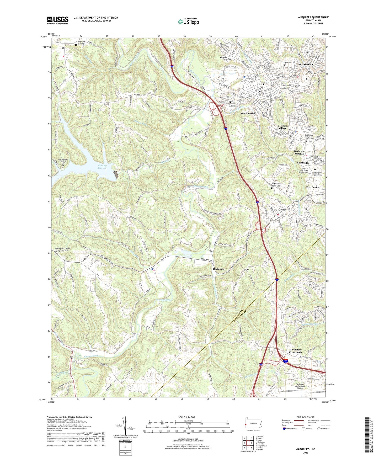
2019 topographic map quadrangle Aliquippa in the state of Pennsylvania. Scale: 1:24000. Based on the newly updated USGS 7.5' US Topo map series, this map is in the following counties: Beaver, Allegheny. The map contains contour data, water features, and other items you are used to seeing on USGS maps, but also has updated roads and other features. This is the next generation of topographic maps. Printed on high-quality waterproof paper with UV fade-resistant inks.
Quads adjacent to this one:
West: Hookstown
Northwest: Midland
North: Beaver
Northeast: Baden
East: Ambridge
Southeast: Oakdale
South: Clinton
Southwest: Burgettstown
Contains the following named places: Aliquippa Bureau of Fire Station 91, Aliquippa Community Hospital, Aliquippa Hospital Airport, Aliquippa Shopping Center, Ambridge Reservoir, B F Jones Memorial Library, Bocktown, Brunton Dairy, City of Aliquippa, Civic Senior Citizens Club, Cochran Acres, Crestmont Shopping Center, Crestmont Village, Davidson Heights, Deliverance Temple Ministries Roots Christian Academy, Five Points, Frames Run, Gorsich School, Green Garden, Green Garden Plaza, Gringo, Gums Run, Hollywood Bridge, Holt, Hopewell Elementary School, Hopewell High School, Hopewell School, Hopewell Senior High School, Hopewell Shopping Center, Hopewell Township Hall, Hopewell Township Police Department, Hopewell Township Volunteer Fire Department Station 92 - 1, Hopewell Township Volunteer Fire Department Station 92 - 2, Independence, Independence Elementary School, Independence Township Hall, Independence Township Police Department, Independence Township Volunteer Fire Department Station 80, J C Bacon Dam, John Anderson Memorial Cemetery, Johnston State School, Jones School, Laughlin School, Little Traverse Creek, Mac Arthur Post Office, McAlisters Crossroads, Moree Field, Mount Carmel Cemetery, Mount Carmel United Presbyterian Church, Mount Olivet Catholic Cemetery, Mount Olivet Church, Mount Olivet Presbyterian Church Cemetery, Mount Zion Methodist Church Cemetery, New Bethlehem Church, New Bethlehem United Presbyterian Church Cemetery, New Sheffield, Obney Run, Ohio United Presbyterian Church Cemetery, Our Lady of Fatima School, Raccoon Cemetery, Raccoon Grange, Raccoon School, Raccoon Township Independent Volunteer Fire Department Station 35, Raredon Run, Rhyming Thyme Day Care Center, Saint Elijah Serbian Cemetery, Saint Titus School, Scottsville, Service Creek, Service Creek Reservoir, Service United Church, Sheffield School, State Game Lands Number 189, Temple Heights School, Tender Years Child Care Center, Township of Hopewell, Township of Independence, Trampmill Run, Traverse Creek, Veasey Cemetery, West Hills Par 3 Golf Course, Woodlawn Cemetery, ZIP Codes: 15001, 15026