MyTopo
Andersonburg Pennsylvania US Topo Map
Couldn't load pickup availability
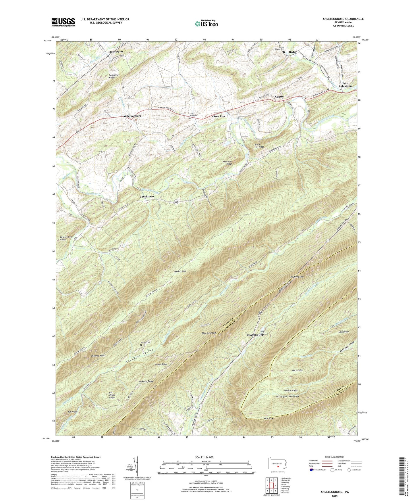
2019 topographic map quadrangle Andersonburg in the state of Pennsylvania. Scale: 1:24000. Based on the newly updated USGS 7.5' US Topo map series, this map is in the following counties: Perry, Cumberland. The map contains contour data, water features, and other items you are used to seeing on USGS maps, but also has updated roads and other features. This is the next generation of topographic maps. Printed on high-quality waterproof paper with UV fade-resistant inks.
Quads adjacent to this one:
West: Blain
Northwest: McCoysville
North: Spruce Hill
Northeast: Ickesburg
East: Landisburg
Southeast: Plainfield
South: Newville
Southwest: Newburg
Contains the following named places: Andersonburg, Bernheisel Ridge, Bill Miller Ridge, Bill Miller Trail, Bixler, Bowers Mountain, Buck Ridge, Bull Run, Bull Run School, Burnt Hill Ridge, Center School, Centre, Centre Church, Chimney Rocks, Cider Path, Cisna Run, Cisna School, Clarks School, Colonel Denning State Park, Community Christian Church, Couchtown, Divide School, Doubling Gap, Doubling Gap Post Office, Emory Chapel Cemetery, Flat Rock, Flat Rock Trail, Fort Robertson, Green Grove School, Gutshall Hollow, Heckman Ridge, Hedge Ridge, Lake Kimberly Dam, Lays Ridge, Lightner Trail, Manassa Church, Manassa School, Messamer Ridge, Old Blain Trail, Pioneer Cemetery, Rock Hollow, Saint Paul Cemetery, Saint Paul Church, Shaw Hollow, South Branch Laurel Run, Stambaugh Hollow, Stony Point, Sundy Place, Township of Southwest Madison, Wildcat Hollow, Wildcat Ridge, Woodburn Trail