MyTopo
Artemas Pennsylvania US Topo Map
Couldn't load pickup availability
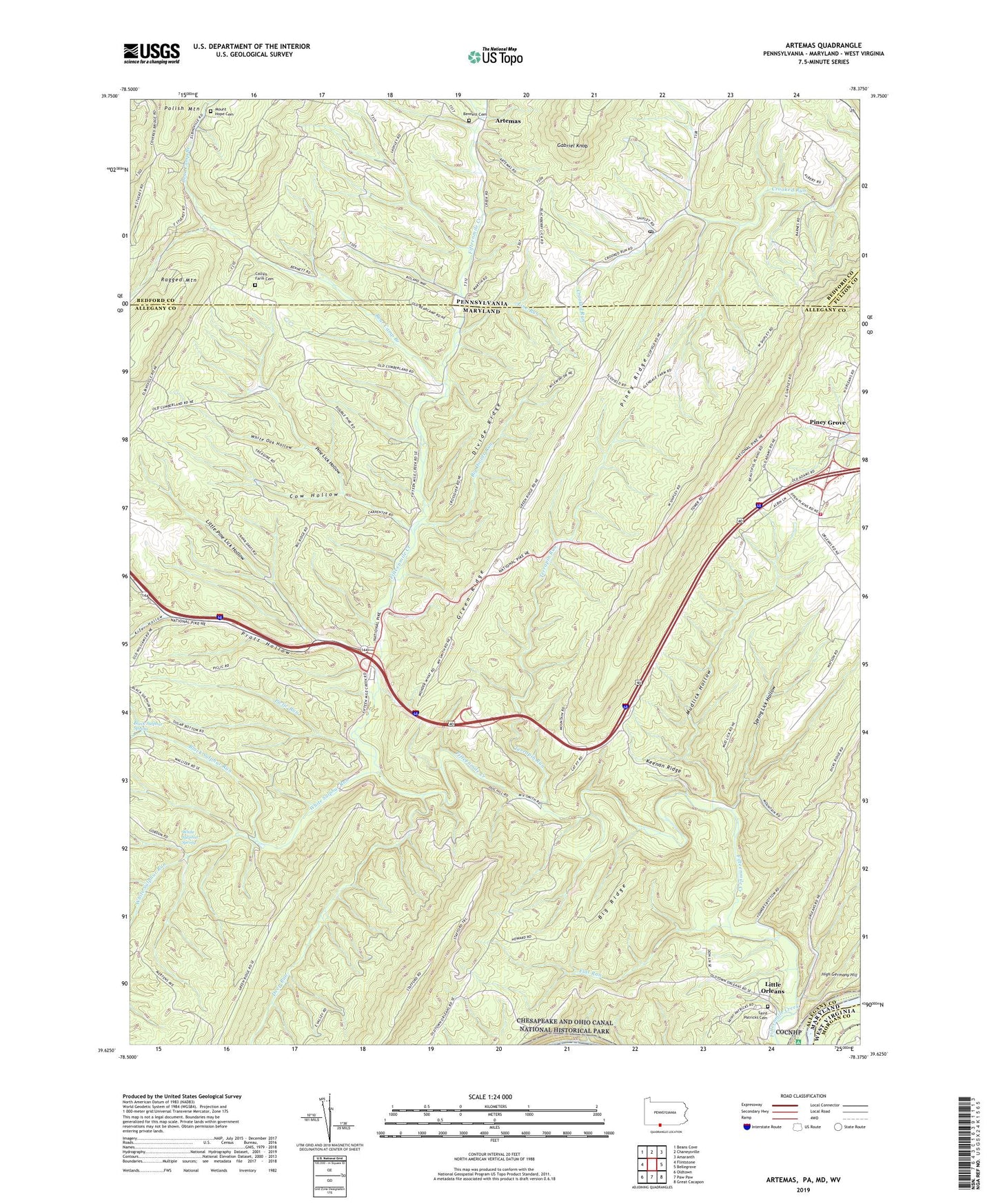
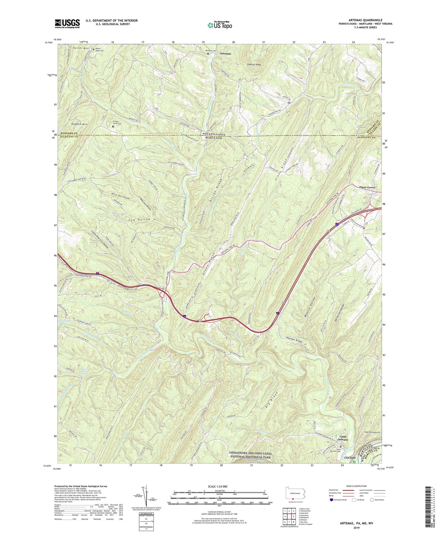
2019 topographic map quadrangle Artemas in the states of Maryland, Pennsylvania, West Virginia. Scale: 1:24000. Based on the newly updated USGS 7.5' US Topo map series, this map is in the following counties: Bedford, Allegany, Morgan, Fulton. The map contains contour data, water features, and other items you are used to seeing on USGS maps, but also has updated roads and other features. This is the next generation of topographic maps. Printed on high-quality waterproof paper with UV fade-resistant inks.
Quads adjacent to this one:
West: Flintstone
Northwest: Beans Cove
North: Chaneysville
Northeast: Amaranth
East: Bellegrove
Southeast: Great Cacapon
South: Paw Paw
Southwest: Oldtown
Contains the following named places: Artemas, Artemas Village Post Office, Bear Camp Branch, Bennett Cemetery, Big Divide Run, Big Ridge, Billmeyer Game Refuge, Black Sulphur Run, Black Sulphur Spring, Collins Farm Cemetery, Cow Hollow, Deep Run, District 1 Orleans, Divide Ridge, Fischers Greenhouse, Flat Run, Gabriel Knob, Hines Trail, Hinkle Trail, Imes Trail, Jim Trail, Keenan Ridge, Kifer Hollow, Line Run, Little Orleans, Little Orleans Census Designated Place, Little Pine Lick Hollow, Long Pond, Mount Hope Cemetery, Mount Hope Church, Mudlick Hollow, Orleans Cross Roads Methodist Episcopal Church, Orleans Volunteer Fire Department, Piclic Run, Pine Lick Hollow, Piney Grove, Piney Plains School, Piney Ridge, Pratt Hollow, Ragged Mountain, Saint Patrick Church, Saint Patricks Cemetery, Spring Lick Hollow, Terrapin Run, The Scalp, Town Hill, White Oak Hollow, White Sulphur Run, White Sulphur Spring, ZIP Code: 21766