
MyTopo
Austin Pennsylvania US Topo Map
Couldn't load pickup availability
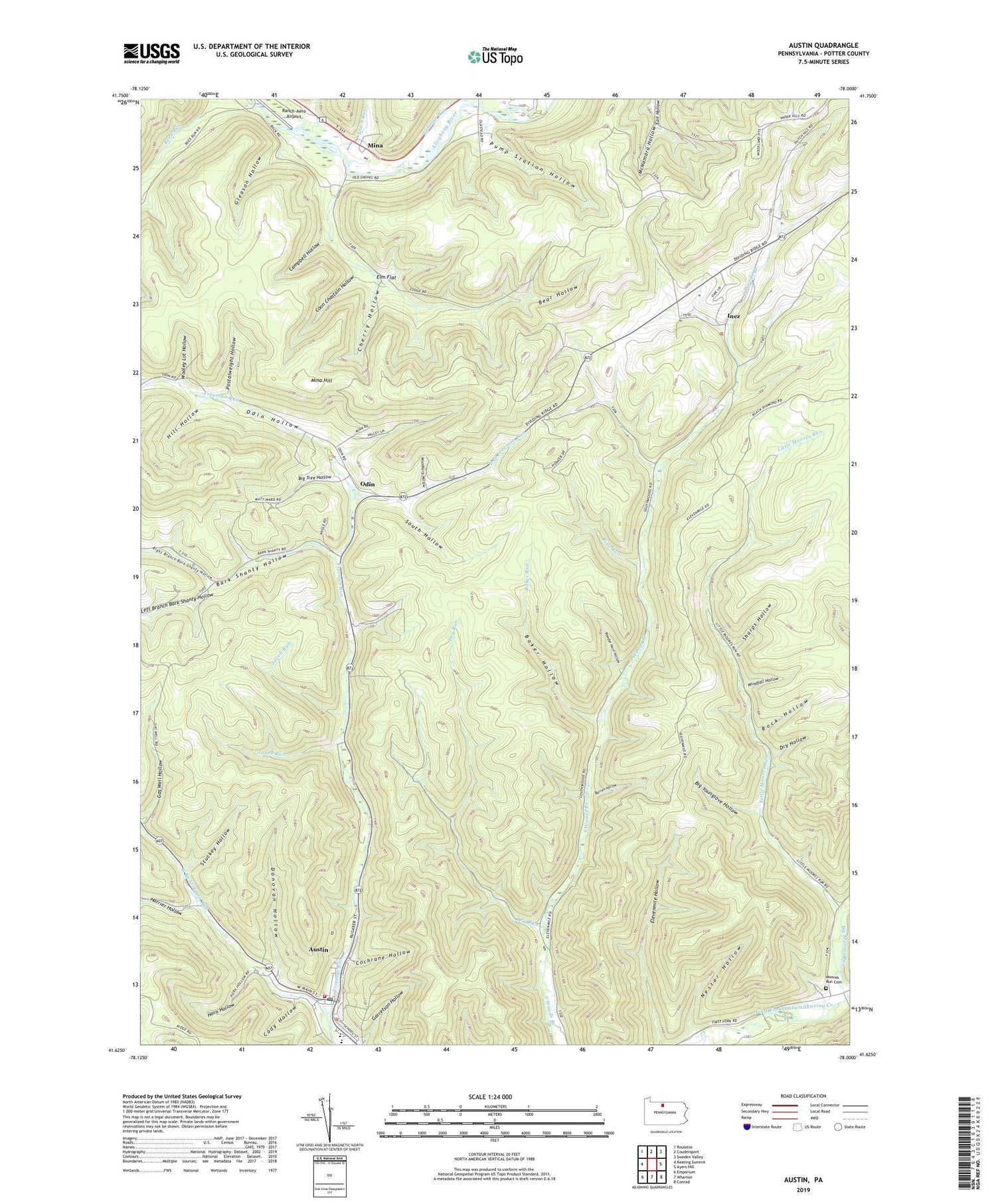
2019 topographic map quadrangle Austin in the state of Pennsylvania. Scale: 1:24000. Based on the newly updated USGS 7.5' US Topo map series, this map is in the following counties: Potter. The map contains contour data, water features, and other items you are used to seeing on USGS maps, but also has updated roads and other features. This is the next generation of topographic maps. Printed on high-quality waterproof paper with UV fade-resistant inks.
Quads adjacent to this one:
West: Keating Summit
Northwest: Roulette
North: Coudersport
Northeast: Sweden Valley
East: Ayers Hill
Southeast: Conrad
South: Wharton
Southwest: Emporium
Contains the following named places: Aspen Trail, Austin, Austin Fire Department Station 44, Austin Post Office, Baker Hollow, Baker Run, Bark Shanty Hollow, Barren Hollow, Bear Hollow, Big Moores Run, Big Tree Hollow, Big Younglove Hollow, Blue Coat Trail, Borough of Austin, Bridge Trail, Campbell Hollow, Cherry Hollow, Cochrane Hollow, Cody Hollow, Coon Chastain Hollow, Donovan Hollow, Dry Hollow, Dry Run, East Branch Freeman Run, Elm Flat, Fork Hill Trail, Gas Well Hollow, Gleason Hollow, Gravel Lick Run, Harrier Hollow, Hemlock Trail, Heth Run, Hill Hollow, Homer Post Office, Horn Hollow, Inez, Inez School, Jacob Run, Jones Run, Left Branch Bark Shanty Hollow, Lehman Run, Little Moores Run, McNamara Hollow, Mina, Mina Hill, Moores Run Cemetery, Moores Run Fire Trail, Nestor Hollow, Odin, Odin Hollow, Odin Hoxie Trail, Pine Run, Postalweight Hollow, Powder Horn Hollow, Pump Station Hollow, Ranch-Aero Airport, Ridge Trail, Right Branch Bark Shanty Hollow, Rock Hollow, Sharps Hollow, South Hollow, Stuckey Hollow, Town Run, Township of Homer, West Branch Freeman Run, White Birch Trail, Windfall Hollow, Woodbury Hollow, Wooley Lot Hollow


