MyTopo
Bangor Pennsylvania US Topo Map
Couldn't load pickup availability
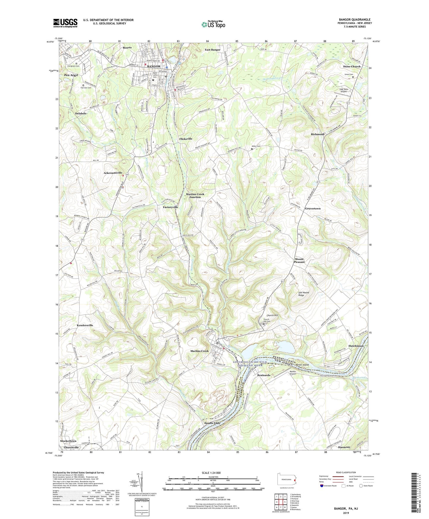
2019 topographic map quadrangle Bangor in the states of Pennsylvania, New Jersey. Scale: 1:24000. Based on the newly updated USGS 7.5' US Topo map series, this map is in the following counties: Northampton, Warren. The map contains contour data, water features, and other items you are used to seeing on USGS maps, but also has updated roads and other features. This is the next generation of topographic maps. Printed on high-quality waterproof paper with UV fade-resistant inks.
Quads adjacent to this one:
West: Wind Gap
Northwest: Saylorsburg
North: Stroudsburg
Northeast: Portland
East: Belvidere
Southeast: Bloomsbury
South: Easton
Southwest: Nazareth
Contains the following named places: Ackermanville, Ackermanville Census Designated Place, Bangor, Bangor Elementary School, Bangor Fire Department Liberty Fire Station 30, Bangor Fire Department Rescue Fire Company Station 30, Bangor Fire Department Second Ward Station 30, Bangor Police Department, Bangor Post Office, Bethel School, Bitz School, Borough of Bangor, Brainards, Brainards Census Designated Place, Brainards School, Buckhorn Creek, Church Hill, Church Hill Cemetery, Clistowackin, Delabole, Depuy Ferry, Factoryville, Fairview Cemetery, Farrow School, Fells School, Flicksville, Franklin Hill School, Frytown, Gap View Airport, Greenwalk Creek, Gruvertown, Harmony Census Designated Place, Harmony Ferry, Harmony Station, Hartzell School, Hutchinson, Keifer Island, Kesslersville, Kingdom Hall Church, Lehigh School, Lincoln School, Little Martins Creek, Lower Mount Bethel Sandt's Eddy Fire Company Station 26, Markle Airport, Martins Creek, Martins Creek Census Designated Place, Martins Creek Ferry, Martins Creek Junction, Martins Creek Post Office, Martins Creek Station, Memorial Park, Mill Dam, Miller Cemetery, Miller School, Mount Airy, Mount Pleasant, Mount Zion Church, Mud Run, Myers School, New Village, Old Hound Ridge, Our Lady of Mount Carmel School, Pius X High School, Plainfield Township Volunteer Fire Company / Plainfield Township Ambulance Corps Substation, Richmond, Roosevelt School, Saint Elizabeths Cemetery, Saint Johns Cemetery, Sandts Eddy, Sandts Eddy Station, Shimerville, Smith School, Stone Church, Stoney Ridge Horse Farm, Teel School, Thomas School, Township of Lower Mount Bethel, Township of Washington, Trinity Church, Uhlers Crossing, Uhlers Station, Union Cemetery, Uttsville, Valley School, Waltz Creek, Washington School, Washington Township Elementary School, Washington Township Police Department, Washington Township Volunteer Fire Company Station 38, Weona Park, ZIP Codes: 18013, 18063