MyTopo
Beaverdale Pennsylvania US Topo Map
Couldn't load pickup availability
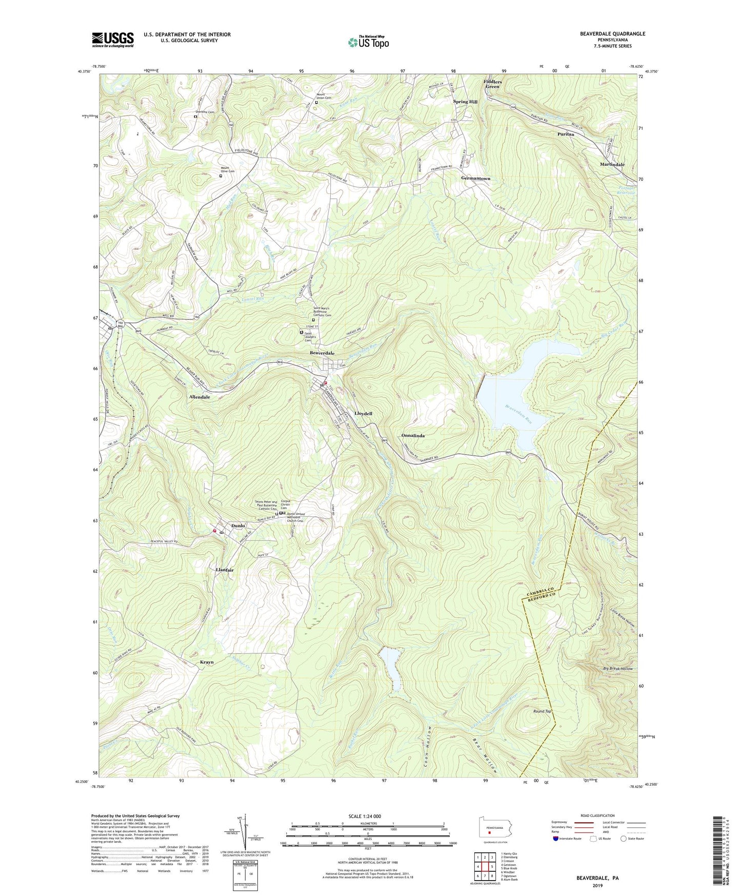
2019 topographic map quadrangle Beaverdale in the state of Pennsylvania. Scale: 1:24000. Based on the newly updated USGS 7.5' US Topo map series, this map is in the following counties: Cambria, Bedford. The map contains contour data, water features, and other items you are used to seeing on USGS maps, but also has updated roads and other features. This is the next generation of topographic maps. Printed on high-quality waterproof paper with UV fade-resistant inks.
Quads adjacent to this one:
West: Geistown
Northwest: Nanty Glo
North: Ebensburg
Northeast: Cresson
East: Blue Knob
Southeast: Alum Bank
South: Ogletown
Southwest: Windber
Contains the following named places: Adams Township Volunteer Fire Company Dunlo Station 82, Allendale, Bear Wallow, Beaverdale, Beaverdale Area Ambulance Service, Beaverdale Census Designated Place, Beaverdale Post Office, Beaverdale Reservoir, Beaverdale Sportsmans Lodge, Beaverdam Run, Beaverdam Run Dam, Big Cedar Run, Birch Run, Bottle Run, Buckhorn Grange, Coon Hollow, Corpus Christi Cemetery, Dunlo, Dunlo Census Designated Place, Dunlo Post Office, Dunlo United Methodist Church Cemetery, Fiddlers Green, Germantown, Krayn, Llanfair, Lloydell, Lloydell Dam, Martindale, Mount Olive Cemetery, Mount Olive Church, Mount Union Cemetery, Mud Run, Onnalinda, Onyx Greentree Landfill, Otto Run, Puritan, Rachel Run, Round Top, Saint Joseph's Cemetery, Saint Mary's Byzantine Catholic Cemetery, Saints Peter and Paul Byzantine Catholic Cemetery, Sherbine Cemetery, Sidman, Sidman Post Office, Spring Hill Census Designated Place, State Game Lands Number 26, Sulphur Creek, Summerhill Township Volunteer Fire Company Station 80, Sunflower, Township of Adams, Township of Summerhill, Triangle Area High School, ZIP Codes: 15921, 15930, 15946, 15955