MyTopo
Belleville Pennsylvania US Topo Map
Couldn't load pickup availability
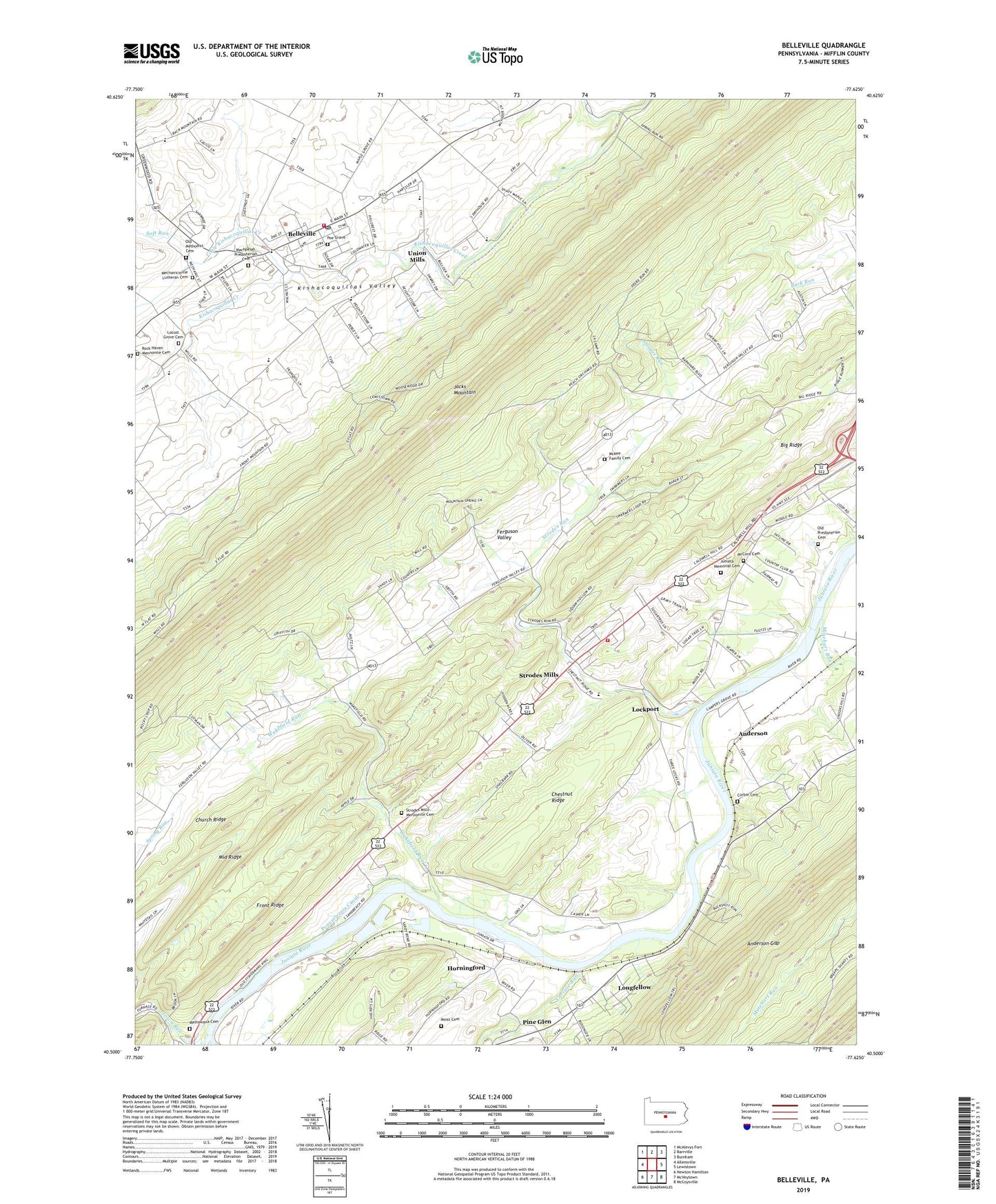
2019 topographic map quadrangle Belleville in the state of Pennsylvania. Scale: 1:24000. Based on the newly updated USGS 7.5' US Topo map series, this map is in the following counties: Mifflin. The map contains contour data, water features, and other items you are used to seeing on USGS maps, but also has updated roads and other features. This is the next generation of topographic maps. Printed on high-quality waterproof paper with UV fade-resistant inks.
Quads adjacent to this one:
West: Allensville
Northwest: McAlevys Fort
North: Barrville
Northeast: Burnham
East: Lewistown
Southeast: McCoysville
South: McVeytown
Southwest: Newton Hamilton
Contains the following named places: Anderson, Anderson Gap, Belleville, Belleville Census Designated Place, Belleville Fire Company Station 24, Belleville Post Office, Belleville School, Big Valley Church, Big Valley Emergency Medical Services, Blue Juniata Camp, Bratton Airport, Cargill Airport, Carlisle Run, Center School, Centre Union Church, Chestnut Ridge, Church Ridge, Corbin Cemetery, Ferguson Valley, Front Ridge, Granville, Horningford, Juniata Memorial Cemetery, Lapolds Ford, Lewistown Airport, Lewistown Country Club, Little Kishacoquillas Creek, Lockport, Locust Grove Cemetery, Locust Grove Church, Locust Grove School, Longfellow, Longfellow Census Designated Place, Longfellow School, Machpelah Presbyterian Cemetery, Maple Grove Church, Maple Grove School, Mattawana Cemetery, McCord Cemetery, McKee Family Cemetery, McKee School, Mechanic Street, Mechanicsville, Mechanicsville Lutheran Cemetery, Middle Ridge, Miller Dam, Minehart Run, Moist Cemetery, Oak Grove School, Old Methodist Cemetery, Old Presbyterian Cemetery, Ore Bank School, Pennsylvania Canal, Pine Glen, Poe Grave, Rock Haven Mennonite Cemetery, Saint Johns Church, School Number 7, Soft Run, State Game Lands Number 113, Strodes Mills, Strodes Mills Census Designated Place, Strodes Mills Mennonite Cemetery, Strodes Run, Town Run, Township of Oliver, Township of Union, Union Mills, Valley Church, Wakefield Run, Wesley Chapel, West Granville Fire Company Station 17, ZIP Code: 17004