MyTopo
Black Moshannon Pennsylvania US Topo Map
Couldn't load pickup availability
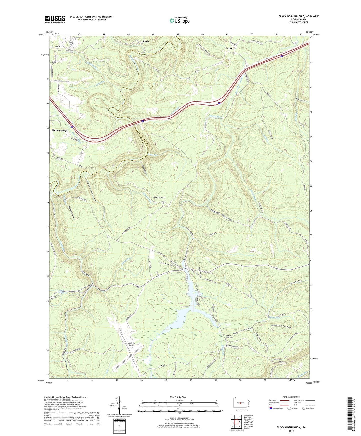
2019 topographic map quadrangle Black Moshannon in the state of Pennsylvania. Scale: 1:24000. Based on the newly updated USGS 7.5' US Topo map series, this map is in the following counties: Centre, Clearfield. The map contains contour data, water features, and other items you are used to seeing on USGS maps, but also has updated roads and other features. This is the next generation of topographic maps. Printed on high-quality waterproof paper with UV fade-resistant inks.
Quads adjacent to this one:
West: Philipsburg
Northwest: Frenchville
North: Karthaus
Northeast: Snow Shoe
East: Bear Knob
Southeast: Julian
South: Port Matilda
Southwest: Sandy Ridge
Contains the following named places: Antes, Arctic Springs, Arctic Springs Park, Beaver Mills, Beaver Mills Cemetery, Benner Run, Black Moshannon Dam, Black Moshannon Lake, Black Moshannon State Park, Browns Run, Dry Hollow, Dry Hollow Trail, East Branch Rock Run, Gorton, Grassflat Run, Groe Run, Hall Run, Hunters Rocks, Hutton Run, Kephart Dam, Knox Run, Laurel Run, Meyers Run, Middle Branch Rock Run, Mid-State Airport, Moshannon State Forest, North Run, North Run Trail, Old Huckleberry Trail, Panther Hollow, Peale, Philipsburg Radio Range Station, Potter Run, Rattlesnake Lookout Tower, Rattlesnake Trail, Rock Run, Sawdust Hollow, Shirks Run, Short Trail, Sixmile Run, Smays Run, Smays Trail, Tark Hill Run, Turtle Rocks, Viaduct, ZIP Code: 16849