MyTopo
Blairsville Pennsylvania US Topo Map
Couldn't load pickup availability
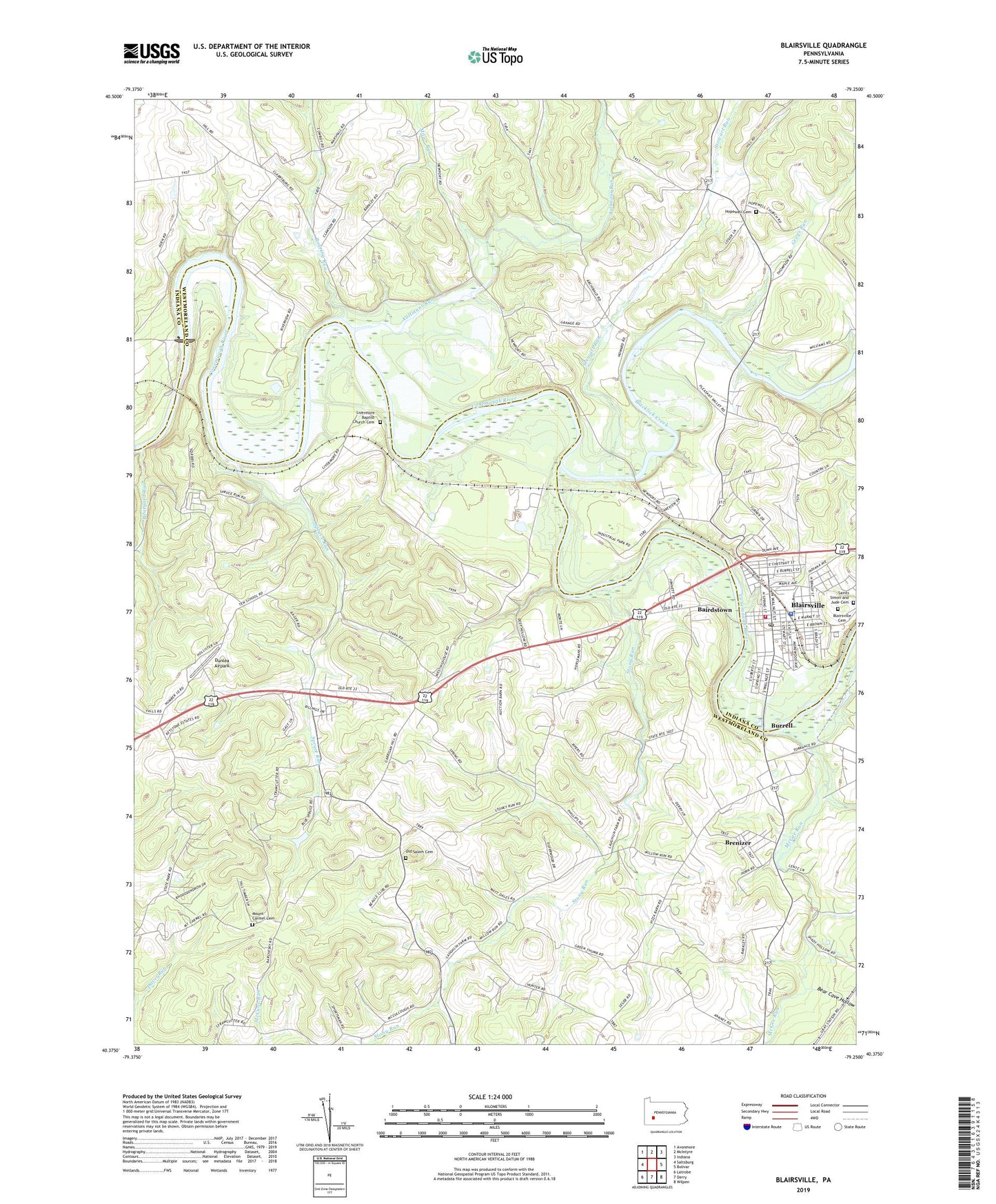
2019 topographic map quadrangle Blairsville in the state of Pennsylvania. Scale: 1:24000. Based on the newly updated USGS 7.5' US Topo map series, this map is in the following counties: Westmoreland, Indiana. The map contains contour data, water features, and other items you are used to seeing on USGS maps, but also has updated roads and other features. This is the next generation of topographic maps. Printed on high-quality waterproof paper with UV fade-resistant inks.
Quads adjacent to this one:
West: Saltsburg
Northwest: Avonmore
North: McIntyre
Northeast: Indiana
East: Bolivar
Southeast: Wilpen
South: Derry
Southwest: Latrobe
Contains the following named places: Aultmans Run, Bairdstown, Bear Cave Hollow, Blacklick Creek, Blairsville, Blairsville Cemetery, Blairsville Junior High School, Blairsville Post Office, Blairsville Young Mens Volunteer Fire Company Station 120, Boatyard Run, Borough of Blairsville, Bow, Brenizer, Brenizer Elementary School, Burrell, Citizens Ambulance Service Blairsville Station 20, Cokeville, Conemaugh Dam, Conemaugh Lake National Recreation Area, Conemaugh River Lake, DeLuca Field, Dunlea Airpark, Fillmore, Greys Run, Harbridge Run, Hopewell Cemetery, Hopewell Church, Jellison, Livermore, Livermore Baptist Church Cemetery, McGee Run, Miller Run, Mount Carmel Cemetery, Old Salem Cemetery, Old Salem Church, Roaring Run, Saints Simon and Jude Catholic School, Saints Simon and Jude Cemetery, Shirey Run, Snyder, Spruce Run, Stewart Run, Stony Run, Third Ward Elementary School, Township of Black Lick, Township of Derry