MyTopo
Adams Run South Carolina US Topo Map
Couldn't load pickup availability
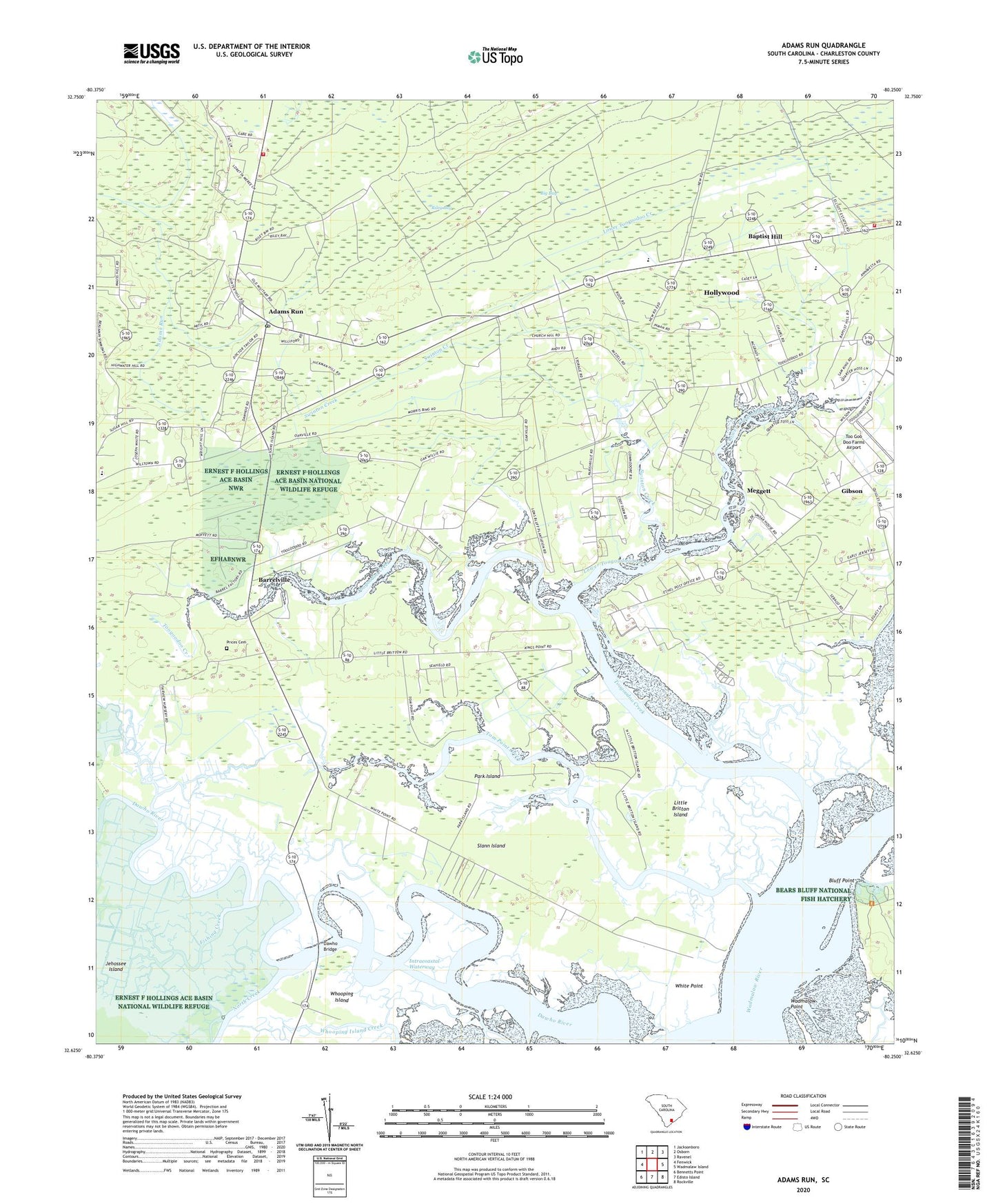
2020 topographic map quadrangle Adams Run in the state of South Carolina. Scale: 1:24000. Based on the newly updated USGS 7.5' US Topo map series, this map is in the following counties: Charleston. The map contains contour data, water features, and other items you are used to seeing on USGS maps, but also has updated roads and other features. This is the next generation of topographic maps. Printed on high-quality waterproof paper with UV fade-resistant inks.
Quads adjacent to this one:
West: Fenwick
Northwest: Jacksonboro
North: Osborn
Northeast: Ravenel
East: Wadmalaw Island
Southeast: Rockville
South: Edisto Island
Southwest: Bennetts Point
Contains the following named places: Adams Run, Adams Run Census Designated Place, Adams Run Post Office, Adams Run School, Allen Church, Baptist Hill, Baptist Hill Elementary School, Baptist Hill High School, Barrelville, Bears Bluff, Bears Bluff National Fish Hatchery, Bethel Church, Big Bay, Bluff Point, C C Blaney Elementary School, Christ Church, Dawho Bridge, Dawho River, Ebenezer Church, Ernest F Hollings Ace Basin National Wildlife Refuge, Faith Church, First Zion Church, Fishing Creek, Gannon, Gibson, Greater Saint Lukes Church, Jehossee Island, Laroche, Laurel Hill, Little Britton Island, Little Zion Church, Lower Toogoodoo Creek, Minnie Hughes Elementary School, Mount Hor Church, Newton Berry Farms, North Creek, Oakville School, Park Island, Prices Cemetery, R D Schroder Middle School, Riley Bay, Saint Paul Episcopal Church, Saint Pauls Church, Saint Paul's Fire Department Station 1, Saint Paul's Fire Department Station 5, Saint Pauls School, Slann Island, South Carolina Noname 10063 D-3044 Dam, Swinton Creek, Tom Point Creek, Too Goo Doo Farms Airport, Toogoodoo Creek, Town of Meggett, Wadmalaw Point, Wadmalaw River, Wesley Church, Wesley Memorial Church, White Point, White Point Landing, Whooping Island, WMGL-FM (Ravenel), ZIP Code: 29449