MyTopo
Adrian South Carolina US Topo Map
Couldn't load pickup availability
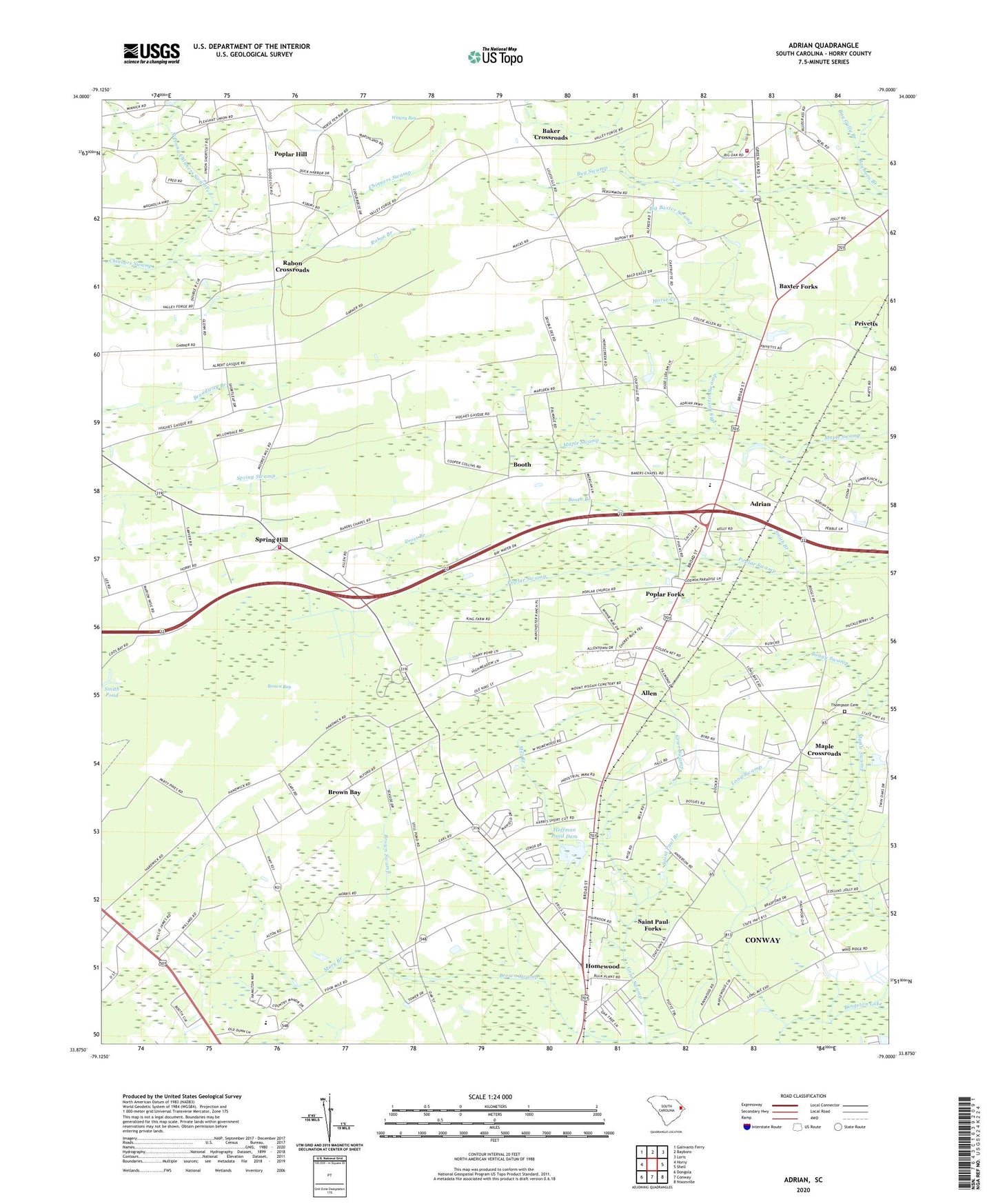
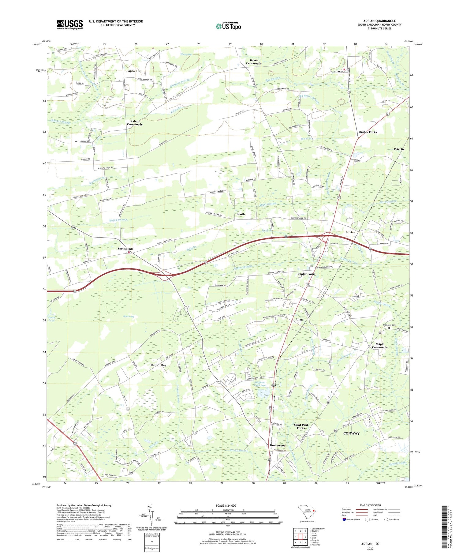
2020 topographic map quadrangle Adrian in the state of South Carolina. Scale: 1:24000. Based on the newly updated USGS 7.5' US Topo map series, this map is in the following counties: Horry. The map contains contour data, water features, and other items you are used to seeing on USGS maps, but also has updated roads and other features. This is the next generation of topographic maps. Printed on high-quality waterproof paper with UV fade-resistant inks.
Quads adjacent to this one:
West: Horry
Northwest: Galivants Ferry
North: Bayboro
Northeast: Loris
East: Shell
Southeast: Nixonville
South: Conway
Southwest: Dongola
Contains the following named places: Academy for Technology and Academics, Adrian, Allen, Allens School, Anderson Chapel, Aynor Conway Career Center, Baker Crossroads, Bakers Chapel, Barter School, Baxter Forks, Bay Gully Branch, Big Baxter Swamp, Boggy Swamp, Booth, Booth Branch, Broadway Branch, Brown Bay, Cebu, Cockran School, Cross Branch, Evergreen Freewill Church, Free Will Church, Friendship Church, Happy Home Church, Hoffman Pond Dam, Homewood, Homewood Census Designated Place, Homewood Church, Homewood School, Horry Church, Horry County Fire Department Allens, Horry County Fire Rescue Station 15 - Bayboro, Horse Creek, Joy, Little Baxter Swamp, Long Swamp, Maple Church, Maple Crossroads, Mary Branch, Mill Branch, Mount Aeral Church, North Prong Chinners Swamp, Pine Ridge Business Center, Pisgah Church, Pleasant Union Church, Polecat Bay, Poplar Church, Poplar Forks, Poplar Hill, Poplar Hill Church, Poplar Hill School, Poplar School, Priver Branch, Privetts, Rabon Branch, Rabon Crossroads, Saint Paul Branch, Saint Paul Forks, Saint Paul School, Saint Pauls Church, Smith Branch, South Carolina Highway Patrol Troop 5 Post D, South Carolina Noname 26002 D-3622 Dam, South Prong Chinners Swamp, Spring Hill, Thompson Cemetery, Tyllers Mill, Valley Forge School, WHMC-FM (Conway), WHMC-TV (Conway), Zion Church, ZIP Code: 29511