MyTopo
Alvin South Carolina US Topo Map
Couldn't load pickup availability
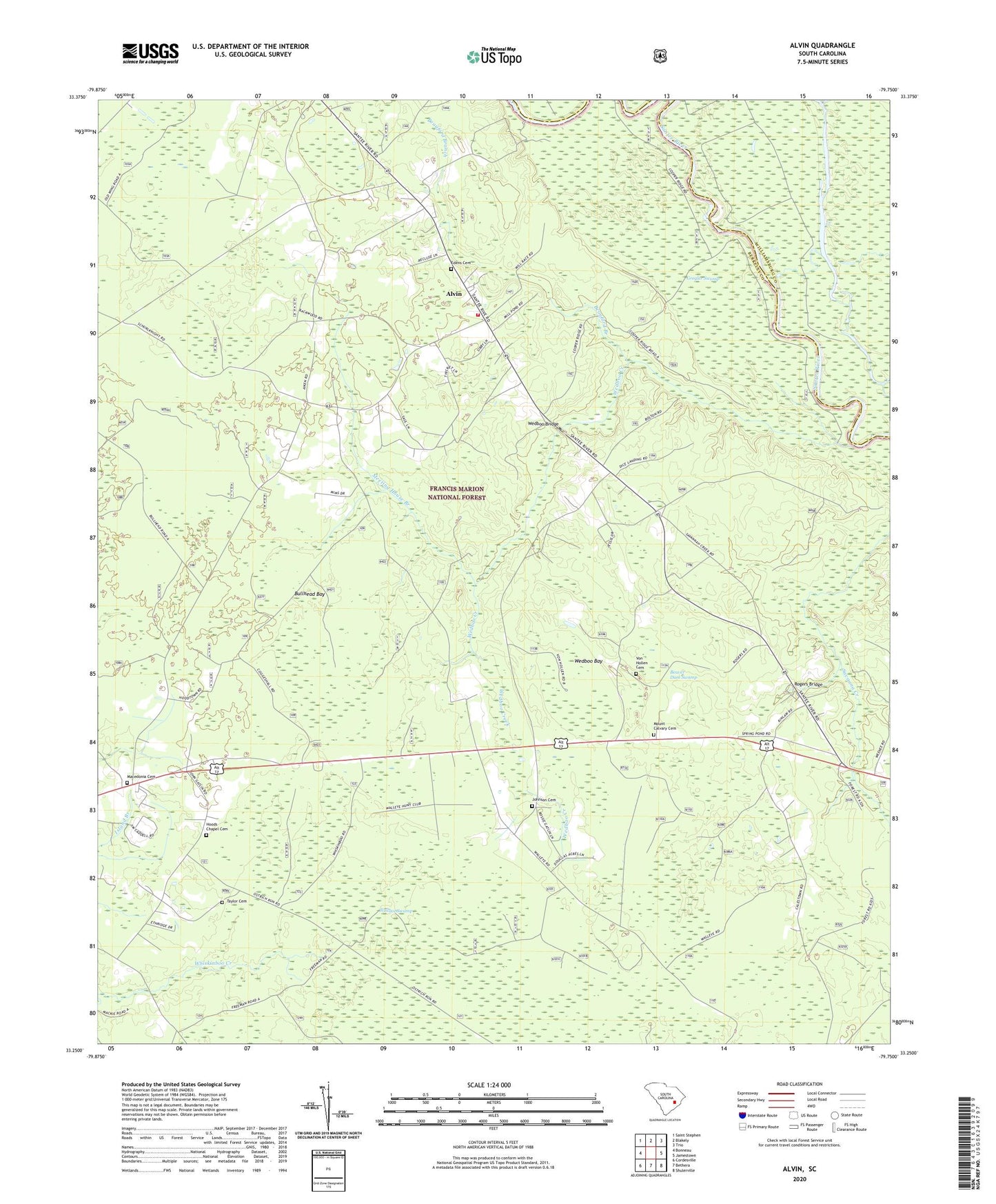
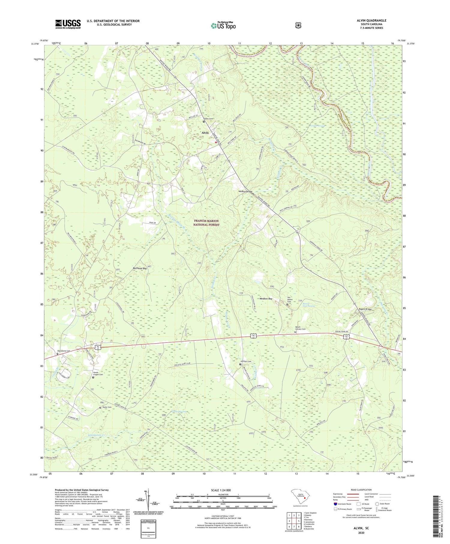
2020 topographic map quadrangle Alvin in the state of South Carolina. Scale: 1:24000. Based on the newly updated USGS 7.5' US Topo map series, this map is in the following counties: Berkeley, Williamsburg. The map contains contour data, water features, and other items you are used to seeing on USGS maps, but also has updated roads and other features. This is the next generation of topographic maps. Printed on high-quality waterproof paper with UV fade-resistant inks.
Quads adjacent to this one:
West: Bonneau
Northwest: Saint Stephen
North: Blakely
Northeast: Trio
East: Jamestown
Southeast: Shulerville
South: Bethera
Southwest: Cordesville
Contains the following named places: Alvin, Alvin Fire Department, Beauford Branch, Beaver Dam Swamp, Bethlehem Church, Bullhead Bay, Calestown, Calestown Church, Edens Cemetery, Emmanuel Church, Gravel Hill Lookout Tower, Hickory Grove, Holly Hill Church, Hoods Chapel Cemetery, Hoods Chapel Methodist Church, Hopes Chapel, Johnson Cemetery, Johnson Church, Laurel Hill School, Macedonia Cemetery, Macedonia Church, Meeting House Branch, Mount Calvary Cemetery, Mount Calvary Holiness Church, New Emanuel School, New Emmanuel Church, Rogers Bridge, Santee Church, Savanna Creek, Sugar Loaf Plantation, Taylor Cemetery, Von Hollen Cemetery, Wallace Swamp, Wedboo Bay, Wedboo Bridge, Wedboo Creek