MyTopo
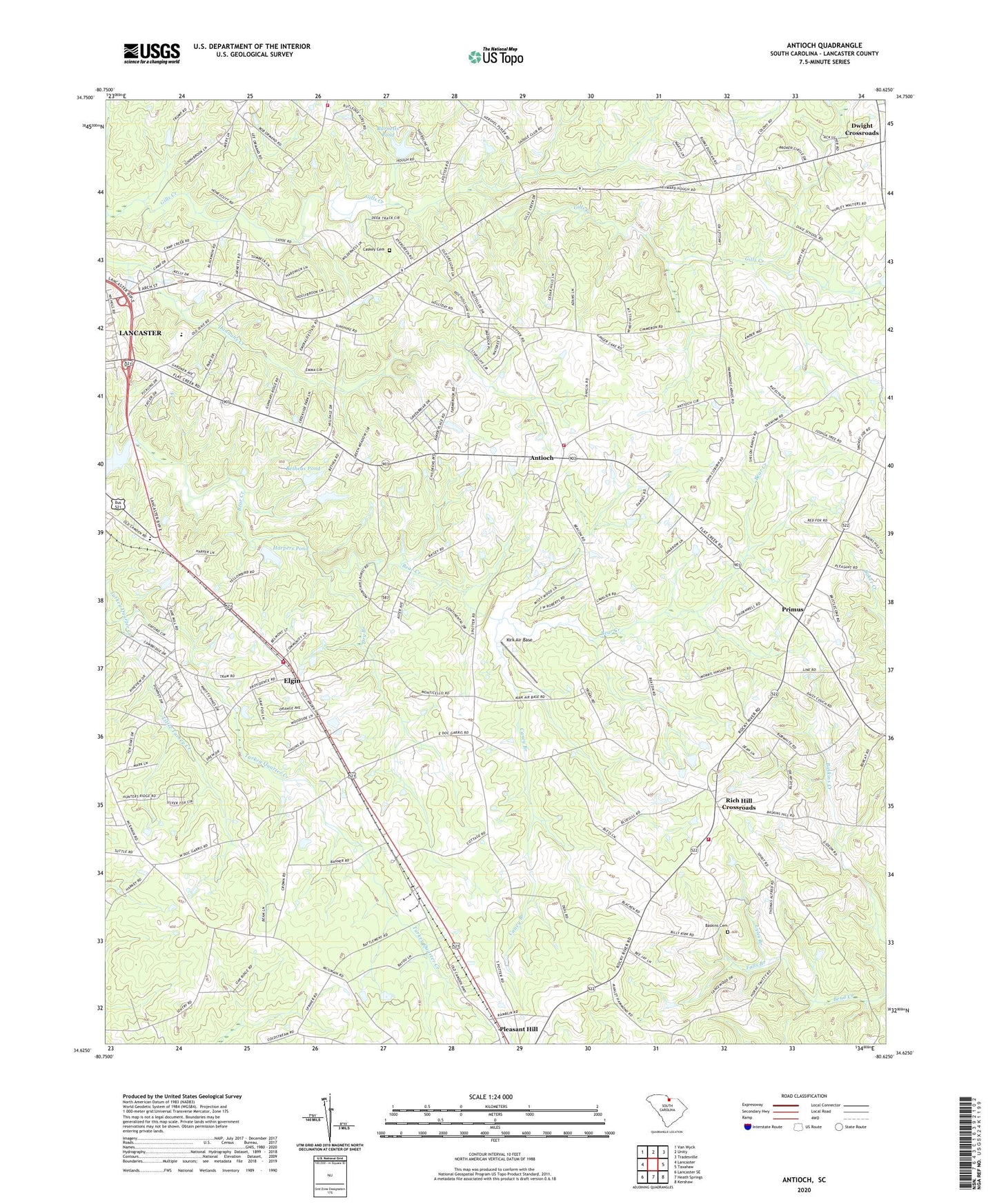
Antioch South Carolina US Topo Map
Couldn't load pickup availability
2020 topographic map quadrangle Antioch in the state of South Carolina. Scale: 1:24000. Based on the newly updated USGS 7.5' US Topo map series, this map is in the following counties: Lancaster. The map contains contour data, water features, and other items you are used to seeing on USGS maps, but also has updated roads and other features. This is the next generation of topographic maps. Printed on high-quality waterproof paper with UV fade-resistant inks.
Quads adjacent to this one:
West: Lancaster
Northwest: Van Wyck
North: Unity
Northeast: Tradesville
East: Taxahaw
Southeast: Kershaw
South: Heath Springs
Southwest: Lancaster SE
Contains the following named places: Antioch, Antioch Acres, Antioch Baptist Church, Antioch Fire Department Station 1, Antioch School, Bailey's Greenhouse, Baker Place, Baskins Cemetery, Bethea Pond Dam Number One D-1771, Bethea Pond Dam Number Two D-1770, Betheas Pond, Buford Battle Ground Monument, Buford Census Designated Place, Burnett Lake D-1769 Dam, Burnetts Pond, Calvary Church, Camp Creek Fire Department Station 4, Cane Creek WCD Dam Number 18-A D-1786, Caney Branch, Caskey Cemetery, Centennial African Methodist Episcopal Zion Church, Dixie School, Dry Branch, Dwight Crossroads, Elgin, Elgin Census Designated Place, Elgin Fire Department Station 6, Elgin School, Elgin Woods, Evergreen Acres, Falls Branch, Gills Creek Associate Reformed Presbyterian Church, Glenwood Heights Baptist Church, Harpers Pond, Harpers Pond D-1772 Dam, High Point Church, Hopewell Church, Hyde Park Church, Kennon Heights, Kirk Air Base, Lancaster County, Lancaster County Emergency Medical Services, Lancaster County Home, Little Turkey Creek, Lyles Branch, New Bethel Church, Oak Ridge Church, Oak Ridge School, Parker Pond Dam D-1779, Parkers Pond, Pilgrim Church, Pleasant Dale, Pleasant Dale Church, Pleasant Grove Church, Pleasant Hill Church, Pleasant Hill School, Primus, Red Hill School, Rich Hill Baptist Church, Rich Hill Crossroads, Rich Hill Fire Department - Lancaster County Station 15, Rich Hill School, Saint Lukes Church, Smoke Rise, South Carolina Highway Patrol Troop 4 Post D, Trinity Church, WLCM-AM (Lancaster), ZIP Code: 29720