MyTopo
Bull Pond South Carolina US Topo Map
Couldn't load pickup availability
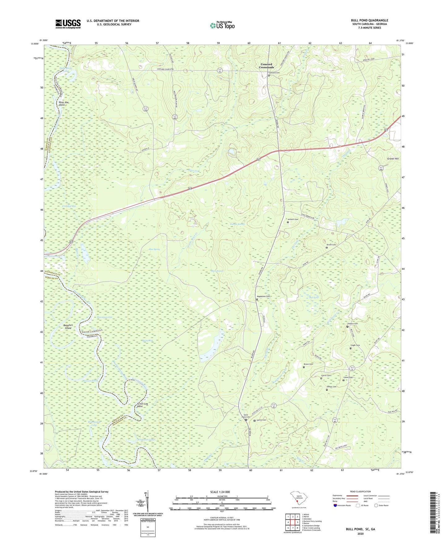
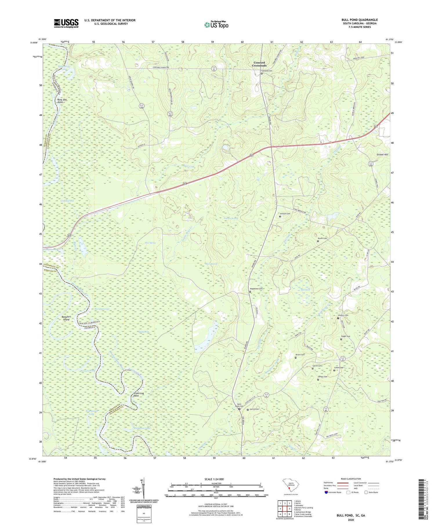
2020 topographic map quadrangle Bull Pond in the states of South Carolina, Georgia. Scale: 1:24000. Based on the newly updated USGS 7.5' US Topo map series, this map is in the following counties: Allendale, Screven. The map contains contour data, water features, and other items you are used to seeing on USGS maps, but also has updated roads and other features. This is the next generation of topographic maps. Printed on high-quality waterproof paper with UV fade-resistant inks.
Quads adjacent to this one:
West: Burtons Ferry Landing
Northwest: Millett
North: Martin
Northeast: Allendale
East: Barton
Southeast: Solomons Crossroads
South: Brier Creek Landing
Southwest: Jacksonboro Bridge
Contains the following named places: Antioch Cemetery, Antioch Church, Beaufort Island, Blacks Landing, Blue Spring, Box Store, Brier Creek, Brierpatch Lake, Brooks School, Brown Cemetery, Bull Pond, Bull Pond School, Cane Creek Church, Cohen Cemetery, Concord Cemetery, Concord Church, Concord Crossroads, Cooks Chapel School, Crooked Cut, Dead River Lake, Erwinton Church, Erwinton Plantation, Fennell Hill Landing, Ferguson Lake, Flowers Cemetery, Folger Cemetery, Garvin Cemetery, Gravel Hill, Gravel Hill Plantation, Green Log Point, Horsepen Gut, Johnsons Landing, King Creek Landing, Little Brier Creek, Magdalene Cemetery, Magdalene Church, Mars Branch, Martin Spring Run, McLean School, Milbury, Mount Lake, Possum Eddy, Rices Pond Dam D-2573, Ring Jaw Point, Saint Paul Church, Saint Pauls Cemetery, Spring Run, Stony Creek, Striker Cemetery, Sweet Bethel Church, Trinity School, Virgin Mary Church, Warren Branch, Watchcaw Creek, Willingham Plantation, ZIP Code: 29810