MyTopo
Alpena South Dakota US Topo Map
Couldn't load pickup availability
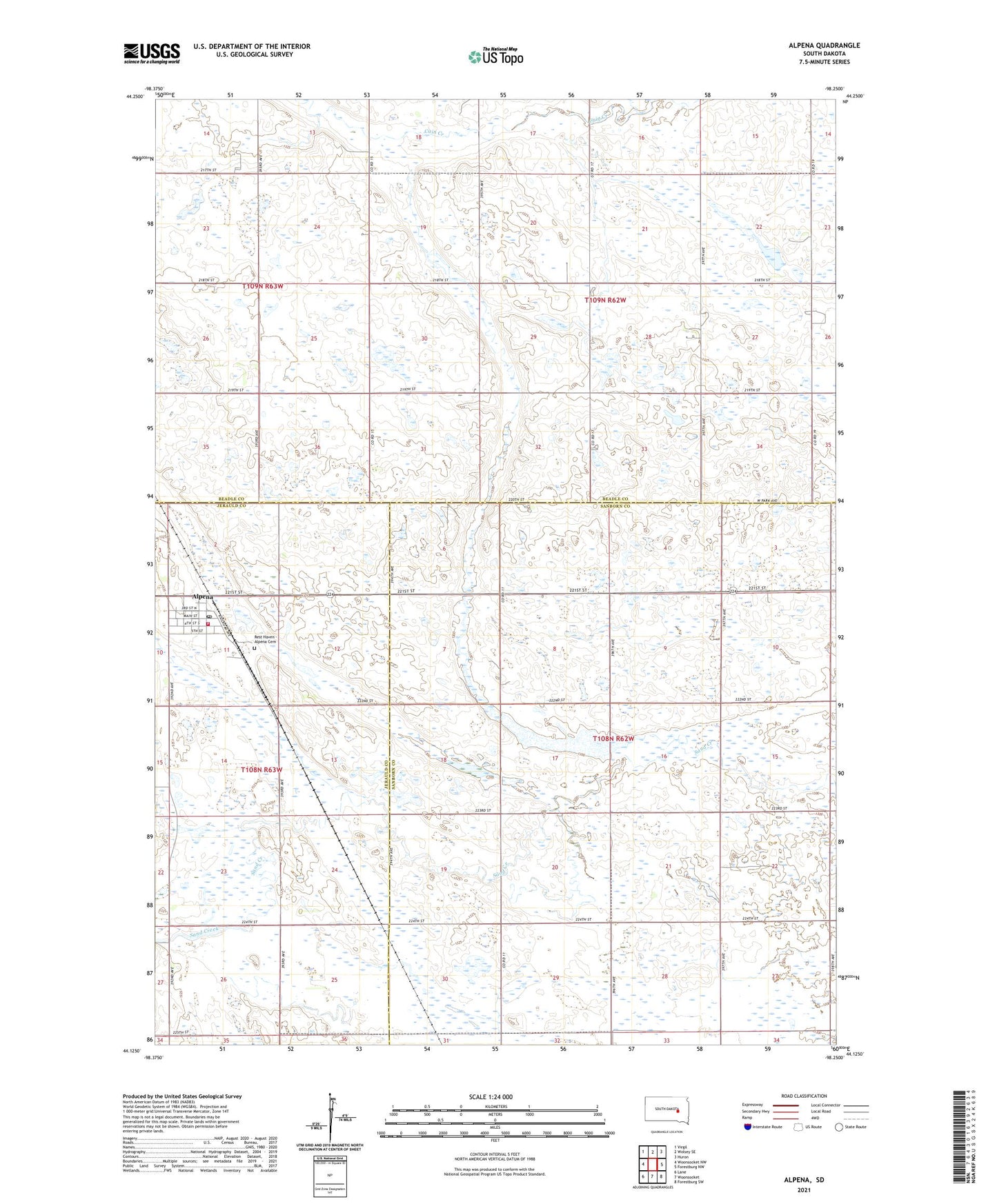
2021 topographic map quadrangle Alpena in the state of South Dakota. Scale: 1:24000. Based on the newly updated USGS 7.5' US Topo map series, this map is in the following counties: Beadle, Sanborn, Jerauld. The map contains contour data, water features, and other items you are used to seeing on USGS maps, but also has updated roads and other features. This is the next generation of topographic maps. Printed on high-quality waterproof paper with UV fade-resistant inks.
Quads adjacent to this one:
West: Woonsocket NW
Northwest: Virgil
North: Wolsey SE
Northeast: Huron
East: Forestburg NW
Southeast: Forestburg SW
South: Woonsocket
Southwest: Lane
Contains the following named places: Alpen High School, Alpena, Alpena Community Center, Alpena Elementary School, Alpena Fire Department, Alpena Middle School, Alpena Post Office, Eastman School Number 4, Rest Haven - Alpena Cemetery, Town of Alpena, Township of Grant, Township of Warren, Warren Township Hall, Willard Church