MyTopo
Artesian NE South Dakota US Topo Map
Couldn't load pickup availability
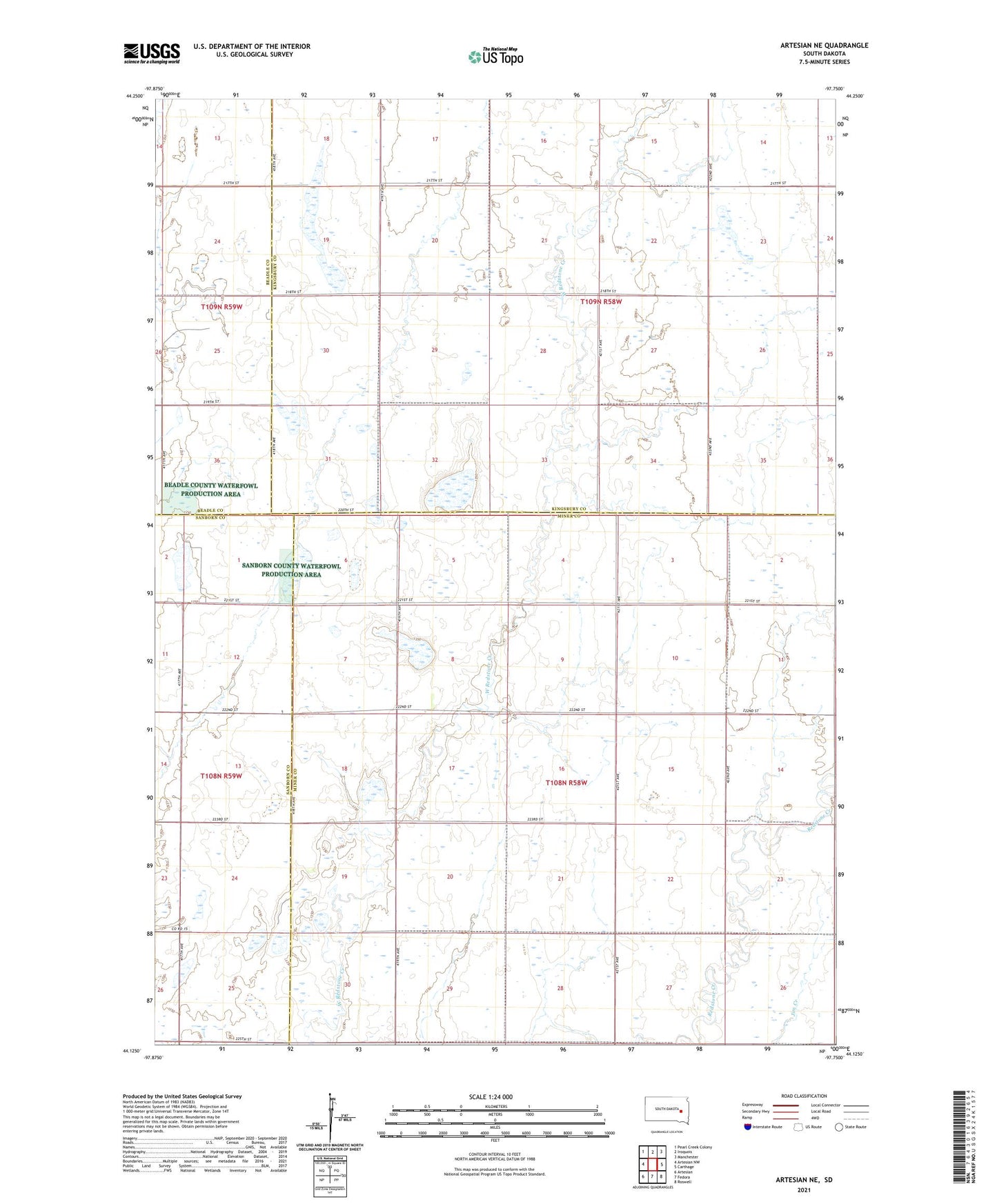
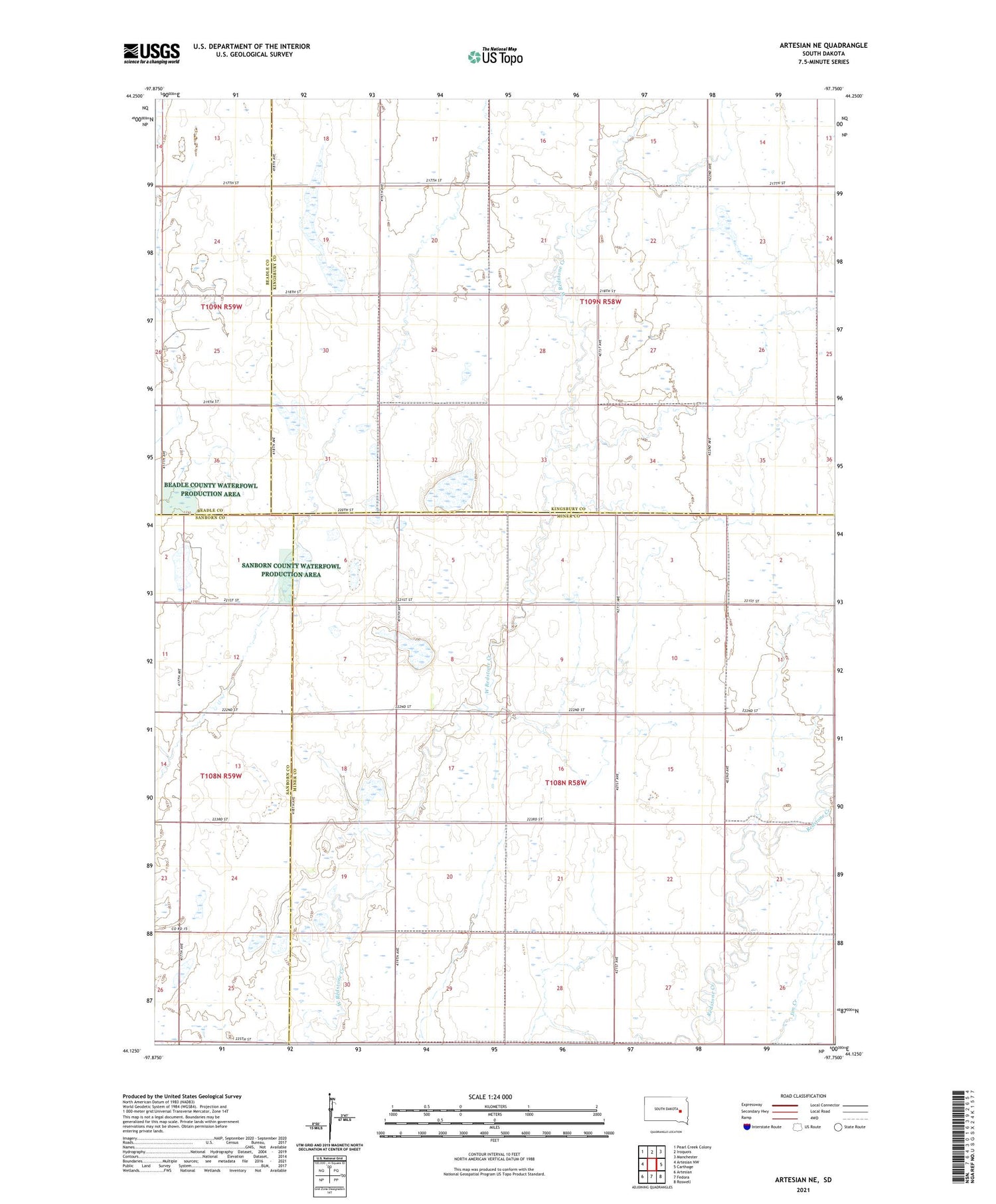
2021 topographic map quadrangle Artesian NE in the state of South Dakota. Scale: 1:24000. Based on the newly updated USGS 7.5' US Topo map series, this map is in the following counties: Miner, Kingsbury, Sanborn, Beadle. The map contains contour data, water features, and other items you are used to seeing on USGS maps, but also has updated roads and other features. This is the next generation of topographic maps. Printed on high-quality waterproof paper with UV fade-resistant inks.
Quads adjacent to this one:
West: Artesian NW
Northwest: Pearl Creek Colony
North: Iroquois
Northeast: Manchester
East: Carthage
Southeast: Roswell
South: Fedora
Southwest: Artesian
Contains the following named places: Afton Township Hall, Hanchett, Saint Anthonys Church, School Number 10, School Number 9, Township of Redstone