MyTopo
Astoria South Dakota US Topo Map
Couldn't load pickup availability
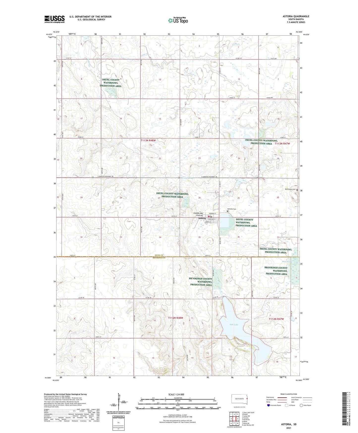
2021 topographic map quadrangle Astoria in the state of South Dakota. Scale: 1:24000. Based on the newly updated USGS 7.5' US Topo map series, this map is in the following counties: Deuel, Brookings. The map contains contour data, water features, and other items you are used to seeing on USGS maps, but also has updated roads and other features. This is the next generation of topographic maps. Printed on high-quality waterproof paper with UV fade-resistant inks.
Quads adjacent to this one:
West: Toronto
Northwest: Clear Lake South
North: Brandt
Northeast: Canby NW
East: Hendricks
Southeast: Lake Benton NW
South: White NE
Southwest: White
Contains the following named places: Astoria, Astoria Post Office, Astoria State Wildlife Management Area, Astoria Volunteer Fire Department, Battle Creek School, Bethany Cemetery, Bethel Lutheran Church, Bethlehem Cemetery, Good View School, Hillside School, Jorstad Spring, Oak Lake, Oak Lake Girl Scout Camp, Scandinavia Post Office, Singsaas Slough State Wildlife Management Area, Snow Mound School, Town of Astoria, Township of Scandinavia, United Norwegian Church, ZIP Code: 57213