MyTopo
Acala Texas US Topo Map
Couldn't load pickup availability
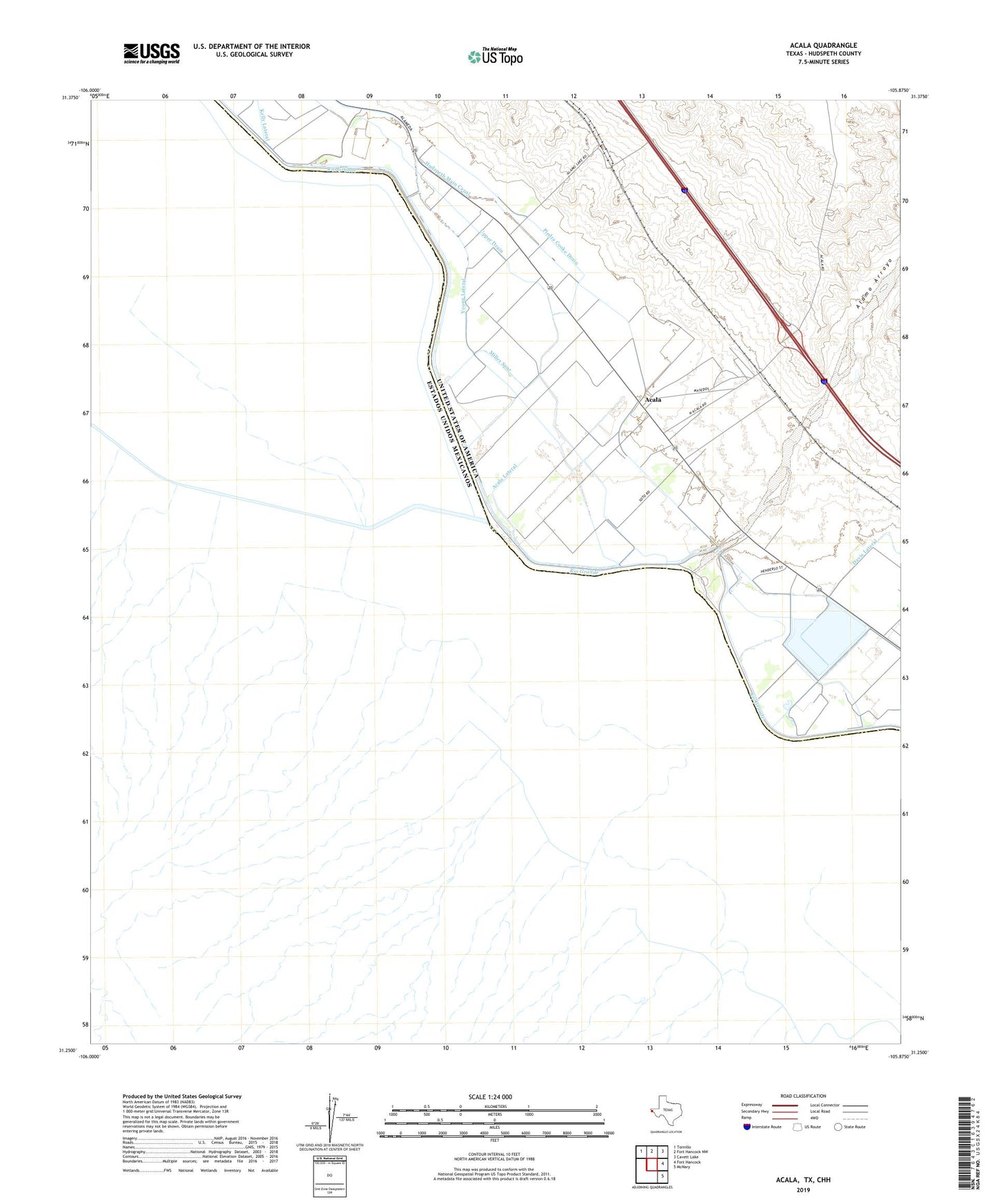
2019 topographic map quadrangle Acala in the state of Texas. Scale: 1:24000. Based on the newly updated USGS 7.5' US Topo map series, this map is in the following counties: Hudspeth. The map contains contour data, water features, and other items you are used to seeing on USGS maps, but also has updated roads and other features. This is the next generation of topographic maps. Printed on high-quality waterproof paper with UV fade-resistant inks.
Quads adjacent to this one:
Northwest: Tornillo
North: Fort Hancock NW
Northeast: Cavett Lake
East: Fort Hancock
Southeast: McNary
Contains the following named places: Acala, Acala Census Designated Place, Acala Lateral, Alamo Feeder, Hudspeth Main Canal, Iser, McCaskills Crossing, Miller Spur, Piedra Cooke Drain, Riverside, Texas No Name Number 47 Dam, Upper Drain, Young Lateral, ZIP Code: 79839