MyTopo
Alamocitos Camp Texas US Topo Map
Couldn't load pickup availability
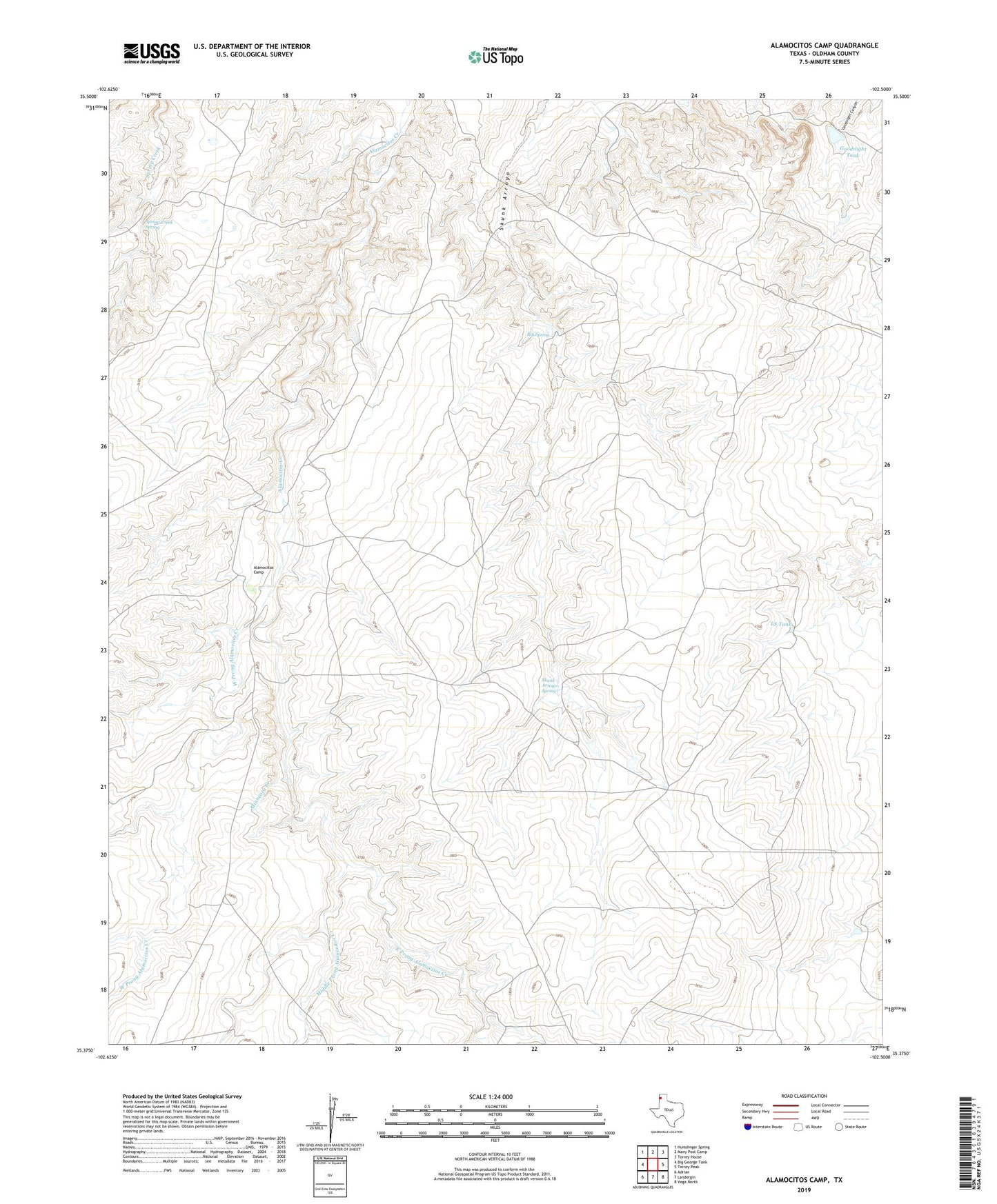
2019 topographic map quadrangle Alamocitos Camp in the state of Texas. Scale: 1:24000. Based on the newly updated USGS 7.5' US Topo map series, this map is in the following counties: Oldham. The map contains contour data, water features, and other items you are used to seeing on USGS maps, but also has updated roads and other features. This is the next generation of topographic maps. Printed on high-quality waterproof paper with UV fade-resistant inks.
Quads adjacent to this one:
West: Big George Tank
Northwest: Humdinger Spring
North: Many Post Camp
Northeast: Torrey House
East: Torrey Peak
Southeast: Vega North
South: Landergin
Southwest: Adrian
Contains the following named places: Alamocitos Camp, Big Spring, Deep Well Windmill, East Alamocitos Windmill, East Prong Alamocitos Creek, Goodnight Tank, Goodnight Tank Dam, LS Tank, Middle Prong Alamocitos Creek, New Windmill, Oil Well Windmill, Oldham County, Skunk Arroyo Spring, Skunk Arroyo Windmill, Spring Creek Spring, TO Woody Windmill, West Prong Alamocitos Creek