MyTopo
Ambrose Texas US Topo Map
Couldn't load pickup availability
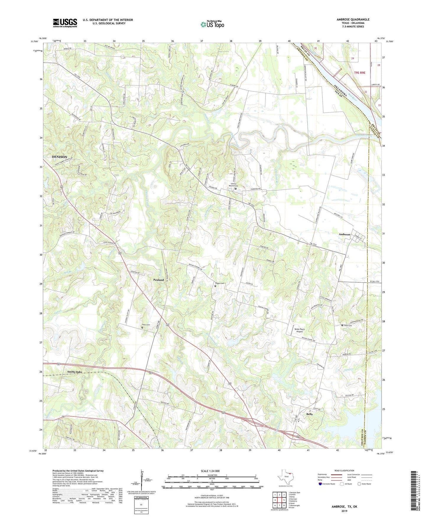
2019 topographic map quadrangle Ambrose in the states of Texas, Oklahoma. Scale: 1:24000. Based on the newly updated USGS 7.5' US Topo map series, this map is in the following counties: Grayson, Fannin, Bryan. The map contains contour data, water features, and other items you are used to seeing on USGS maps, but also has updated roads and other features. This is the next generation of topographic maps. Printed on high-quality waterproof paper with UV fade-resistant inks.
Quads adjacent to this one:
West: Sherman
Northwest: Denison Dam
North: Achille
Northeast: Kemp
East: Mulberry
Southeast: Ector
South: Whitewright
Southwest: Howe
Contains the following named places: Allred Cemetery, Ambrose, Bells Elementary School, Blair Cemetery, Bona, Bush Cemetery, Calf Creek, Cherry Mound Cemetery, Cherry Mound Church, Cleveland Branch, Corneliason Creek, Dugan - Whiting Cemetery, Francis Family Cemetery, Goff Cemetery, Gover, Hebron Cemetery, Hebron Church, Iron Ore Creek, Isom Cemetery, Jack Branch, Jeremiah Cemetery, Mill Creek, Penland, Sandy Creek, Shaw Cemetery, Skida Patch Airport, Smith Creek, Smith Oaks, Soil Conservation Service Site 21 Dam, Soil Conservation Service Site 21 Reservoir, Soil Conservation Service Site 25 Dam, Soil Conservation Service Site 25 Reservoir, Soil Conservation Service Site 32 Dam, Soil Conservation Service Site 32 Reservoir, Soil Conservation Service Site 33 Dam, Soil Conservation Service Site 33 Reservoir, Soil Conservation Service Site 34a Dam, Soil Conservation Service Site 34a Reservoir, South Gale, Stern Lake, Stern Lake Dam, Terrace, Virginia Point Cemetery, ZIP Code: 75021