MyTopo
Angle Utah US Topo Map
Couldn't load pickup availability
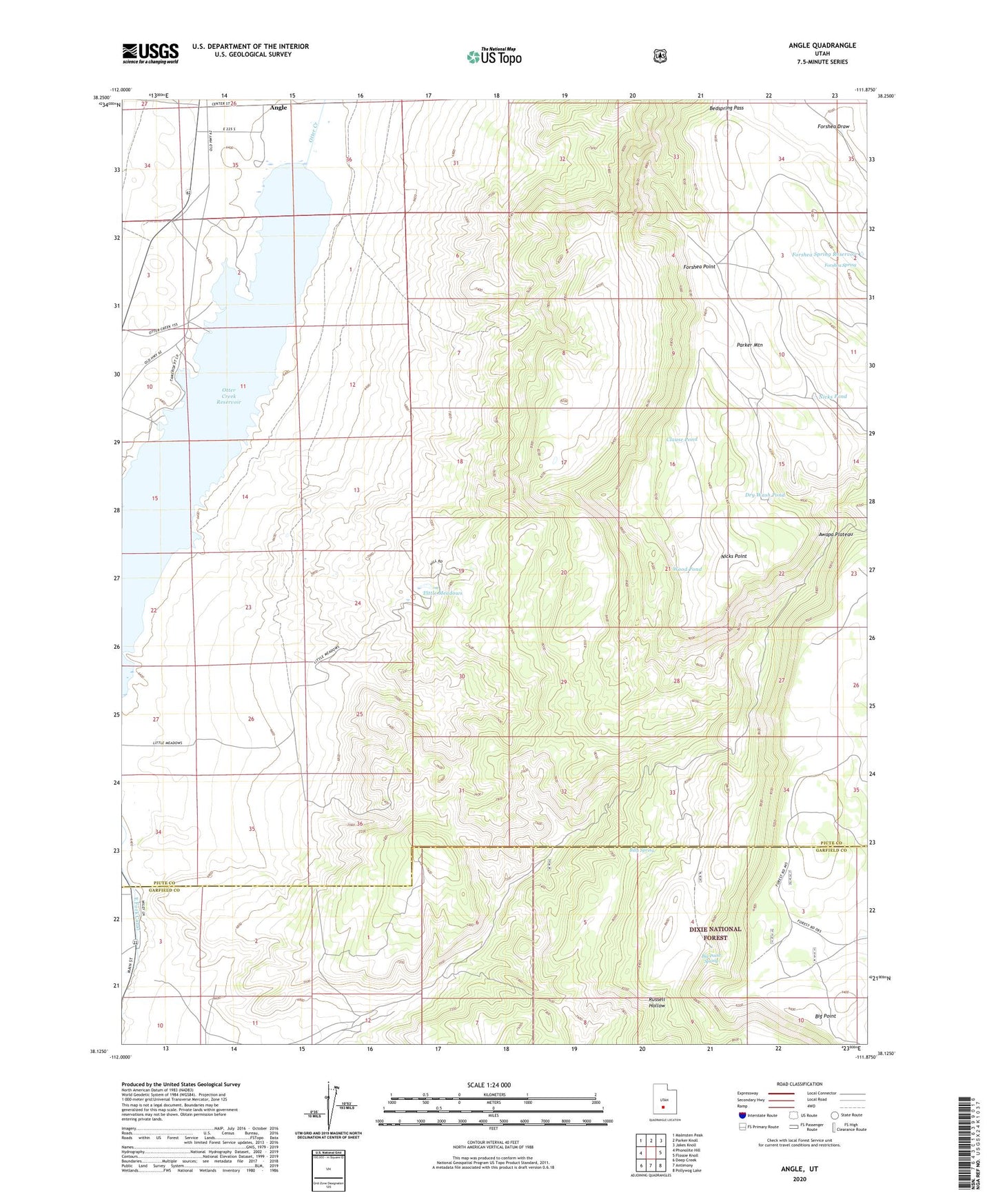
2020 topographic map quadrangle Angle in the state of Utah. Scale: 1:24000. Based on the newly updated USGS 7.5' US Topo map series, this map is in the following counties: Piute, Garfield. The map contains contour data, water features, and other items you are used to seeing on USGS maps, but also has updated roads and other features. This is the next generation of topographic maps. Printed on high-quality waterproof paper with UV fade-resistant inks.
Quads adjacent to this one:
West: Phonolite Hill
Northwest: Malmsten Peak
North: Parker Knoll
Northeast: Jakes Knoll
East: Flossie Knoll
Southeast: Pollywog Lake
South: Antimony
Southwest: Deep Creek
Contains the following named places: Angle, Bedspring Pass, Big Point, Big Point Spring, Billy Spring, Black Burn Trail, Clause Pond, Dry Wash Pond, East Fork Canal, Forshea Point, Forshea Spring, Forshea Spring Reservoir, Little Meadows, Nicks Cabin, Nicks Point, Nicks Pond, Otter Creek, Otter Creek Reservoir, Wood Pond