
MyTopo
Antimony Utah US Topo Map
Couldn't load pickup availability
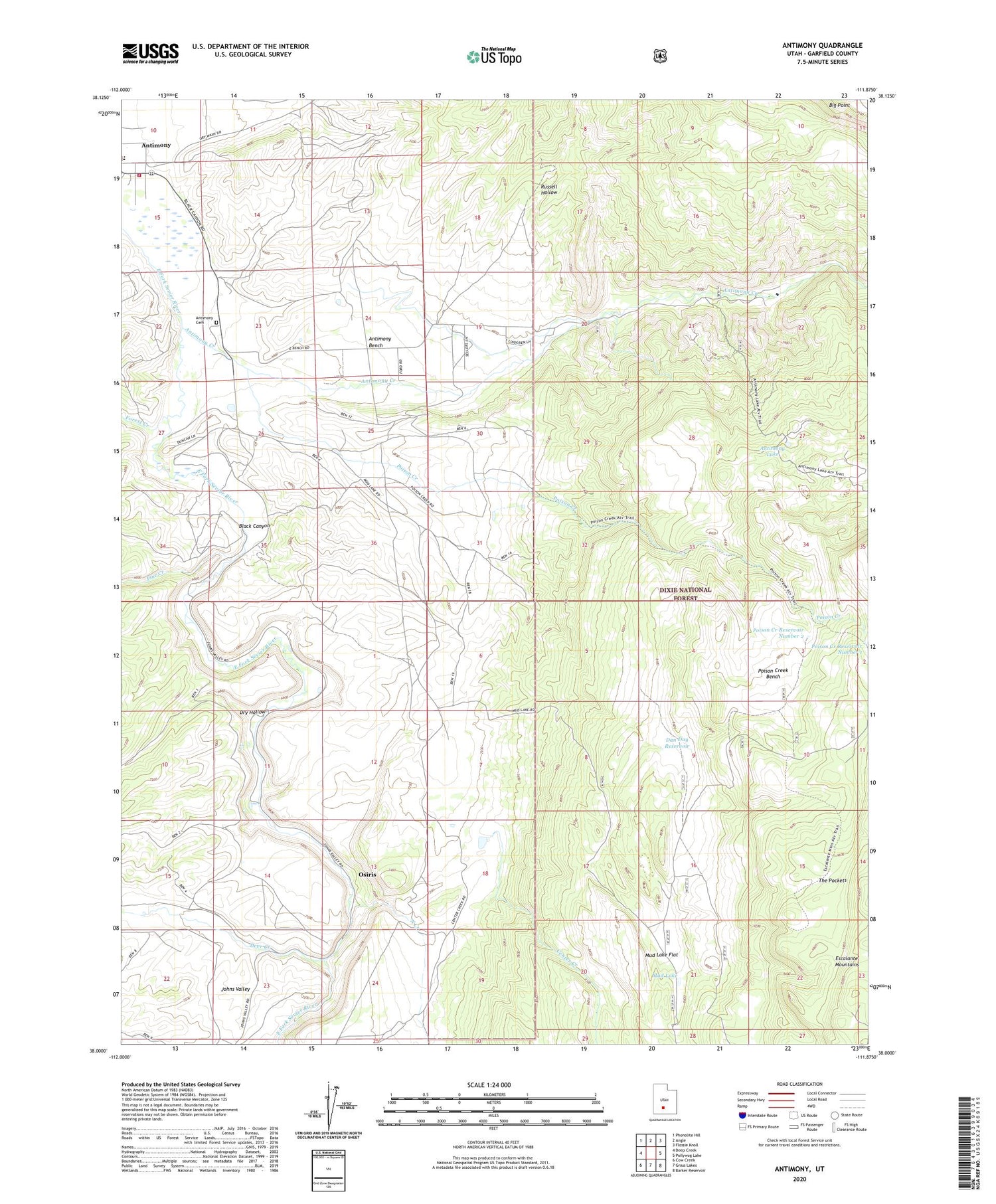
2020 topographic map quadrangle Antimony in the state of Utah. Scale: 1:24000. Based on the newly updated USGS 7.5' US Topo map series, this map is in the following counties: Garfield. The map contains contour data, water features, and other items you are used to seeing on USGS maps, but also has updated roads and other features. This is the next generation of topographic maps. Printed on high-quality waterproof paper with UV fade-resistant inks.
Quads adjacent to this one:
West: Deep Creek
Northwest: Phonolite Hill
North: Angle
Northeast: Flossie Knoll
East: Pollywog Lake
Southeast: Barker Reservoir
South: Grass Lakes
Southwest: Cow Creek
Contains the following named places: Antimony, Antimony Bench, Antimony Cemetery, Antimony Creek, Antimony Elementary School, Antimony Lake, Antimony Volunteer Fire Department, Black Canyon, Center Creek, Dan Day Reservoir, Deer Creek, Dry Hollow, Forest Creek, Johns Valley, Little Forest Creek, Mud Lake, Mud Lake Flat, North Creek, Osiris, Pine Creek, Poison Creek, Poison Creek Bench, Poison Creek Reservoir Number 1, Poison Creek Reservoir Number 2, Russell Hollow, The Church of Jesus Christ of Latter Day Saints, The Pockets, Town of Antimony


