MyTopo
Asphalt Wash Utah US Topo Map
Couldn't load pickup availability
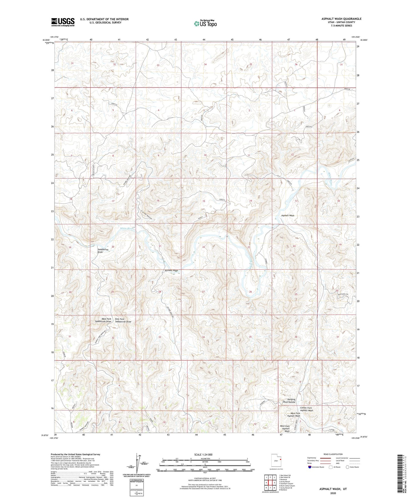
2020 topographic map quadrangle Asphalt Wash in the state of Utah. Scale: 1:24000. Based on the newly updated USGS 7.5' US Topo map series, this map is in the following counties: Uintah. The map contains contour data, water features, and other items you are used to seeing on USGS maps, but also has updated roads and other features. This is the next generation of topographic maps. Printed on high-quality waterproof paper with UV fade-resistant inks.
Quads adjacent to this one:
West: Archy Bench
Northwest: Red Wash SW
North: Red Wash SE
Northeast: Bonanza
East: Southam Canyon
Southeast: Rainbow
South: Archy Bench SE
Southwest: Buck Camp Canyon
Contains the following named places: Asphalt Wash, Atchees Wash, Center Fork Asphalt Wash, East Fork Saddletree Draw, Hanging Rock Hollow, Saddletree Draw, Southman Canyon Gas Field, West Fork Asphalt Wash, West Fork Saddletree Draw