MyTopo
Andover Vermont US Topo Map
Couldn't load pickup availability
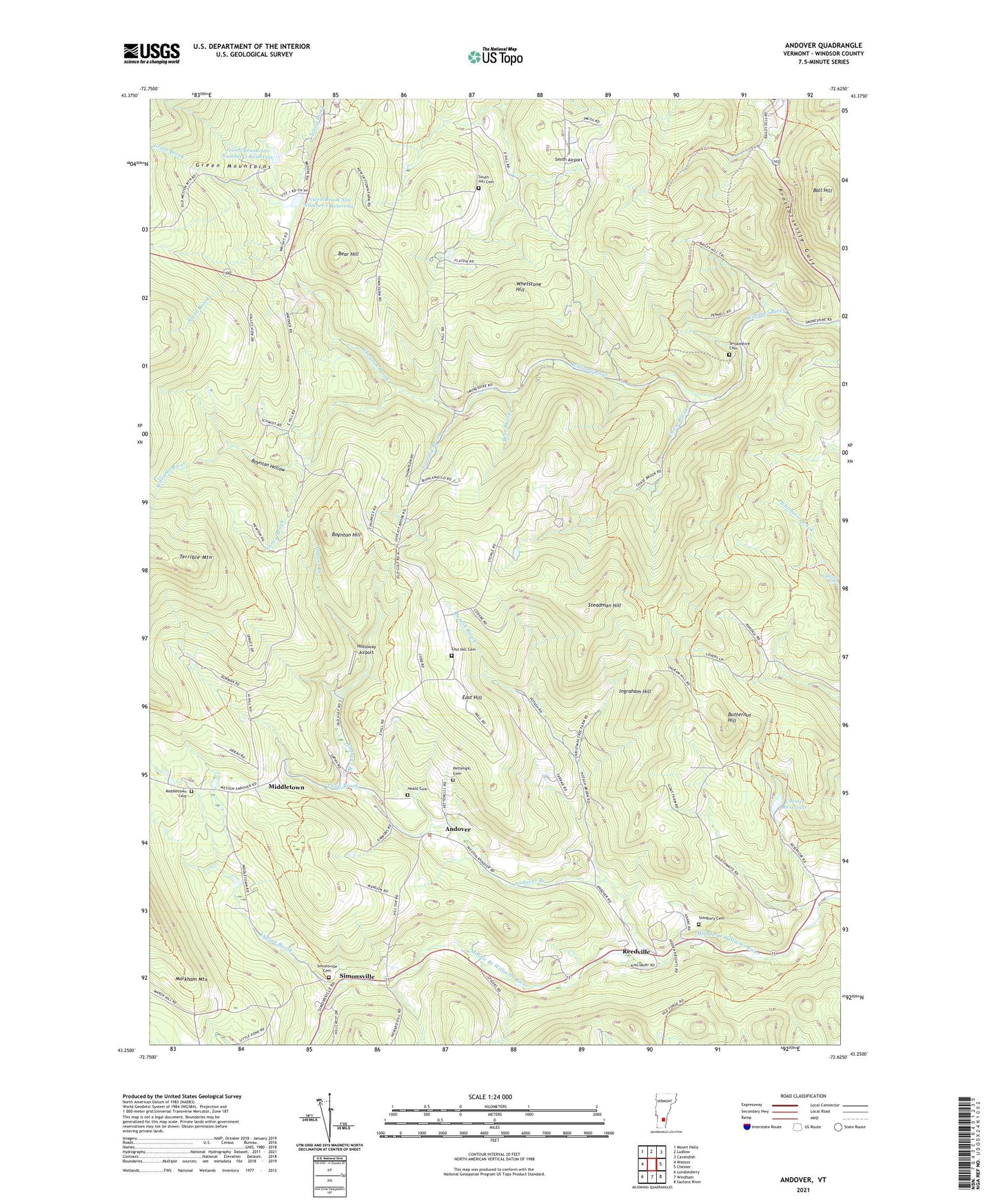
2021 topographic map quadrangle Andover in the state of Vermont. Scale: 1:24000. Based on the newly updated USGS 7.5' US Topo map series, this map is in the following counties: Windsor. The map contains contour data, water features, and other items you are used to seeing on USGS maps, but also has updated roads and other features. This is the next generation of topographic maps. Printed on high-quality waterproof paper with UV fade-resistant inks.
Quads adjacent to this one:
West: Weston
Northwest: Mount Holly
North: Ludlow
Northeast: Cavendish
East: Chester
Southeast: Saxtons River
South: Windham
Southwest: Londonderry
Contains the following named places: Andover, Andover Branch, Andover Community Church, Ball Hill, Barton School, Bear Brook, Bear Hill, Boynton Hill, Boynton Hills School, Boynton Hollow, Butternut Hill, Chase Brook, Chester Reservoir, Chester Town Forest, East Hill, East Hill Cemetery, East Hill School, Grant Brook, Heald Cemetery, Holloway Airport, Horseshoe Acres, Ingraham Hill, Jewell Brook Site Number 1 Dam, Jewell Brook Site Number 1 Reservoir, Jewell Brook Site Number 2 Dam, Jewell Brook Site Number 2 Reservoir, Lovejoy Brook, Lyman Brook, Middletown, Middletown Cemetery, Nancy Brook, Pettengill Cemetery, Potash Brook, Proctor-Piper State Forest, Reedville, Simonsville, Simonsville Cemetery, Simsbury Cemetery, Simsbury School, Smith Airport, Smokeshire Cemetery, Smokeshire School, South Hill Cemetery, Steadman Hill, Terrible Mountain, Town of Andover, Trout Brook, Wadleigh School, Wheaton Brook, Whetstone Hill, Williams River State Forest, Wymans Falls, ZIP Code: 05143