MyTopo
Bakersfield Vermont US Topo Map
Couldn't load pickup availability
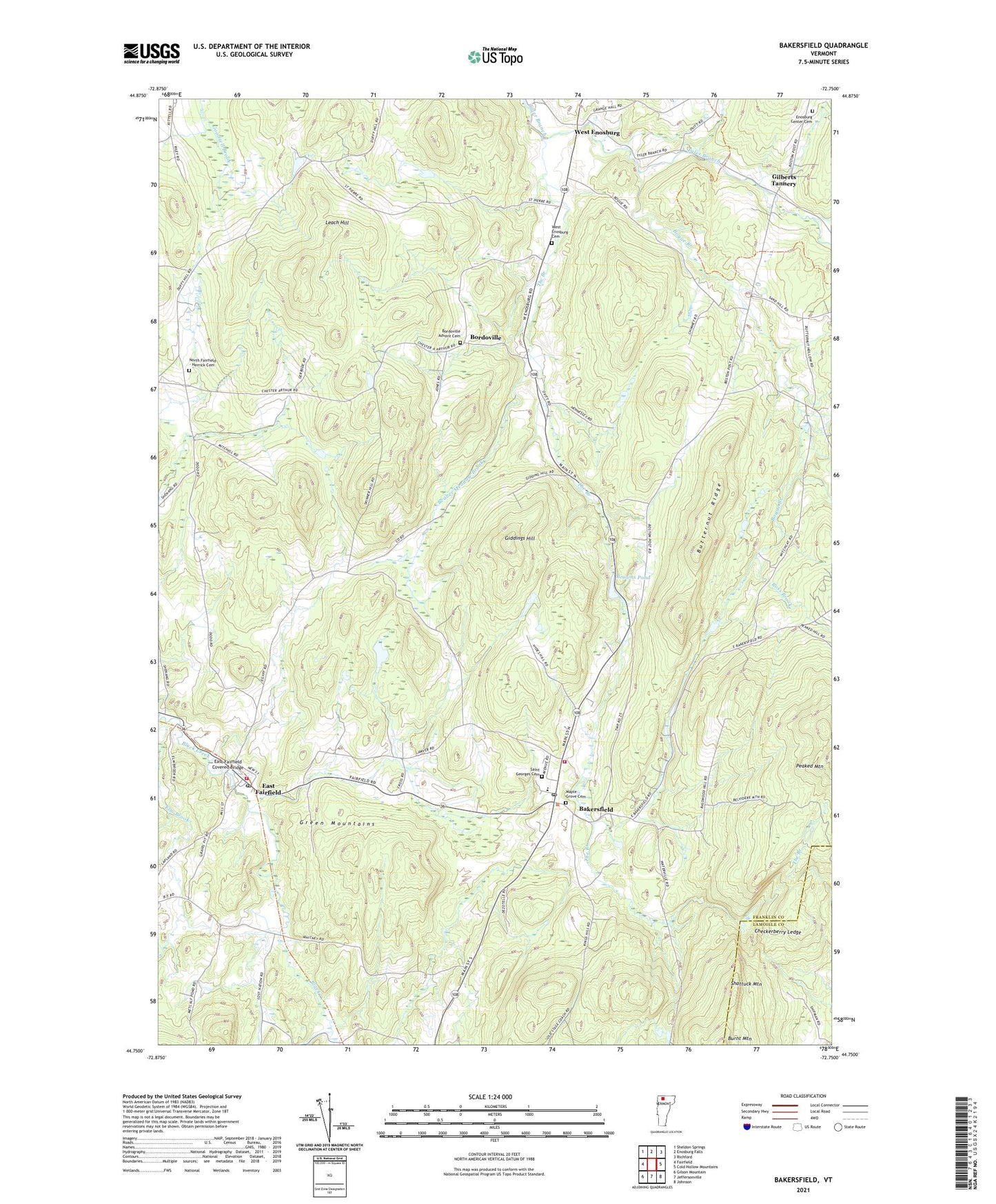
2021 topographic map quadrangle Bakersfield in the state of Vermont. Scale: 1:24000. Based on the newly updated USGS 7.5' US Topo map series, this map is in the following counties: Franklin, Lamoille. The map contains contour data, water features, and other items you are used to seeing on USGS maps, but also has updated roads and other features. This is the next generation of topographic maps. Printed on high-quality waterproof paper with UV fade-resistant inks.
Quads adjacent to this one:
West: Fairfield
Northwest: Sheldon Springs
North: Enosburg Falls
Northeast: Richford
East: Cold Hollow Mountains
Southeast: Johnson
South: Jeffersonville
Southwest: Gilson Mountain
Contains the following named places: Advent Christian Church, Bakersfield, Bakersfield Census Designated Place, Bakersfield Elementary School, Bakersfield Fire Department, Bakersfield Post Office, Basswood School, Beaver Meadow Brook, Bogue Branch, Bordoville, Bordoville Advent Cemetery, Branch School, Browns Pond, Browns Pond Dam, Buckley School, Burnt Mountain, Butternut Ridge, Checkerberry Ledge, Chester Arthur Church, Cooks Brook, Duffy Hill School, East Fairfield, East Fairfield Covered Bridge, East Fairfield Fire Department, East Fairfield Post Office, Egypt School, Enosburg Center Cemetery, F H Brigham Memorial Free Library, Giddings Hill, Gilberts Tannery, Herrick School, Lapland School, Leach Hill, Maple Grove Cemetery, North Fairfield - Herrick Cemetery, North School, President Arthur Birthplace Museum, Ross Brook, Saddle Pond, Saint Georges Cemetery, School Number 11, Shattuck Mountain, The Branch, Town of Bakersfield, Tri-Church Parish Church, West Enosburg, West Enosburg Cemetery, West School, Wolf Run Country Club, Wolf Run Cross Country Ski Center