MyTopo
Craftsbury Vermont US Topo Map
Couldn't load pickup availability
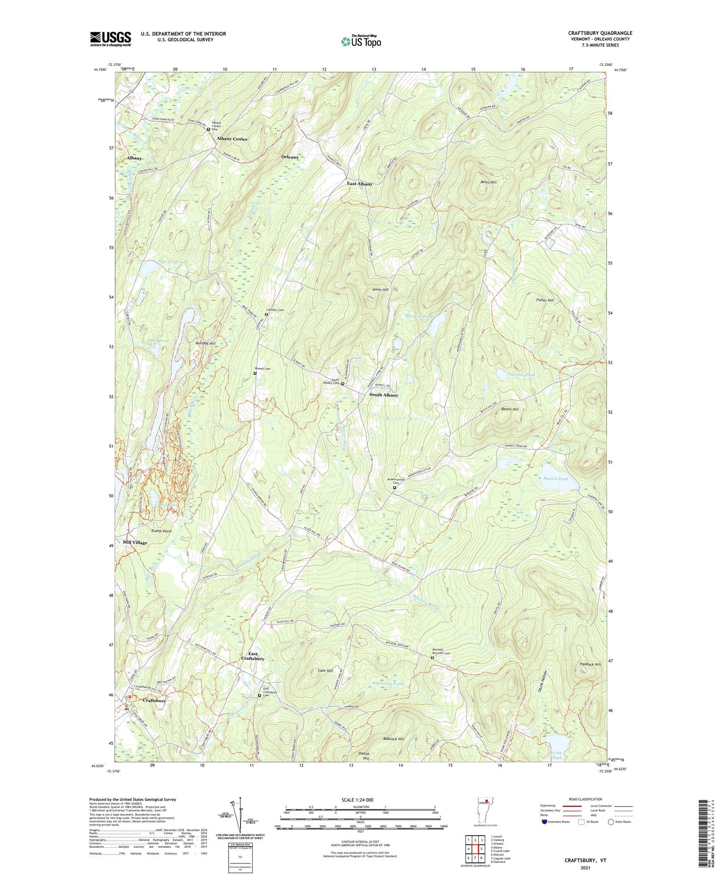
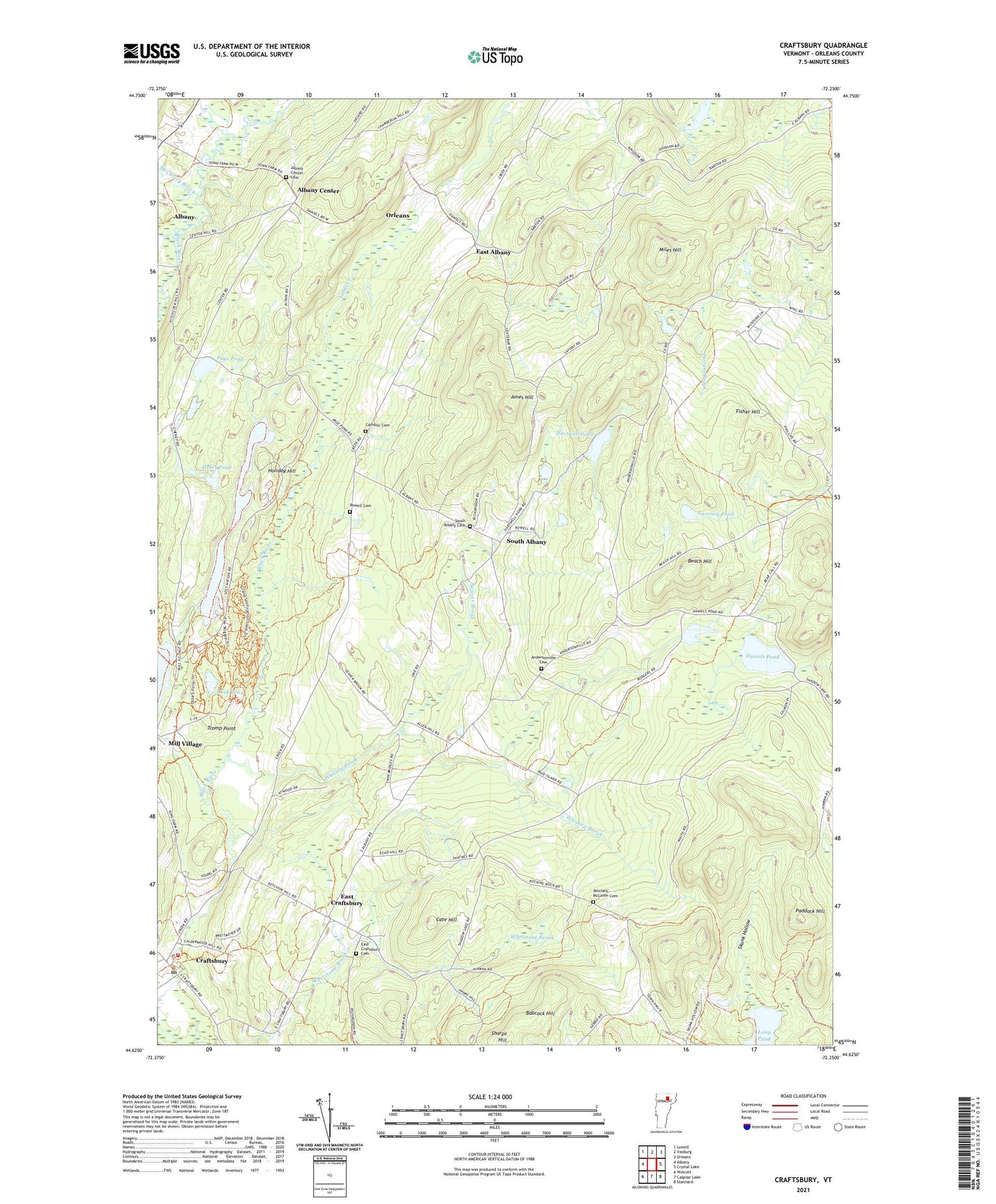
2021 topographic map quadrangle Craftsbury in the state of Vermont. Scale: 1:24000. Based on the newly updated USGS 7.5' US Topo map series, this map is in the following counties: Orleans. The map contains contour data, water features, and other items you are used to seeing on USGS maps, but also has updated roads and other features. This is the next generation of topographic maps. Printed on high-quality waterproof paper with UV fade-resistant inks.
Quads adjacent to this one:
West: Albany
Northwest: Lowell
North: Irasburg
Northeast: Orleans
East: Crystal Lake
Southeast: Stannard
South: Caspian Lake
Southwest: Wolcott
Contains the following named places: Albany Center, Albany Center Cemetery, Ames Hill, Andersonville Cemetery, Babcock Hill, Beach Hill, Cate Hill, Catholic Cemetery, Craftsbury, Craftsbury Fire Department, Craftsbury Nordic Center, Craftsbury Post Office, Craftsbury School, Daniels Pond, Duck Pond, East Albany, East Craftsbury, East Craftsbury Cemetery, East Craftsbury Presbyterian Church, Fisher Hill, Gebbie Corner, Great Hosmer Pond, Hartwell Pond, Hazen Road School, Heart Pond, Holiday Hill, Holiday Hill Camp, John Woodruff Simpson Memorial Library, Lamphean Brook, Long Pond, McCleary Brook, Merrill Corner, Miles Hill, Mitchell - McLaren Cemetery, Old Covenanter Church, Paddock Hill, Page Pond, Rowell Cemetery, Seaver Brook, Skunk Hollow, South Albany, South Albany Cemetery, Sweeney Pond, Town of Albany, Whitney Brook, Wright School, ZIP Code: 05827