MyTopo
Fairlee Vermont US Topo Map
Couldn't load pickup availability
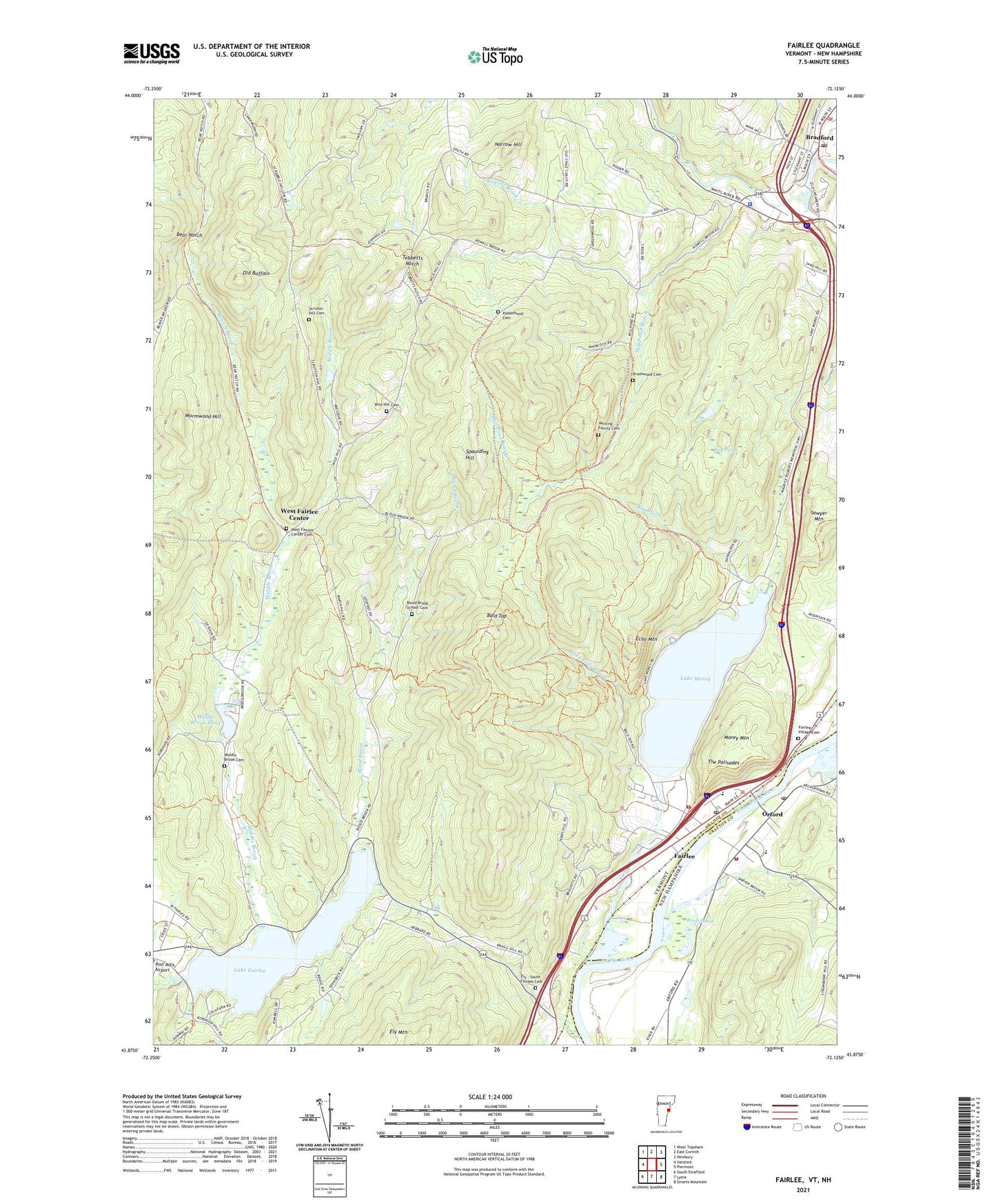
2021 topographic map quadrangle Fairlee in the states of Vermont, New Hampshire. Scale: 1:24000. Based on the newly updated USGS 7.5' US Topo map series, this map is in the following counties: Orange, Grafton. The map contains contour data, water features, and other items you are used to seeing on USGS maps, but also has updated roads and other features. This is the next generation of topographic maps. Printed on high-quality waterproof paper with UV fade-resistant inks.
Quads adjacent to this one:
West: Vershire
Northwest: West Topsham
North: East Corinth
East: Piermont
Southeast: Smarts Mountain
South: Lyme
Southwest: South Strafford
Contains the following named places: Bald Top, Bear North Brook, Bear Notch, Bear Ridge Raceway, Big Brook, Blood Bank School, Blood Brook, Blood Brook School, Blood Brook School Cemetery, Bog Pond, Bonnie Oaks Golf Course, Bradford, Bradford Census Designated Place, Bradford Dam, Bradford Golf Course, Bradford Historic District, Bradford Municipal Forest, Bradford Police Department, Bradford Post Office, Brushwood Cemetery, Echo Mountain, Ely, Ely - South Fairlee Cemetery, Ely Mountain, Fairlee, Fairlee Census Designated Place, Fairlee Drive-In, Fairlee Municipal Forest, Fairlee Post Office, Fairlee Public Library, Fairlee Village Cemetery, Fairlee Volunteer Fire Department, Glen Falls Brook, Jacobs Brook, Kidderhood Cemetery, Kidderhood School, Lake Fairlee, Lake Fairlee Dam, Lake Morey, Middle Brook, Middle Brook Cemetery, Middle Brook Dam, Middle Brook Pond, Mill Pond Brook, Morey Mountain, Narrow Hill, Old Buffalo, Orford, Orford Academy, Orford Congregational Church, Orford Post Office, Orford Street Historic District, Orford Volunteer Fire Department, Reeds Marsh, Rivendell Academy High School, Rivendell Academy Middle School, Rowell Brook, Saint Martins Chapel, Samuel Morey Elementary School, Sawyer Mountain, School Number 7, School Number 9, Scruton Hill Cemetery, South Bradford Church, Spaulding Hill, Tebbetts Notch, The Palisades, Town of Fairlee, Town of West Fairlee, Upper Valley Ambulance, Vermont State Police Bradford Outpost, Village of Bradford, West Fairlee Center, West Fairlee Center Cemetery, Whiting Family Cemetery, Wild Hill Cemetery, Wormwood Hill, ZIP Code: 05045