MyTopo
Ludlow Vermont US Topo Map
Couldn't load pickup availability
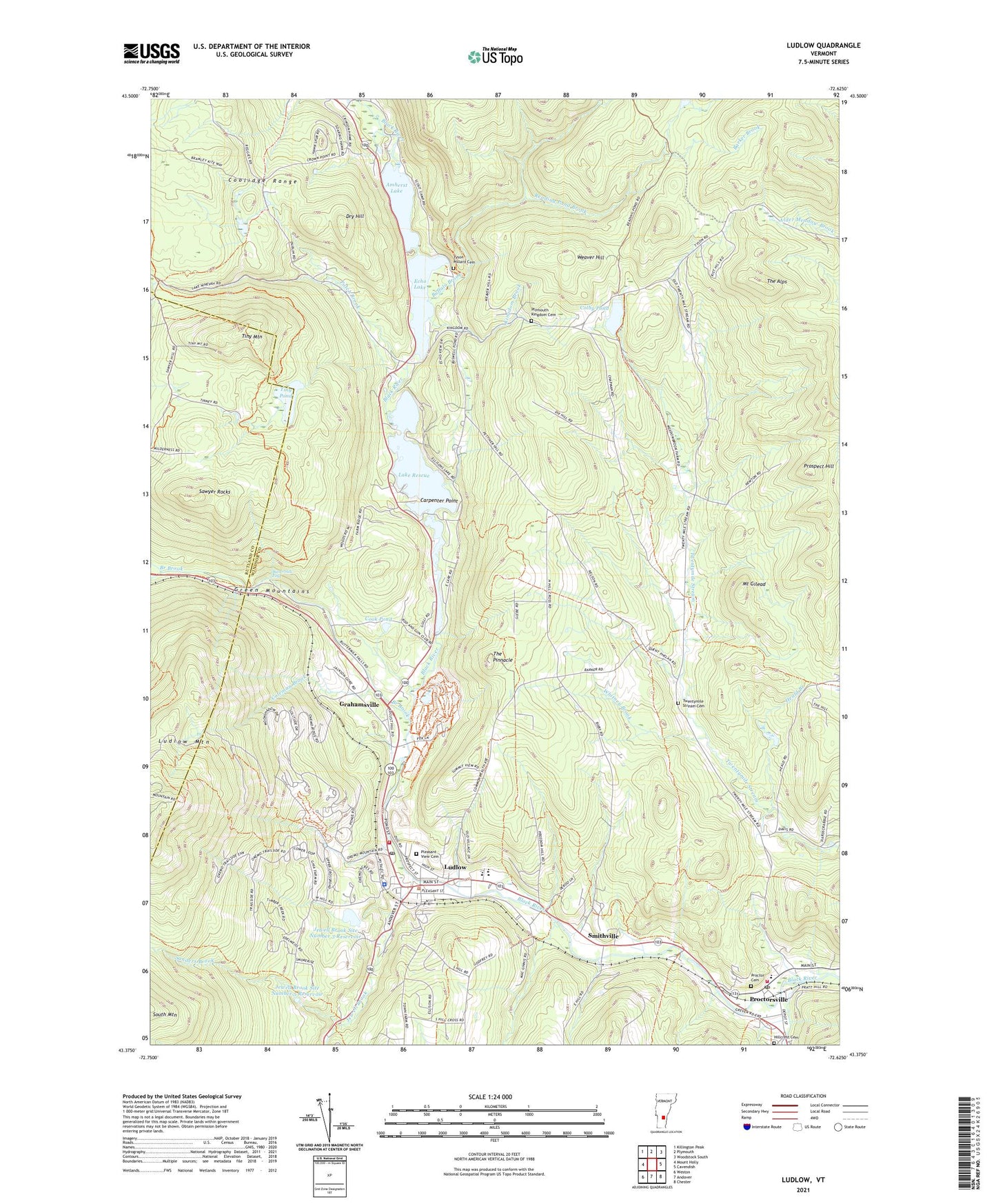
2021 topographic map quadrangle Ludlow in the state of Vermont. Scale: 1:24000. Based on the newly updated USGS 7.5' US Topo map series, this map is in the following counties: Windsor, Rutland. The map contains contour data, water features, and other items you are used to seeing on USGS maps, but also has updated roads and other features. This is the next generation of topographic maps. Printed on high-quality waterproof paper with UV fade-resistant inks.
Quads adjacent to this one:
West: Mount Holly
Northwest: Killington Peak
North: Plymouth
Northeast: Woodstock South
East: Cavendish
Southeast: Chester
South: Andover
Southwest: Weston
Contains the following named places: Amherst Lake, Barker Brook, Black River Academy, Black River Academy Museum, Black River High School, Branch Brook, Buffalo Brook, Buttermilk Falls, Camp Plymouth, Camp Plymouth State Park, Carpenter Point, Cavendish Fire Department - Proctorsville Station, Cavendish Town Elementary School, Church of the Annunciation, Colby Pond, Colby Pond Dam, Coleman Brook, Cook Pond, Dorsey Park, Dry Hill, Echo Lake, Fletcher Farm School for the Arts and Crafts, Fletcher Memorial Library, Fox Run Cross Country Ski Center, Fox Run Golf Course, Gethsemane Episcopal Church, Gilchrist School, Grahamsville, Heald Branch, Hemingway School, Hideaway Campgrounds, Hillcrest Cemetery, Jewell Brook, Jewell Brook Site Number 3 Dam, Jewell Brook Site Number 3 Reservoir, Jewell Brook Site Number 5 Dam, Jewell Brook Site Number 5 Reservoir, Kingdom Brook, Lake Rescue, Lake Rescue Dam, Ludlow, Ludlow Ambulance Service, Ludlow Baptist Church, Ludlow Chamber of Commerce, Ludlow Elementary School, Ludlow Fire Department, Ludlow Municipal Forest, Ludlow Police Department, Ludlow Post Office, Ludlow Shopping Plaza Shopping Center, Ludlow Town Forest, Ludlow Town Hall, Meadow Brook Farms Campground, Mount Gilead, Okemo Mountain School, Okemo Mountain Ski Area, Patch Brook, Pleasant View Cemetery, Plymouth Kingdom, Plymouth Kingdom Cemetery, Proctor Cemetery, Proctorsville, Proctorsville Census Designated Place, Proctorsville Post Office, Prospect Hill, Reading Pond Brook, Reservoir Pond, Reservoir Pond Dam, Rutland Windsor Supervisory Union, Sanders Brook, Sawyer Rocks, Smithville, The Alps, The Pinnacle, Tiny Mountain, Tiny Pond, Town of Ludlow, Twentymile Stream Cemetery, Tyson, Tyson - Pollard Cemetery, United Church of Ludlow, Village of Ludlow, Weaver Hill, Wheeler School, Whitney Brook, ZIP Codes: 05149, 05153