MyTopo
Vergennes East Vermont US Topo Map
Couldn't load pickup availability
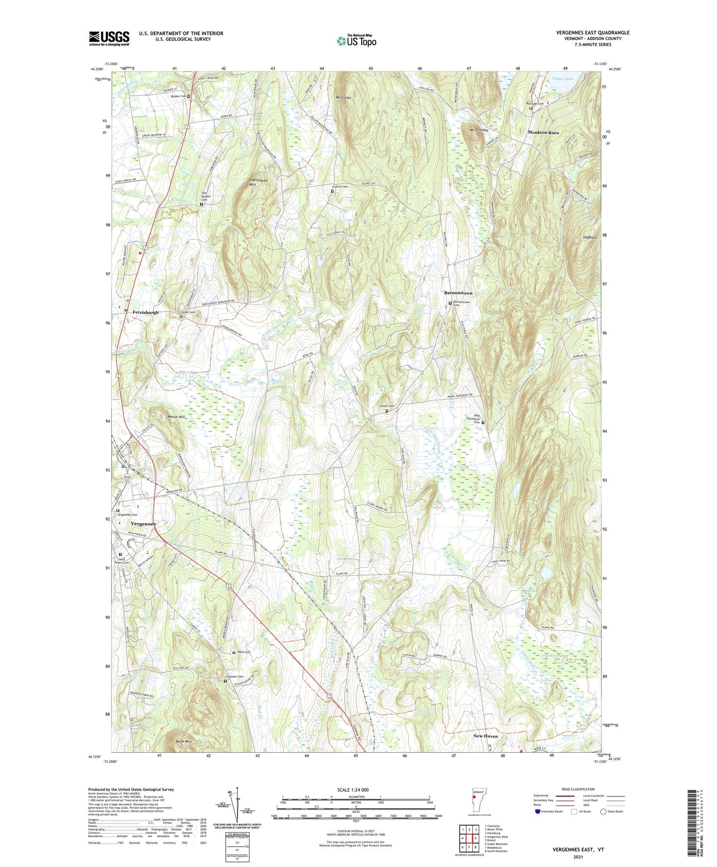
2021 topographic map quadrangle Vergennes East in the state of Vermont. Scale: 1:24000. Based on the newly updated USGS 7.5' US Topo map series, this map is in the following counties: Addison. The map contains contour data, water features, and other items you are used to seeing on USGS maps, but also has updated roads and other features. This is the next generation of topographic maps. Printed on high-quality waterproof paper with UV fade-resistant inks.
Quads adjacent to this one:
West: Vergennes West
Northwest: Charlotte
North: Mount Philo
Northeast: Hinesburg
East: Bristol
Southeast: South Mountain
South: Middlebury
Southwest: Snake Mountain
Contains the following named places: Abel Thompson Cemetery, Allandra Farm, Assembly of God Christian Center, Barnumtown, Barnumtown Cemetery, Beeman Elementary School, Borough Cemetery, Buck Mountain, Callery Dam, Carter Cemetery, Cedar Swamp, Champlain Valley Christian School, Champlain Valley Creamery, Chipman Cemetery, Collins Cemetery, Ferrisburg Community Church, Ferrisburg Municipal Forest, Ferrisburgh, Ferrisburgh Central School, Ferrisburgh Post Office, Ferrisburgh Volunteer Fire Department, Hogback, Huizenga Dairy Farm, Marsh Hill, Monkton Boro, Monkton Central School, Mount Florona, Mount Fuller, Mud Creek, New Haven Census Designated Place, New Haven Fire Station, Norton Brook Dam, Old Quaker Cemetery, Quaker Cemetery, Robeby Museum, Rokeby Museum Special Collections Library, Russell Memorial Library, Saint Peters Cemetery, Shellhouse Mountain, Town of Monkton, Town of Waltham, Union Cemetery, Vergennes Armory Heliport, Vergennes Cemetery, Vergennes Dam, Vergennes Municipal Forest, Vergennes Union Elementary School, Vergennes Union High School, Vergennes Watershed, Vermont Industrial School, Ward Cemetery, ZIP Code: 05473