MyTopo
Alum Ridge Virginia US Topo Map
Couldn't load pickup availability
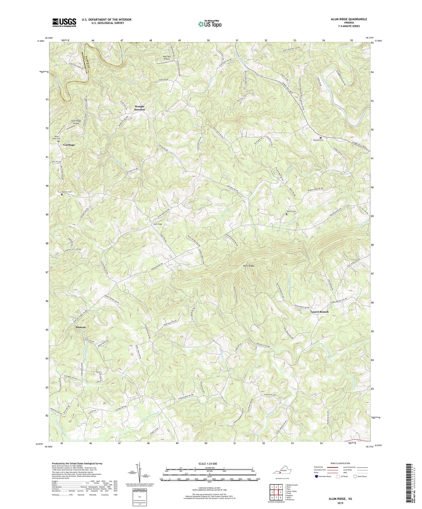
2019 topographic map quadrangle Alum Ridge in the state of Virginia. Scale: 1:24000. Based on the newly updated USGS 7.5' US Topo map series, this map is in the following counties: Floyd, Montgomery. The map contains contour data, water features, and other items you are used to seeing on USGS maps, but also has updated roads and other features. This is the next generation of topographic maps. Printed on high-quality waterproof paper with UV fade-resistant inks.
Quads adjacent to this one:
West: Indian Valley
Northwest: Radford South
North: Riner
Northeast: Pilot
East: Floyd
Southeast: Woolwine
South: Willis
Southwest: Dugspur
Contains the following named places: Alum Ridge, Alum Ridge Airport, Alum Ridge Church, Alum Ridge School, Beaver Creek Church, Carthage, Deer Run Airport, Dobbins Creek, Duncan, Duncan Cemetery, Duncan Chapel Church, Duncan Farm, Earls Branch, Greasy Creek Church, Howell Creek, Laurel Branch, Laurel Branch Church, Lost Bent Creek, Mannon Cemetery, Pleasant Valley Church, Reedsville Church, Sidney Creek, Sowers Cemetery, Spurlock Creek, Wangle Junction, West Fork Church, White Oak Grove Baptist Church, White Rock Cemetery, Wills Ridge