MyTopo
Amelia Court House Virginia US Topo Map
Couldn't load pickup availability
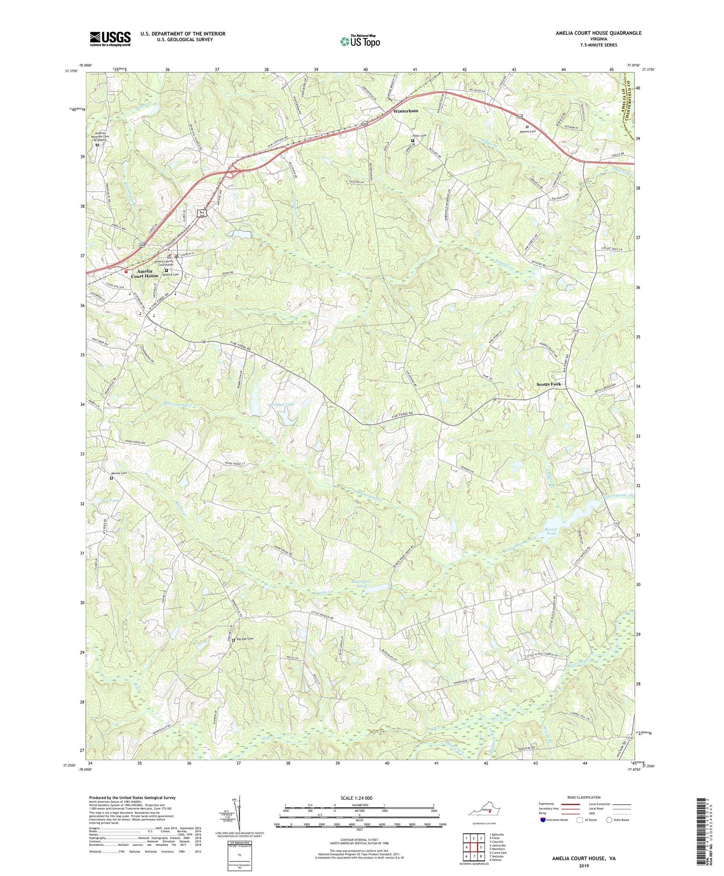
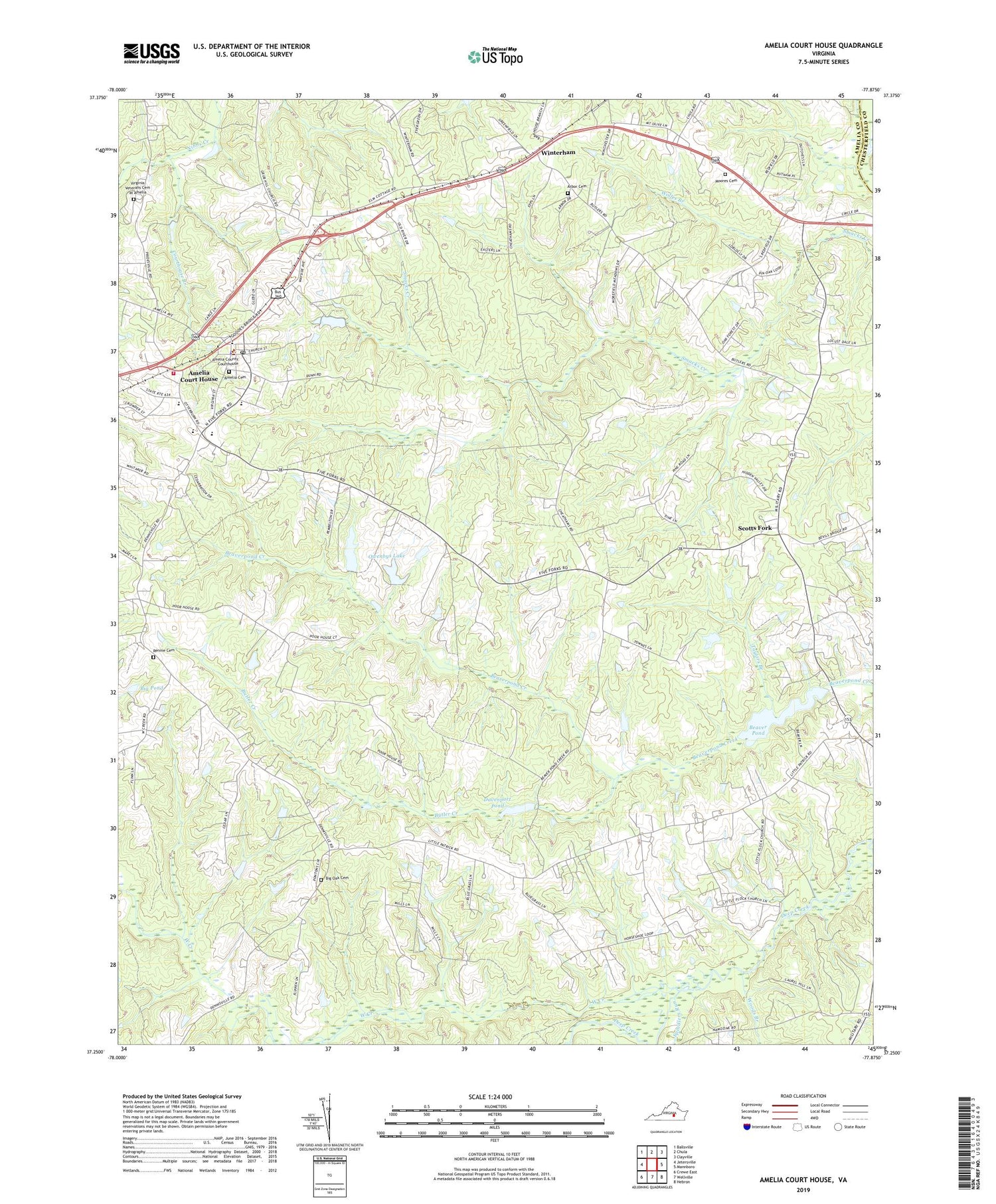
2019 topographic map quadrangle Amelia Court House in the state of Virginia. Scale: 1:24000. Based on the newly updated USGS 7.5' US Topo map series, this map is in the following counties: Amelia, Chesterfield. The map contains contour data, water features, and other items you are used to seeing on USGS maps, but also has updated roads and other features. This is the next generation of topographic maps. Printed on high-quality waterproof paper with UV fade-resistant inks.
Quads adjacent to this one:
West: Jetersville
Northwest: Ballsville
North: Chula
Northeast: Clayville
East: Mannboro
Southeast: Hebron
South: Wellville
Southwest: Crewe East
Contains the following named places: Albright Presbyterian Church, Amelia Academy, Amelia Cemetery, Amelia County, Amelia County Elementary School, Amelia County Fire Services Assistant Coordinator, Amelia County High School, Amelia County Middle School, Amelia County Sheriff's Office, Amelia County Volunteer Fire Department Company 1 Amelia Courthouse, Amelia Court House, Amelia Court House Census Designated Place, Amelia Court House Post Office, Amelia Emergency Squad, Amelia Fire Department Administration, Amelia Presbyterian Church, Arbor Cemetery, Arbor Church, Barnard Dam, Beaver Dam, Beaver Pond, Beaverpond Mill, Bethia Church, Bethia School, Big Oak Cemetery, Big Oak Church, Big Pond, Brays Store, Butler Creek, Calvary Church, Chula School, Courthouse Branch, Davenport Pond, Davenports Pond Dam, District 3, District 4, Five Forks, Jones Dam, Kempis, Little Bethel Church, Little Flock Church, Little Fork Church, Manaza Hill Church, Moores Cemetery, Moores Church, Morefield Mine, Mount Herman Church, Mount Olive Church, Otterburn, Owenbys Dam, Owenbys Lake, Pointons Store, Promise Land Church, Rennie Cemetery, Rennie Church, Robinson School, Rowlet Mill, Russel Grove High School, Saint Pauls Church, Scotts Fork, Spindlers Run, Stark Dam, Tabernacle Church, Taylors Branch, Vaughans Dam, Virginia Department of Forestry Amelia County, Virginia Veterans Cemetery at Amelia, West Creek, Whitakers Dam, Whites Mill, Whites Pond, Wilsons Corner, Winterham, Wolfes Branch, Woods Branch, Zion Hill Church, ZIP Code: 23002