MyTopo
Andersonville Virginia US Topo Map
Couldn't load pickup availability
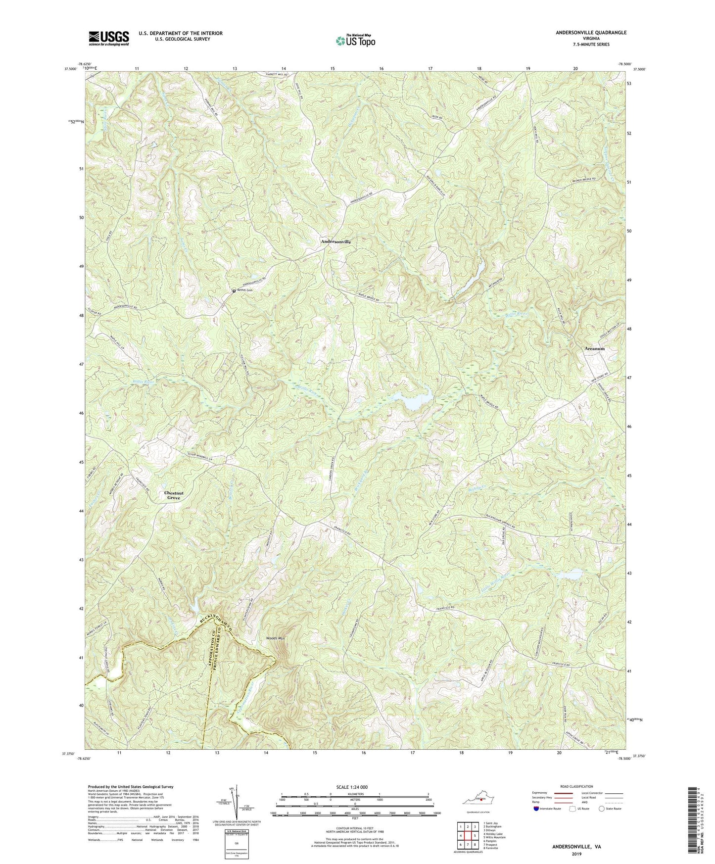
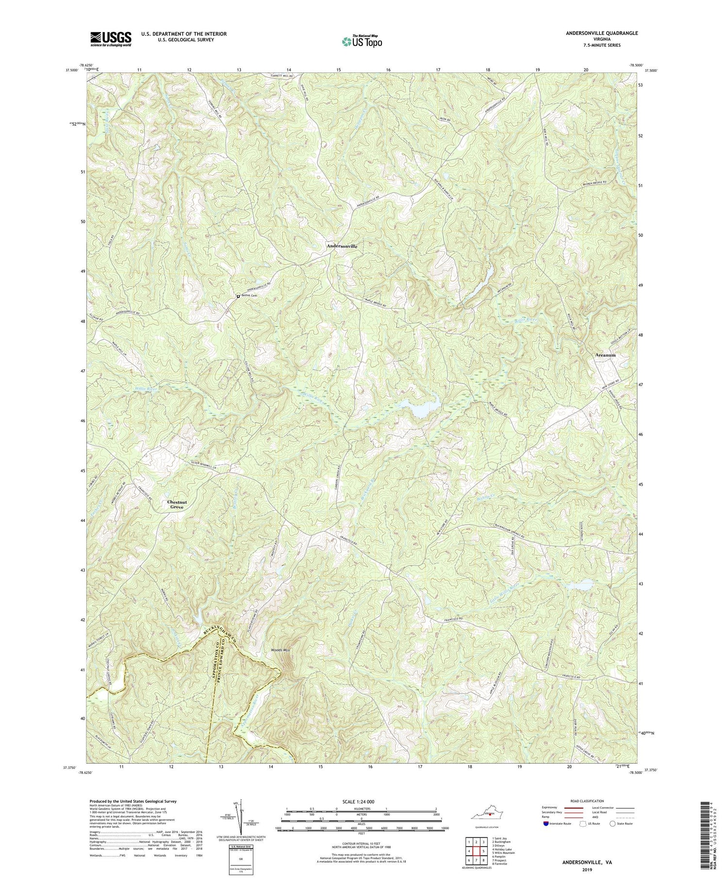
2019 topographic map quadrangle Andersonville in the state of Virginia. Scale: 1:24000. Based on the newly updated USGS 7.5' US Topo map series, this map is in the following counties: Buckingham, Appomattox, Prince Edward. The map contains contour data, water features, and other items you are used to seeing on USGS maps, but also has updated roads and other features. This is the next generation of topographic maps. Printed on high-quality waterproof paper with UV fade-resistant inks.
Quads adjacent to this one:
West: Holiday Lake
Northwest: Saint Joy
North: Buckingham
Northeast: Dillwyn
East: Willis Mountain
Southeast: Farmville
South: Prospect
Southwest: Pamplin
Contains the following named places: Andersonville, Areanum, Beasley Creek, Bethel Cemetery, Bethel Church, Brickyard Branch, Chestnut Grove, Chestnut Grove Church, Concord Church, Cut Banks Ford, District 3, Enonville, First Liberty Church, Jenkins Creek, Lee Experimental Forest, Mount Carmel Church, New Store, Sams Creek, Second Liberty Church, Willis River Number 1a Dam, Willis River Number 1b Dam, Willis River Number 6a Dam, Woods Mountain